Country:
Region:
City:
Latitude and Longitude:
Time Zone:
Postal Code:
IP information under different IP Channel
ip-api
Country
Region
City
ASN
Time Zone
ISP
Blacklist
Proxy
Latitude
Longitude
Postal
Route
Luminati
Country
ASN
Time Zone
Europe/Berlin
ISP
Global Village GmbH
Latitude
Longitude
Postal
IPinfo
Country
Region
City
ASN
Time Zone
ISP
Blacklist
Proxy
Latitude
Longitude
Postal
Route
db-ip
Country
Region
City
ASN
Time Zone
ISP
Blacklist
Proxy
Latitude
Longitude
Postal
Route
ipdata
Country
Region
City
ASN
Time Zone
ISP
Blacklist
Proxy
Latitude
Longitude
Postal
Route
Popular places and events near this IP address

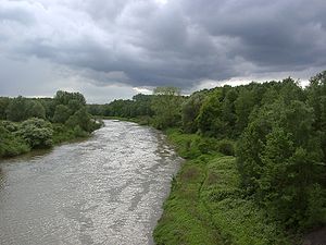
Lippe (river)
River in Germany
Distance: Approx. 4674 meters
Latitude and longitude: 51.65083333,6.60416667
The Lippe (German pronunciation: [ˈlɪpə]) is a river in North Rhine-Westphalia, Germany. It is a right tributary of the Rhine and 220.3 km (136.9 mi) in length with an elevation difference of 125 metres and a catchment area of 4.890 km². The source is located at the edge of the Teutoburg Forest in Bad Lippspringe close to the city of Paderborn.

Wesel
Town in North Rhine-Westphalia, Germany
Distance: Approx. 5495 meters
Latitude and longitude: 51.65861111,6.61777778
Wesel (German pronunciation: [ˈveːzl̩] ) is a city in North Rhine-Westphalia, Germany. It is the capital of the Wesel district.

Wesel transmitter
Tower in Germany
Distance: Approx. 5062 meters
Latitude and longitude: 51.64888889,6.57805556
The FM and TV-mast Wesel is a 320.8 metre tall guyed steel framework radio mast of the Deutsche Telekom AG at Wesel-Büderich, Germany. FM and TV-mast Wesel was built in 1968 and is used for FM- and TV transmission. FM and TV-mast Wesel is the second tallest structure in Northrhine-Westphalia.

Voerde
Town in North Rhine-Westphalia, Germany
Distance: Approx. 4897 meters
Latitude and longitude: 51.6,6.68333333
Voerde ([ˈføːɐ̯də]) is a town in the district of Wesel, in North Rhine-Westphalia, Germany. It is situated on the right bank of the Rhine, approximately 10 kilometres (6.2 mi) south-east of Wesel, and 20 km north of Duisburg.

Lower Rhine region
Distance: Approx. 4687 meters
Latitude and longitude: 51.57777778,6.56916667
The Lower Rhine region or Niederrhein is a region around the Lower Rhine section of the river Rhine in North Rhine-Westphalia, Germany, between approximately Oberhausen and Krefeld in the East and the Dutch border around Kleve in the West. As the region can be defined either geographically, linguistically, culturally, or by political, economic and traffic relations throughout the centuries, as well as by more recent political subdivisions, its precise borders are disputable and occasionally may be seen as extending beyond the Dutch border. A cultural bond of the German Lower Rhine region is its Low Franconian language, specifically the Kleverlandish dialect (German: Kleverländisch, Dutch: Kleverlands), which includes the Dutch dialects just across the border.

Wesel citadel
Distance: Approx. 4717 meters
Latitude and longitude: 51.65166667,6.61527778
The Wesel citadel is the largest intact fortification system of the Rhineland and was built 1688–1722 in Wesel according to plans by Johan de Corbin, in the form of a pentagonal star, with each point of the star being a bastion. The citadel was the core of the fortress of Wesel. It is currently used as a cultural centre.

Wesel Railway Bridge
Railway bridge in Wesel, Germany
Distance: Approx. 5363 meters
Latitude and longitude: 51.6559,6.5944
The Wesel Railway Bridge was a bridge on the Haltern–Venlo railway, built as part of the Hamburg–Venlo railway by the Cologne-Minden Railway Company, and opened on 1 March 1874.

Wesel station
Railway station in Wesel, Germany
Distance: Approx. 5259 meters
Latitude and longitude: 51.65583333,6.62722222
Wesel is a railway station in Wesel, North Rhine-Westphalia, Germany. The station is located on the Arnhem-Oberhausen railway and the Bocholt-Wesel railway. The train services are operated by Deutsche Bahn and Abellio Deutschland.

Friedrichsfeld (Niederrhein) station
Railway station in Germany
Distance: Approx. 3028 meters
Latitude and longitude: 51.62805556,6.64583333
Friedrichsfeld is a railway station in Friedrichsfeld, part of Voerde, North Rhine-Westphalia, Germany. The station is located on the Arnhem-Oberhausen railway. The train services are operated by Deutsche Bahn and Abellio Deutschland.
Voerde (Niederrhein) station
Railway station in North Rhine-Westphalia, Germany
Distance: Approx. 5306 meters
Latitude and longitude: 51.59722222,6.68833333
Voerde is a railway station in Voerde, North Rhine-Westphalia, Germany. The station is located on the Arnhem-Oberhausen railway. The train services are operated by Deutsche Bahn and Abellio Deutschland.

Rotbach (Rhine)
River in North Rhine-Westphalia, Germany
Distance: Approx. 6509 meters
Latitude and longitude: 51.5724,6.6871
Rotbach is a river of North Rhine-Westphalia, Germany. It is a right tributary of the Rhine in Möllen, near Dinslaken.

Möllen
Ortsteil of Voerde in North Rhine-Westphalia, Germany
Distance: Approx. 6758 meters
Latitude and longitude: 51.58166667,6.70111111
Möllen is the southernmost administrative district of Voerde in Wesel district, North Rhine-Westphalia, having 3040 inhabitants.
Weather in this IP's area
overcast clouds
12 Celsius
11 Celsius
10 Celsius
14 Celsius
1023 hPa
80 %
1023 hPa
1020 hPa
10000 meters
2 m/s
3.32 m/s
183 degree
100 %
07:34:55
16:59:21
