217.138.239.144 - IP Lookup: Free IP Address Lookup, Postal Code Lookup, IP Location Lookup, IP ASN, Public IP
Country:
Region:
City:
Location:
Time Zone:
Postal Code:
IP information under different IP Channel
ip-api
Country
Region
City
ASN
Time Zone
ISP
Blacklist
Proxy
Latitude
Longitude
Postal
Route
Luminati
Country
Region
eng
City
salford
ASN
Time Zone
Europe/London
ISP
M247 Ltd
Latitude
Longitude
Postal
IPinfo
Country
Region
City
ASN
Time Zone
ISP
Blacklist
Proxy
Latitude
Longitude
Postal
Route
IP2Location
217.138.239.144Country
Region
cordoba
City
villa allende
Time Zone
America/Argentina/Cordoba
ISP
Language
User-Agent
Latitude
Longitude
Postal
db-ip
Country
Region
City
ASN
Time Zone
ISP
Blacklist
Proxy
Latitude
Longitude
Postal
Route
ipdata
Country
Region
City
ASN
Time Zone
ISP
Blacklist
Proxy
Latitude
Longitude
Postal
Route
Popular places and events near this IP address

Ingeniero Aeronáutico Ambrosio L.V. Taravella International Airport
International airport serving Cordoba, Argentina
Distance: Approx. 8457 meters
Latitude and longitude: -31.31,-64.20833333
Ingeniero Aeronáutico Ambrosio L.V. Taravella International Airport (Spanish: Aeropuerto Internacional de Córdoba Ingeniero Aeronáutico Ambrosio L.V. Taravella, IATA: COR, ICAO: SACO), more commonly known as Pajas Blancas, is located 9 kilometres (5 nautical miles) north-northwest of the center of Córdoba, the capital city of the Córdoba Province in Argentina.

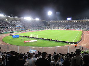
Estadio Mario Alberto Kempes
Football stadium in Córdoba, Argentina
Distance: Approx. 9506 meters
Latitude and longitude: -31.36895556,-64.24624444
The Estadio Mario Alberto Kempes, formerly known as Estadio Córdoba, is a stadium in the Chateau Carreras neighborhood of Córdoba, Argentina. Owned by the Córdoba Province, the venue is used mostly for association football and rugby union matches and also sometimes for athletics. The stadium was built in 1976 in preparation for the 1978 FIFA World Cup, with a capacity for 37,851 spectators although it doesn't provide seating for all of them, like many Argentine stadiums.
Unquillo
City in Córdoba, Argentina
Distance: Approx. 7114 meters
Latitude and longitude: -31.23333333,-64.31666667
Unquillo is a city in the province of Córdoba, Argentina. It has 18,483 inhabitants as per the 2010 census [INDEC]. It is located about 28 km north-northwest from the center of the provincial capital, Córdoba City, and 14 km east of Cosquín.
Córdoba Argentina Temple
Temple of the Church of Jesus Christ of Latter-day Saints in Argentina
Distance: Approx. 8558 meters
Latitude and longitude: -31.35861111,-64.24555556
The Córdoba Argentina Temple is a temple of the Church of Jesus Christ of Latter-day Saints (LDS Church) in the Villa Belgrano neighborhood of Cordoba, Argentina.
Villa Allende
Distance: Approx. 744 meters
Latitude and longitude: -31.3,-64.3
Villa Allende is a city in Córdoba Province, Argentina in the department of Colón. Villa Allende was founded in 1889 and has 27,164 inhabitants (Provincial Census 2008). Located just 19 km away from Córdoba.
Weather in this IP's area
clear sky
31 Celsius
31 Celsius
30 Celsius
32 Celsius
1004 hPa
43 %
1004 hPa
937 hPa
10000 meters
8.23 m/s
180 degree
