217.13.170.20 - IP Lookup: Free IP Address Lookup, Postal Code Lookup, IP Location Lookup, IP ASN, Public IP
Country:
Region:
City:
Location:
Time Zone:
Postal Code:
ISP:
ASN:
language:
User-Agent:
Proxy IP:
Blacklist:
IP information under different IP Channel
ip-api
Country
Region
City
ASN
Time Zone
ISP
Blacklist
Proxy
Latitude
Longitude
Postal
Route
db-ip
Country
Region
City
ASN
Time Zone
ISP
Blacklist
Proxy
Latitude
Longitude
Postal
Route
IPinfo
Country
Region
City
ASN
Time Zone
ISP
Blacklist
Proxy
Latitude
Longitude
Postal
Route
IP2Location
217.13.170.20Country
Region
niedersachsen
City
salzgitter
Time Zone
Europe/Berlin
ISP
Language
User-Agent
Latitude
Longitude
Postal
ipdata
Country
Region
City
ASN
Time Zone
ISP
Blacklist
Proxy
Latitude
Longitude
Postal
Route
Popular places and events near this IP address

Salzgitter
City in Lower Saxony, Germany
Distance: Approx. 318 meters
Latitude and longitude: 52.15,10.33333333
Salzgitter (German pronunciation: [zalt͡sˈɡɪtɐ] ; Eastphalian: Soltgitter) is an independent city in southeast Lower Saxony, Germany, located between Hildesheim and Braunschweig. Together with Wolfsburg and Braunschweig, Salzgitter is one of the seven Oberzentren of Lower Saxony (roughly equivalent to a metropolitan area). With 101,079 inhabitants and 223.92 square kilometres (86.46 sq mi) (as of 31 December 2015), its area is the largest in Lower Saxony and one of the largest in Germany.
Lengede
Municipality in Lower Saxony, Germany
Distance: Approx. 5695 meters
Latitude and longitude: 52.2,10.3
Lengede is a municipality in the district of Peine, in Lower Saxony, Germany, some 18 kilometers southwest of Braunschweig and 40 kilometers southeast of Hanover. It became known to the world in 1963 because of a mining disaster and the subsequent rescue operation of eleven surviving miners, which became known as the "Wunder von Lengede" ("Miracle of Lengede").

Söhlde
Municipality in Lower Saxony, Germany
Distance: Approx. 8524 meters
Latitude and longitude: 52.2,10.23333333
Söhlde is a village and a municipality in the district of Hildesheim, in Lower Saxony, Germany. It is situated approximately 20 km east of Hildesheim, and 10 km northwest of Salzgitter.

Burgdorf, Wolfenbüttel
Municipality in Lower Saxony, Germany
Distance: Approx. 7842 meters
Latitude and longitude: 52.15,10.21666667
Burgdorf is a municipality in the district of Wolfenbüttel, in Lower Saxony, Germany.

Cramme
Municipality in Lower Saxony, Germany
Distance: Approx. 8957 meters
Latitude and longitude: 52.11305556,10.44555556
Cramme is a municipality in the district of Wolfenbüttel, in Lower Saxony, Germany.

Elbe, Lower Saxony
Municipality in Lower Saxony, Germany
Distance: Approx. 8382 meters
Latitude and longitude: 52.08333333,10.28333333
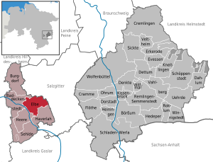
Elbe is a municipality in the district of Wolfenbüttel, in Lower Saxony, Germany.

Salzgittersee
Artificial lake in Lower Saxony
Distance: Approx. 1867 meters
Latitude and longitude: 52.15694444,10.305
Salzgittersee (Salzgitter Lake) is a lake in the city of Salzgitter in Lower Saxony, Germany. At an elevation of 78 m, its surface area is 0.75 km2.

Konrad mine
Former iron ore mine in Salzgitter, Germany
Distance: Approx. 6481 meters
Latitude and longitude: 52.19944444,10.38777778
The Konrad mine (Schacht Konrad) is a former iron ore mine proposed as a deep geological repository for medium- and low level radioactive waste in the city Salzgitter in the Metropolitan region Hannover-Braunschweig-Göttingen-Wolfsburg in southeast Lower Saxony, Germany, located between Hildesheim and Braunschweig.

Salder House
Distance: Approx. 1915 meters
Latitude and longitude: 52.13580612,10.33750278
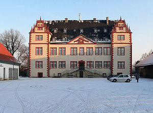
Salder House (German: Schloss Salder) is a stately home in the Renaissance style in Salder, a village in the borough of Salzgitter in Lower Saxony. It was built in 1608 for the lords of Saldern by master builder, Paul Francke, by order of Kriegsrat David Sachses of Wolfenbüttel. In 1695, the heir to the throne, Augustus William of Brunswick-Wolfenbüttel bought the complex and had major restoration work carried out on it.

Lichtenberg Castle (Salzgitter)
Distance: Approx. 4541 meters
Latitude and longitude: 52.12139,10.28861
Lichtenberg Castle (German: Burg Lichtenberg), also called the Heinrichsburg ("Henry Castle"), is a ruined castle dating to the 12th century in the Lichtenberge hills (the northwestern part of the Salzgitter Hills) near Salzgitter in the German state of Lower Saxony. The ruins are found south of and above the Salzgitter suburb of Lichtenberg on the steep summit of the Burgberg (241 metres high). The site, which is extremely good from a strategic perspective, shows the ideal type of ground plan of a hill castle from the High Middle Ages.
Weddel station
Railway station in Cremlingen, Germany
Distance: Approx. 2962 meters
Latitude and longitude: 52.1609,10.3726
Weddel (German: Bahnhof Weddel) is a railway station located in Weddel, Germany. The station is located on the Brunswick–Magdeburg railway and Weddel loop. The train services are operated by Metronom and Deutsche Bahn.

Schandelah station
Railway station in Cremlingen, Germany
Distance: Approx. 5495 meters
Latitude and longitude: 52.1602,10.4109
Schandelah (German: Bahnhof Schandelah) is a railway station located in Schandelah, Germany. The station is located on the Brunswick–Magdeburg railway. The train services are operated by Deutsche Bahn.
Weather in this IP's area
overcast clouds
1 Celsius
-5 Celsius
-0 Celsius
2 Celsius
1033 hPa
61 %
1033 hPa
1018 hPa
10000 meters
8.05 m/s
12.52 m/s
38 degree
99 %
