217.13.164.23 - IP Lookup: Free IP Address Lookup, Postal Code Lookup, IP Location Lookup, IP ASN, Public IP
Country:
Region:
City:
Location:
Time Zone:
Postal Code:
ISP:
ASN:
language:
User-Agent:
Proxy IP:
Blacklist:
IP information under different IP Channel
ip-api
Country
Region
City
ASN
Time Zone
ISP
Blacklist
Proxy
Latitude
Longitude
Postal
Route
db-ip
Country
Region
City
ASN
Time Zone
ISP
Blacklist
Proxy
Latitude
Longitude
Postal
Route
IPinfo
Country
Region
City
ASN
Time Zone
ISP
Blacklist
Proxy
Latitude
Longitude
Postal
Route
IP2Location
217.13.164.23Country
Region
niedersachsen
City
sickte
Time Zone
Europe/Berlin
ISP
Language
User-Agent
Latitude
Longitude
Postal
ipdata
Country
Region
City
ASN
Time Zone
ISP
Blacklist
Proxy
Latitude
Longitude
Postal
Route
Popular places and events near this IP address
Wolfenbüttel (district)
District in Lower Saxony, Germany
Distance: Approx. 7038 meters
Latitude and longitude: 52.16666667,10.58333333
Wolfenbüttel is a district in southeastern Lower Saxony, Germany. Neighboring districts are (clockwise from the north) the district-free City of Braunschweig, the district of Helmstedt, the district of Harz in Saxony-Anhalt, and the districts of Goslar, Hildesheim and Peine. The district-free city of Salzgitter cuts through the district of Wolfenbüttel in the southwest.

Elm (hills)
Mountain range in Lower Saxony, Germany
Distance: Approx. 6745 meters
Latitude and longitude: 52.19916667,10.73611111
The Elm () is a range of hills north of the Harz mountains in the Helmstedt and Wolfenbüttel districts of Lower Saxony, Germany. It has a length of about 25 km (15.5 mi) and a width of 3–8 km (2–5 mi) and rises to an elevation of 323 meters. Surrounded by the Northern European Lowlands, the Elm is almost uninhabited and the largest beech forest in Northern Germany.

Cremlingen
Municipality in Lower Saxony, Germany
Distance: Approx. 3477 meters
Latitude and longitude: 52.24888889,10.65416667
Cremlingen is a municipality in the district of Wolfenbüttel, Lower Saxony, Germany. It borders Lehre, Königslutter, Sickte, and Braunschweig. Parts of it are adjacent to the Elm hills.

Erkerode
Municipality in Lower Saxony, Germany
Distance: Approx. 3934 meters
Latitude and longitude: 52.21666667,10.7
Erkerode is a small village and a community in the District of Wolfenbüttel, in the south-east of Lower Saxony, Germany. It is nearly 16 kilometres (9.9 mi) south-east of Braunschweig. The Elm, a range of forested hills, is close by.

Sickte
Municipality in Lower Saxony, Germany
Distance: Approx. 455 meters
Latitude and longitude: 52.21555556,10.63777778
Sickte is a municipality in the district of Wolfenbüttel, in Lower Saxony, Germany. It is situated west of the Elm, approx. 10 km northeast of Wolfenbüttel, and 10 km southeast of Braunschweig.

Riddagshausen Abbey
Monastery in Lower Saxony, Germany
Distance: Approx. 7023 meters
Latitude and longitude: 52.267386,10.577264
Riddagshausen Abbey (German: Kloster Riddagshausen) was a Cistercian monastery just outside the city of Brunswick in Germany.

Dettum
Municipality in Lower Saxony, Germany
Distance: Approx. 6003 meters
Latitude and longitude: 52.16666667,10.66666667
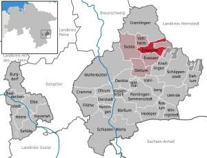
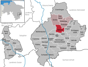
Dettum is a municipality in the district of Wolfenbüttel, in Lower Saxony, Germany.

Evessen
Municipality in Lower Saxony, Germany
Distance: Approx. 5580 meters
Latitude and longitude: 52.19027778,10.71
Evessen is a municipality in the district of Wolfenbüttel, in Lower Saxony, Germany.

Veltheim
Municipality in Lower Saxony, Germany
Distance: Approx. 2871 meters
Latitude and longitude: 52.21972222,10.68444444
Veltheim (historically known as Veltheim an der Ohe) is a municipality in the district of Wolfenbüttel, in Lower Saxony, Germany.
Sickte (Samtgemeinde)
Distance: Approx. 651 meters
Latitude and longitude: 52.21666667,10.63333333
Sickte is a Samtgemeinde ("collective municipality") in the district of Wolfenbüttel, in Lower Saxony, Germany. Its seat is in the village Sickte.

Castle Salzdahlum
Summer palace in Germany, 1684 to 1813
Distance: Approx. 5010 meters
Latitude and longitude: 52.19222222,10.58277778
Castle Salzdahlum (German: Schloss Salzdahlum) was a former summer palace built by Anthony Ulrich, Duke of Brunswick-Wolfenbüttel in 1684. For cost reasons, the buildings were almost exclusively made of wood, with the cladding giving the impression of a building made of sandstone. In 1813 the castle was demolished due to dilapidation; today there are almost no remains of the building.
Dettum station
Railway station in Dettum, Germany
Distance: Approx. 6986 meters
Latitude and longitude: 52.1568,10.66113
Dettum station is a railway station in the municipality of Dettum, located in the Wolfenbüttel district in Lower Saxony, Germany.
Weather in this IP's area
mist
1 Celsius
-3 Celsius
1 Celsius
2 Celsius
1029 hPa
94 %
1029 hPa
1016 hPa
4100 meters
5.14 m/s
260 degree
100 %