Country:
 Romania
Region:
City:
Latitude and Longitude:
Time Zone:
Postal Code:
IP information under different IP Channel
ip-api
Country
Region
City
ASN
Time Zone
ISP
Blacklist
Proxy
Latitude
Longitude
Postal
Route
IPinfo
Country
Region
City
ASN
Time Zone
ISP
Blacklist
Proxy
Latitude
Longitude
Postal
Route
MaxMind
Country
Region
City
ASN
Time Zone
ISP
Blacklist
Proxy
Latitude
Longitude
Postal
Route
Luminati
Country
RORegion
cj
City
campiaturzii
ASN
Time Zone
Europe/Bucharest
ISP
Orange Romania S.A.
Latitude
Longitude
Postal
db-ip
Country
Region
City
ASN
Time Zone
ISP
Blacklist
Proxy
Latitude
Longitude
Postal
Route
ipdata
Country
Region
City
ASN
Time Zone
ISP
Blacklist
Proxy
Latitude
Longitude
Postal
Route
Popular places and events near this IP address

Temes County
County of the Kingdom of Hungary
Distance: Approx. 67 meters
Latitude and longitude: 45.75,21.23333333
County of Temes (Hungarian: Temes, Romanian: Timiș, Serbian: Тамиш or Tamiš, German: Temes or Temesch) was an administrative county (comitatus) of the Kingdom of Hungary. Its territory is now in southwestern Romania and northeastern Serbia. The capital of the county was Temesvár (Romanian: Timișoara, Serbian: Темишвар or Temišvar, German: Temeswar or Temeschwar), which also served as the kingdom's capital between 1315–1323.

West University of Timișoara
Romanian university
Distance: Approx. 444 meters
Latitude and longitude: 45.74694444,21.23111111
The West University of Timișoara (Romanian: Universitatea de Vest din Timișoara; abbreviated UVT) is a public higher education institution located in Timișoara. Classified by the Ministry of National Education as a university of education and scientific research, UVT is one of the nine members of the Universitaria Consortium (the group of Romanian elite universities). Also, the West University is a component institution of the National Research–Development–Innovation System in its capacity as an accredited higher education institution.

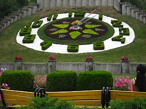
Roses Park, Timișoara
Distance: Approx. 131 meters
Latitude and longitude: 45.75,21.23194444
Roses Park (Romanian: Parcul Rozelor), previously known as Rosarium or Ștefan Plavăț Park of Culture and Leisure, is an urban park in Timișoara, located north of the Bega River.

Ion Creangă Children's Park
Distance: Approx. 294 meters
Latitude and longitude: 45.75222222,21.23638889
Ion Creangă Children's Park (Romanian: Parcul Copiilor „Ion Creangă”) is a children's park in Timișoara that bears the name of Romanian children's author Ion Creangă.
Civic Park, Timișoara
Urban park in Timișoara, Romania
Distance: Approx. 398 meters
Latitude and longitude: 45.75388889,21.23138889
The Civic Park (Romanian: Parcul Civic), also known as the City Park (Romanian: Parcul Cetății), is an urban park in central Timișoara.
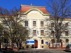
Carmen Sylva National Pedagogical College
Pedagogical high school
Distance: Approx. 423 meters
Latitude and longitude: 45.75416667,21.23527778
Carmen Sylva National Pedagogical College is a high school with pedagogical profile in Timișoara, named after Queen Elisabeth of Romania, patroness of the arts bearing the pseudonym Carmen Sylva. The college operates with 43 classrooms, four laboratories, a library with over 50,000 volumes, boarding school and canteen.
Constantin Diaconovici Loga National College (Timișoara)
High school in Timișoara, Romania
Distance: Approx. 250 meters
Latitude and longitude: 45.75277778,21.23416667
Constantin Diaconovici Loga National College is one of the most prestigious high schools in Timișoara. It is named after Romanian educator Constantin Diaconovici Loga (1770–1850). Before the establishment of the communist regime in Romania, the Boys' High School functioned in the building.

Eugen Todoran Central University Library
Distance: Approx. 382 meters
Latitude and longitude: 45.74722222,21.2325
Eugen Todoran Central University Library (abbreviated BCUT) is an academic library in Timișoara. Founded in 1944, it serves the West University of Timișoara (UVT). The library is subordinated and funded by the Ministry of National Education.
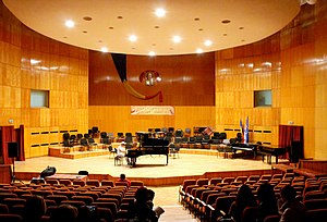
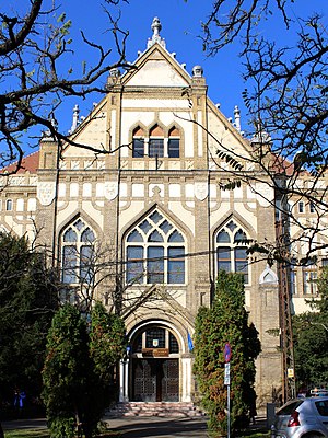
Ion Vidu National College of Art
Arts high school in Timișoara, Timiș County, Romania
Distance: Approx. 445 meters
Latitude and longitude: 45.74666667,21.23444444
Ion Vidu National College of Art (Romanian: Colegiul Național de Artă "Ion Vidu") is an arts high school located at 2 Cluj Street, Timișoara, Romania. Founded in 1906, the school has 18 classrooms, 54 instrumental study rooms, and the 340-seat Mihai Perian Concert Hall.

Israelite High School (Timișoara)
Jewish school in Romania
Distance: Approx. 440 meters
Latitude and longitude: 45.75111111,21.22777778
The Israelite High School was a school of the Jewish community of Timișoara, Romania. The high school operated between 1919 and 1948, with a number of about 700 students. It had four middle school classes for girls, eight theoretical high school classes for boys and eight commercial high school classes for boys.

Hodoș wooden church
Heritage site in Timiș County, Romania
Distance: Approx. 308 meters
Latitude and longitude: 45.75083333,21.22944444
Hodoș wooden church, dedicated to Saint Demeter, originates from the village of the same name in Timiș County, Romania, and dates back to 1774. The church was moved in 1970 to the yard of the Orthodox Diocesan Center in Timișoara. It is included in the list of historical monuments with the code TM-II-m-B-06145.

Postal Palace, Timișoara
Building in Timișoara, Romania
Distance: Approx. 466 meters
Latitude and longitude: 45.75472222,21.23444444
The Postal Palace, known locally as Poșta Mare (Main Post Office), is a historical building in Timișoara, Romania, housing the local branch of Poșta Română, the national operator of postal services and express courier services.
Weather in this IP's area
broken clouds
12 Celsius
12 Celsius
12 Celsius
13 Celsius
1013 hPa
98 %
1013 hPa
1003 hPa
10000 meters
3.6 m/s
280 degree
75 %
07:38:35
19:07:59