217.11.182.191 - IP Lookup: Free IP Address Lookup, Postal Code Lookup, IP Location Lookup, IP ASN, Public IP
Country:
Region:
City:
Location:
Time Zone:
Postal Code:
ISP:
ASN:
language:
User-Agent:
Proxy IP:
Blacklist:
IP information under different IP Channel
ip-api
Country
Region
City
ASN
Time Zone
ISP
Blacklist
Proxy
Latitude
Longitude
Postal
Route
db-ip
Country
Region
City
ASN
Time Zone
ISP
Blacklist
Proxy
Latitude
Longitude
Postal
Route
IPinfo
Country
Region
City
ASN
Time Zone
ISP
Blacklist
Proxy
Latitude
Longitude
Postal
Route
IP2Location
217.11.182.191Country
Region
khatlon
City
bustonqal'a
Time Zone
Asia/Dushanbe
ISP
Language
User-Agent
Latitude
Longitude
Postal
ipdata
Country
Region
City
ASN
Time Zone
ISP
Blacklist
Proxy
Latitude
Longitude
Postal
Route
Popular places and events near this IP address

Bokhtar
Place in Khatlon, Tajikistan
Distance: Approx. 4662 meters
Latitude and longitude: 37.83638889,68.78027778
Bokhtar (Tajik: Бохтар), previously known as Qurghonteppa, Kurganteppa and Kurgan-Tyube, is a city in southwestern Tajikistan, which serves as the capital of the Khatlon region. Bokhtar is the largest city in southern Tajikistan, and is located 100 kilometres (62 mi) south of Dushanbe and 150 kilometres (93 mi) north of Kunduz, Afghanistan.

Kushoniyon District
Place in Khatlon Region, Tajikistan
Distance: Approx. 9311 meters
Latitude and longitude: 37.7675,68.80166667
Kushoniyon District (Russian: Район Кушониён/Кушониёнский район; Tajik: Ноҳияи Кӯшониён, before 2018: Bokhtar District) is a district in Khatlon Region, Tajikistan, surrounding the regional capital Qurghonteppa (Bokhtar). Its administrative capital is the town of Ismoili Somoni (pop. 8,500).
Tsentralnyi Stadium (Bokhtar)
Distance: Approx. 5104 meters
Latitude and longitude: 37.83111111,68.77722222
Bokhtar Markazii Stadium or Bokhtar Central Stadium is a multi-use stadium in Bokhtar, Tajikistan. It is used mostly for football matches and serves as the home of Vakhsh Bokhtar and Tajik Telecom Qurghonteppa, both of the Ligai Olii Tojikiston. The stadium has a capacity of 10,000 people.

Bokhtar International Airport
Airport in Qurghonteppa, Khatlon Province
Distance: Approx. 3199 meters
Latitude and longitude: 37.86222222,68.86277778
Bokhtar International Airport (Tajik: Фурудгоҳи байналмилалии «Бохтар», romanized: Furudgohi Baynalmilalii Bohtar, Russian: Международный аэропорт «Бохтар»; ) is an international airport (IATA: KQT, ICAO: UTDT) five kilometers northeast of the city of Bokhtar (until 2018 was called Qurghonteppa), near the village of Levakant. Also known as Kurgan-Tyube, but after renaming the city of Kurgan-Tyube to Bokhtar, it changed its name in the same way. It is one of the four international airports in Tajikistan.
Qurghonteppa Oblast
Former administrative subdivision in Tajikistan
Distance: Approx. 5898 meters
Latitude and longitude: 37.79527778,68.8225
Qurghonteppa Oblast (also known as Kurgan-Tyube Oblast (Russian: Курга́н-Тюби́нская область; Tajik: Вилояти Кӯрғонтеппа)) was an administrative subdivision in Tajikistan until 1992, when it was merged with Kulob Oblast to create Khatlon Province.
Levakant
Place in Khatlon Region, Tajikistan
Distance: Approx. 7791 meters
Latitude and longitude: 37.86666667,68.91666667
Levakant (Russian: Левакант; Tajik: Левакант, Kalininabad (Калилининобод) until February 1996, Sarband (Сарбанд) until January 2018), is a city in south-west Tajikistan. It is part of Khatlon Region, located just east of the regional capital Bokhtar and about 120 km south of the national capital Dushanbe. The Golovnaya Dam on the river Vakhsh lies directly to its east.

Ajina Tepe
Distance: Approx. 5904 meters
Latitude and longitude: 37.798,68.8544
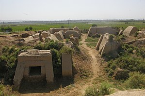
Ajina Tepe (Russian: Аджина-Тепе; Tajik: Аҷинатеппа, romanized: Ajinateppa) is a Buddhist monastery cluster located 12 kilometers east of the city of Bokhtar, Tajikistan. Buddhism in Tokharistan is said to have enjoyed a revival under the Western Turks. Several monasteries dated to the 7th-8th centuries display beautiful Buddhist works of art, such as Kalai Kafirnigan, Ajina Tepe, Khisht Tepe or Kafyr Kala, around which Turkic nobility and populations followed Hinayana Buddhism.
Oriyon, Khatlon
Jamoat in Khatlon Region, Tajikistan
Distance: Approx. 7151 meters
Latitude and longitude: 37.85,68.75
Oriyon (Russian and Tajik: Ориён, formerly: Avangard) is a jamoat in Tajikistan. It is located in Kushoniyon District in Khatlon Region. The jamoat has a total population of 10,392 (2015).
Bokhtariyon
Town and Jamoat in Khatlon Region, Tajikistan
Distance: Approx. 9707 meters
Latitude and longitude: 37.88305556,68.73027778
Bokhtariyon (Tajik: Бохтариён, Persian: باختریان) is a town and jamoat in Tajikistan. It is located in Kushoniyon District in Khatlon Region. The population of the town is 7,900 (January 2020 estimate).
Bustonqala
Town and Jamoat in Khatlon Region, Tajikistan
Distance: Approx. 639 meters
Latitude and longitude: 37.84277778,68.82777778
Bustonqala (Tajik: Бӯстонқалъа, Persian: بستانقلعه) is a town and jamoat in Tajikistan. It is located in Kushoniyon District in Khatlon Region. The population of the town is 4,900 (January 2020 estimate).
Ismoili Somoni
Town and Jamoat in Khatlon Region, Tajikistan
Distance: Approx. 9304 meters
Latitude and longitude: 37.7675,68.80194444
Ismoil Somoni (Tajik: Исмоили Сомони) is a town and jamoat in the Khatlon Region of Tajikistan. It is the capital of Kushoniyon District. The population of the town is 8,500 (January 2020 estimate).
Mehnatobod, Kushoniyon District
Village and Jamoat in Khatlon Region, Tajikistan
Distance: Approx. 9033 meters
Latitude and longitude: 37.76666667,68.83333333
Mehnatobod (Tajik: Меҳнатобод, Persian: محنتآباد) is a village and jamoat in Tajikistan. It is located in Kushoniyon District in Khatlon Region. The jamoat has a total population of 34,201 (2015).
Weather in this IP's area
few clouds
4 Celsius
2 Celsius
4 Celsius
4 Celsius
1038 hPa
87 %
1038 hPa
984 hPa
9000 meters
2 m/s
20 degree
20 %