216.74.253.192 - IP Lookup: Free IP Address Lookup, Postal Code Lookup, IP Location Lookup, IP ASN, Public IP
Country:
Region:
City:
Location:
Time Zone:
Postal Code:
ISP:
ASN:
language:
User-Agent:
Proxy IP:
Blacklist:
IP information under different IP Channel
ip-api
Country
Region
City
ASN
Time Zone
ISP
Blacklist
Proxy
Latitude
Longitude
Postal
Route
db-ip
Country
Region
City
ASN
Time Zone
ISP
Blacklist
Proxy
Latitude
Longitude
Postal
Route
IPinfo
Country
Region
City
ASN
Time Zone
ISP
Blacklist
Proxy
Latitude
Longitude
Postal
Route
IP2Location
216.74.253.192Country
Region
texas
City
arlington
Time Zone
America/Chicago
ISP
Language
User-Agent
Latitude
Longitude
Postal
ipdata
Country
Region
City
ASN
Time Zone
ISP
Blacklist
Proxy
Latitude
Longitude
Postal
Route
Popular places and events near this IP address

Pantego, Texas
Town in Texas, United States
Distance: Approx. 1066 meters
Latitude and longitude: 32.71527778,-97.15472222
Pantego is a town in Tarrant County, Texas, United States. Its population was 2,568 at the 2020 census. It is entirely surrounded by the cities of Arlington and Dalworthington Gardens.
Arlington High School (Texas)
Public school in Arlington, Tarrant County, Texas, United States
Distance: Approx. 2881 meters
Latitude and longitude: 32.719742,-97.118248
Arlington High School (AHS), located in Arlington, Texas, United States, is a secondary school serving grades 9-12. It is one of the six high schools comprising the Arlington Independent School District. AHS has approximately 2,700 students, and are residents of Arlington, Dalworthington Gardens, and Pantego.
Arlington Baptist University
University in Arlington, Texas
Distance: Approx. 1903 meters
Latitude and longitude: 32.739,-97.157
Arlington Baptist University is a private Bible college in Arlington, Texas. It offers both undergraduate and graduate degree programs (only at the masters' level; ABU does not offer doctoral programs).

Maverick Stadium
Distance: Approx. 2190 meters
Latitude and longitude: 32.72920556,-97.12636111
Maverick Stadium is a 12,000-seat multi-purpose stadium on the western edge of University of Texas at Arlington campus. It hosts the university's track and field teams and is also leased by the Pantego Christian Academy for their football team. It usually serves as the site of 1–3 high school football playoff games every year.

MetroCenter (Arlington, Texas)
Entertainment venue and church
Distance: Approx. 2321 meters
Latitude and longitude: 32.7096,-97.130127
The MetroCenter at 1323 W. Pioneer Parkway (Spur 303) in Arlington, Texas, opened in 2005. The 98,000 square-foot venue has hosted concerts, theatrical productions, conferences and other community events, and is also used by Fielder Church as a place of worship. It was built by the church for $17 million, and seats 1,700.

University of Texas at Arlington School of Architecture
Architecture school at the University of Texas at Arlington
Distance: Approx. 3163 meters
Latitude and longitude: 32.730927,-97.116126
The College of Architecture, Planning and Public Affairs at the University of Texas at Arlington is a professional school of design located in Arlington, Texas. The School of Architecture's newest program is a graduate-level Certificate in Property Repositioning and Turnaround, added in 2009. The UT Arlington campus is ideally situated in the center of one of the region’s largest and most diverse urban areas known as the Dallas/Fort Worth Metroplex, creating an ideal laboratory environment where the concepts being discussed in the classroom take shape all around.
Pantego Christian Academy
Private Christian school
Distance: Approx. 678 meters
Latitude and longitude: 32.722026,-97.141651
Pantego Christian Academy (PCA) is a private Christian school in Tarrant County, Texas, United States. Its main campus, the Arlington Campus, has a building at 2201 West Park Row Drive in Arlington and a 57,000-square-foot (5,300 m2) high school building at 2221 West Park Row Drive in Pantego. The Arlington Campus has 670 students in grades pre-kindergarten through grade 12.

Clay Gould Ballpark
Sports venue in Arlington, Texas, US
Distance: Approx. 1650 meters
Latitude and longitude: 32.722021,-97.131157
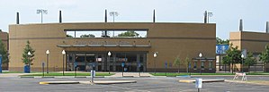
Clay Gould Ballpark (formerly Allan Saxe Stadium and Arlington Athletic Center), the home field of the UT Arlington Mavericks, is located on the campus of The University of Texas at Arlington (UT Arlington). The stadium has a seat capacity of 1,600. Clay Gould Ballpark is located at the intersection of West Park Row Drive and Fielder Road.

Allan Saxe Field
Sports stadium in Arlington, Texas
Distance: Approx. 1806 meters
Latitude and longitude: 32.7225,-97.12944444
Allan Saxe Field is the home of the UTA Mavericks softball team located in Arlington, Texas. As a result of a complete reconstruction in 2014–15, the stadium currently has a capacity of 622. Prior to the renovation, the softball facility had a seating capacity of 250.
UTA Tennis Center
Distance: Approx. 2862 meters
Latitude and longitude: 32.73192,-97.11987
The UTA Tennis Center is the home of the University of Texas at Arlington men's and women's tennis teams. The facility is located near the intersection of Summit Avenue and Greek Row Drive on the UTA campus. Several apartment buildings, constructed by the university, surround the center.

College of Architecture, Planning and Public Affairs
Distance: Approx. 3163 meters
Latitude and longitude: 32.730927,-97.116126
The College of Architecture, Planning and Public Affairs at the University of Texas at Arlington is a professional school of design located in Arlington, Texas. In 2015, The University of Texas at Arlington’s School of Architecture and School of Urban and Public Affairs united to form the College of Architecture, Planning and Public Affairs (CAPPA). The integration of the two schools strengthened the academic and research opportunities available for students and faculty at UTA and provides nationally ranked programs that are unique to the Dallas–Fort Worth region.
Rush Creek (Texas)
Creek in northern Texas
Distance: Approx. 2583 meters
Latitude and longitude: 32.744,-97.1614
Rush Creek is a creek in Tarrant County, Texas. The creek rises near Mansfield and flows for twelve miles. The creek meets Village Creek to the west of Arlington.
Weather in this IP's area
clear sky
3 Celsius
-1 Celsius
2 Celsius
4 Celsius
1024 hPa
61 %
1024 hPa
1001 hPa
10000 meters
4.12 m/s
140 degree