216.74.249.83 - IP Lookup: Free IP Address Lookup, Postal Code Lookup, IP Location Lookup, IP ASN, Public IP
Country:
Region:
City:
Location:
Time Zone:
Postal Code:
IP information under different IP Channel
ip-api
Country
Region
City
ASN
Time Zone
ISP
Blacklist
Proxy
Latitude
Longitude
Postal
Route
Luminati
Country
Region
tx
City
houston
ASN
Time Zone
America/Chicago
ISP
LOGIXCOMM-AS
Latitude
Longitude
Postal
IPinfo
Country
Region
City
ASN
Time Zone
ISP
Blacklist
Proxy
Latitude
Longitude
Postal
Route
IP2Location
216.74.249.83Country
Region
texas
City
forest hill
Time Zone
America/Chicago
ISP
Language
User-Agent
Latitude
Longitude
Postal
db-ip
Country
Region
City
ASN
Time Zone
ISP
Blacklist
Proxy
Latitude
Longitude
Postal
Route
ipdata
Country
Region
City
ASN
Time Zone
ISP
Blacklist
Proxy
Latitude
Longitude
Postal
Route
Popular places and events near this IP address

Everman, Texas
City in Texas, United States
Distance: Approx. 1977 meters
Latitude and longitude: 32.625,-97.28416667
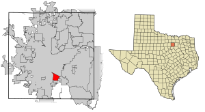
Everman is a city in Tarrant County, Texas, United States. Its population was 6,154 in the 2020 census, an increase over the figure of 6,108 tabulated in 2010.

Forest Hill, Texas
City in Texas, United States
Distance: Approx. 5714 meters
Latitude and longitude: 32.66222222,-97.25722222
Forest Hill is a suburb of Fort Worth in Tarrant County, Texas, United States. The population was 13,955 at the 2020 census.

Kennedale, Texas
City in Texas, United States
Distance: Approx. 5345 meters
Latitude and longitude: 32.63055556,-97.21722222
Kennedale is a city in Tarrant County, Texas, United States. The city had a population of 8,517 as of 2020.
Rendon, Texas
CDP in Texas, United States
Distance: Approx. 4010 meters
Latitude and longitude: 32.57916667,-97.25222222
Rendon is a census-designated place (CDP) in Tarrant County, Texas, United States. The population was 13,533 in 2020.

Barron Field
Distance: Approx. 3701 meters
Latitude and longitude: 32.62388889,-97.30666667
Barron Field (Camp Taliaferro Field #2) is a former World War I military airfield, located 1.0 mile (1.6 km) West-southwest of Everman, Texas. It operated as a training field for the Air Service, United States Army between 1917 until 1921. It was one of thirty-two Air Service training camps established after the United States entry into World War I in April 1917.

Texas Health Huguley Hospital Fort Worth South
Hospital in Texas, United States
Distance: Approx. 5422 meters
Latitude and longitude: 32.58651,-97.31907
Texas Health Huguley Hospital Fort Worth South is a non-profit hospital campus in Burleson, Texas that is part of a joint venture company created by Adventist Health System and Texas Health Resources.

KFJZ
Radio station in Fort Worth, Texas
Distance: Approx. 1775 meters
Latitude and longitude: 32.600969,-97.256125
KFJZ (870 AM) is a radio station broadcasting in the Dallas/Fort Worth metroplex with a financial news/talk format via the BizTalkRadio. This station is licensed in Fort Worth, Texas and is owned and operated by SIGA Broadcasting Corporation. Because it shares the same frequency as "clear channel" station WWL in New Orleans, KFJZ operates only during the daytime hours.
KCLE
Radio station in Burleson, Texas
Distance: Approx. 3851 meters
Latitude and longitude: 32.57861111,-97.28055556
KCLE (1460 AM) is a commercial radio station licensed to Burleson, Texas, which serves the Dallas–Fort Worth metroplex. It is owned by Tron Dinh Do, through licensee Intelli, LLC., operated by Wilkins Radio Network pending acquisition, and broadcasts a Christian radio format. First licensed in July 1922, it is one of Texas' oldest radio stations.
Cowtown Speedway
Automobile raceway in Kennedale, Texas, US
Distance: Approx. 5262 meters
Latitude and longitude: 32.62722222,-97.21666667
Cowtown Speedway was a 0.25-mile-long (0.40 km) high bank clay track automobile raceway in Kennedale, Texas, that hosted weekend races for classes such as Dwarf cars, Sprint cars, stock cars and go-karts.
Herman Clark Stadium
Multi-use stadium in Fort Worth, Texas
Distance: Approx. 6307 meters
Latitude and longitude: 32.66754,-97.283099
Herman Clark Stadium Paul Galvan Field is a 12,000-capacity multi-use stadium in Fort Worth, Texas. The stadium is mostly used for High school football where it hosts teams from the Fort Worth Independent School District but is also used for track & field contests and soccer matches. The playing surface is artificial turf and there is no video scoreboard.

Everman Joe C. Bean High School
Public high school in Everman, Texas, Texas, United States
Distance: Approx. 1957 meters
Latitude and longitude: 32.6198,-97.2885
Everman Joe C. Bean High School (commonly referred to as Everman, Everman High School, and EHS and also E-Block) is a public secondary school located in Everman, Texas (a suburb south of Fort Worth, Texas). The school is a part of the Everman Independent School District (commonly referred to as Everman ISD) and serves students in grades 9-12. The school mascot is the Bulldog, and school colors are purple and gold.
Garden Acres, Texas
Historical unincorporated community in Texas, United States
Distance: Approx. 3636 meters
Latitude and longitude: 32.59444444,-97.3025
Garden Acres was an unincorporated community in Tarrant County, located in the U.S. state of Texas. The area is now largely within the city of Fort Worth, located between Rendon and Everman to the south of the city.
Weather in this IP's area
overcast clouds
-0 Celsius
-5 Celsius
-1 Celsius
1 Celsius
1019 hPa
92 %
1019 hPa
992 hPa
4828 meters
5.14 m/s
310 degree
100 %