216.74.249.19 - IP Lookup: Free IP Address Lookup, Postal Code Lookup, IP Location Lookup, IP ASN, Public IP
Country:
Region:
City:
Location:
Time Zone:
Postal Code:
ISP:
ASN:
language:
User-Agent:
Proxy IP:
Blacklist:
IP information under different IP Channel
ip-api
Country
Region
City
ASN
Time Zone
ISP
Blacklist
Proxy
Latitude
Longitude
Postal
Route
db-ip
Country
Region
City
ASN
Time Zone
ISP
Blacklist
Proxy
Latitude
Longitude
Postal
Route
IPinfo
Country
Region
City
ASN
Time Zone
ISP
Blacklist
Proxy
Latitude
Longitude
Postal
Route
IP2Location
216.74.249.19Country
Region
texas
City
arlington
Time Zone
America/Chicago
ISP
Language
User-Agent
Latitude
Longitude
Postal
ipdata
Country
Region
City
ASN
Time Zone
ISP
Blacklist
Proxy
Latitude
Longitude
Postal
Route
Popular places and events near this IP address

Dalworthington Gardens, Texas
City in Texas, United States
Distance: Approx. 3231 meters
Latitude and longitude: 32.69361111,-97.15666667
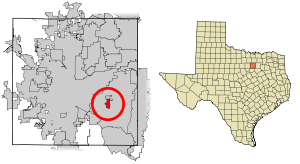
Dalworthington Gardens is a city in Tarrant County, Texas, United States and a suburb of Arlington.

Pantego, Texas
Town in Texas, United States
Distance: Approx. 4523 meters
Latitude and longitude: 32.71527778,-97.15472222
Pantego is a town in Tarrant County, Texas, United States. Its population was 2,568 at the 2020 census. It is entirely surrounded by the cities of Arlington and Dalworthington Gardens.

Martin High School (Arlington, Texas)
Public school in Arlington, Texas, United States
Distance: Approx. 1080 meters
Latitude and longitude: 32.684,-97.18
James W. Martin High School is a secondary school for grades 9 to 12 in Arlington, Texas, United States. It is part of the Arlington Independent School District. The school's colors are red, black and silver.
Pylon Field
Airport
Distance: Approx. 984 meters
Latitude and longitude: 32.68777778,-97.18
Pylon Field was a small airport located in southwest Arlington, Texas, United States. It was originally built in 1960. The airport had a single 1,800-foot unpaved runway.
KFLC
Radio station in Benbrook–Dallas, Texas
Distance: Approx. 4321 meters
Latitude and longitude: 32.7268,-97.19195833
KFLC (1270 AM) is a commercial radio station licensed to Benbrook, Texas, and broadcasting to the Dallas-Fort Worth Metroplex. The station is owned and operated by Latino Media Network, with studios located in the Univision Tower at the Plaza Of The Americas in the City Center District in Downtown Dallas. KFLC airs a Spanish language Adult Contemporary radio format in the daylight, while also broadcasting as a TUDN Radio affiliate in the nighttime, and also carries Spanish language play by play featuring Texas Rangers, Dallas Mavericks, and FC Dallas.
Burton Adventist Academy
Private school in Arlington, Tarrant, Texas, United States
Distance: Approx. 2458 meters
Latitude and longitude: 32.6709,-97.1739
Burton Adventist Academy is a co-educational private Christian school in Arlington, Texas, United States. It covers the grades from pre-kindergarten through twelfth grade. Burton is associated with the Seventh-day Adventist Church and is part of the Seventh-day Adventist education system.
Kennedale High School
School in Kennedale, Texas, United States
Distance: Approx. 3912 meters
Latitude and longitude: 32.65354,-97.198663
Kennedale High School is a public high school in Kennedale, Texas. The only high school in the Kennedale Independent School District, it serves students in Kennedale and a small part of Arlington. It was rated in 2011 "Recognized" by the Texas Education Agency.
The Oakridge School
Private school in Arlington, Texas, US
Distance: Approx. 3991 meters
Latitude and longitude: 32.723717,-97.194207
The Oakridge School is a private school located in Arlington, Texas, US. It educates about 800 students in age groups Preschool-12.
Grace Preparatory Academy
Private school in Arlington, Texas, United States
Distance: Approx. 3329 meters
Latitude and longitude: 32.673435,-97.159468
Grace Preparatory Academy (GPA) is a private, college-preparatory Christian school located in Arlington, Texas, United States. Founded in 1992, it offers programs for Kindergarten through Twelfth Grade students drawn from the Dallas/Fort Worth metroplex. It is the founding member of the National Association of University-Model Schools and is accredited by the Southern Association of Colleges and Schools.
Battle of Village Creek
Distance: Approx. 3814 meters
Latitude and longitude: 32.72194444,-97.185
The Battle of Village Creek, also known as the Village Creek Massacre, occurred on May 24, 1841, on the embankments of Village Creek in what was then the Republic of Texas. The site of the massacre is now located in Tarrant County, Texas, named for Edward H. Tarrant, who commanded the Texan forces in the massacre. Tarrant rallied a volunteer militia of 69 men, including Captain John B. Denton, who would be the Texans’ only fatality and who would also go on to have a North Texas county bear his name.
Sublett Creek
Creek in northern Texas
Distance: Approx. 5145 meters
Latitude and longitude: 32.6472,-97.1647
Sublett Creek is a creek in Tarrant County, Texas. The creek rises in South Arlington, flowing north-east through the Sublett Creek Linear Park where it meets Rush Creek.

Lake Arlington (Texas)
Lake in Texas, United States
Distance: Approx. 2798 meters
Latitude and longitude: 32.70333333,-97.21416667
Lake Arlington is a lake located in West Arlington, Texas. The lake is situated east of Interstate 820, and directly west of the city of Dalworthington Gardens. It is located on Village Creek.
Weather in this IP's area
clear sky
2 Celsius
-2 Celsius
1 Celsius
3 Celsius
1024 hPa
67 %
1024 hPa
1000 hPa
10000 meters
4.12 m/s
140 degree