216.74.248.1 - IP Lookup: Free IP Address Lookup, Postal Code Lookup, IP Location Lookup, IP ASN, Public IP
Country:
Region:
City:
Location:
Time Zone:
Postal Code:
ISP:
ASN:
language:
User-Agent:
Proxy IP:
Blacklist:
IP information under different IP Channel
ip-api
Country
Region
City
ASN
Time Zone
ISP
Blacklist
Proxy
Latitude
Longitude
Postal
Route
db-ip
Country
Region
City
ASN
Time Zone
ISP
Blacklist
Proxy
Latitude
Longitude
Postal
Route
IPinfo
Country
Region
City
ASN
Time Zone
ISP
Blacklist
Proxy
Latitude
Longitude
Postal
Route
IP2Location
216.74.248.1Country
Region
texas
City
keller
Time Zone
America/Chicago
ISP
Language
User-Agent
Latitude
Longitude
Postal
ipdata
Country
Region
City
ASN
Time Zone
ISP
Blacklist
Proxy
Latitude
Longitude
Postal
Route
Popular places and events near this IP address

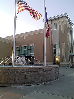
Keller, Texas
City in Texas, United States
Distance: Approx. 1172 meters
Latitude and longitude: 32.9275,-97.23611111
Keller is a city in Tarrant County, Texas, United States, in the Dallas–Fort Worth metroplex. According to the 2020 census, the city's population is 45,776, making Keller the 78th most populated city in Texas. The most recent population estimate, as of July 1, 2021, is 45,397.

Watauga, Texas
City in Texas, United States
Distance: Approx. 6358 meters
Latitude and longitude: 32.87138889,-97.24916667
Watauga () is a city in Tarrant County, Texas, United States, and a suburb of Fort Worth. The population was 23,650 at the 2020 census. The city's businesses and retail markets are generally located on Highway 377.

Fossil Ridge High School (Fort Worth, Texas)
American public high school
Distance: Approx. 5882 meters
Latitude and longitude: 32.89305556,-97.29527778
Fossil Ridge High School (FRHS) is an American public high school located in northeast Fort Worth, Texas. It is the second high school inside the Keller Independent School District. Most nearby schools such as Fossil Hill Middle School and Vista Ridge Middle School graduates feed into Fossil Ridge.
Westlake Academy
School in Westlake, Texas, United States
Distance: Approx. 7115 meters
Latitude and longitude: 32.985924,-97.215162
Westlake Academy (WA) is an open-enrollment charter school in the United States state of Texas, operating under the International Baccalaureate (IB) curriculum.

Central High School (Fort Worth, Texas)
Public high school in Fort Worth, Texas, United States
Distance: Approx. 2891 meters
Latitude and longitude: 32.910062,-97.270389
Central High School is a public high school in north Fort Worth, Texas, United States. The school is located entirely within the Keller Independent School District, and primarily serves neighborhoods adjacent to Highway 377 to the east and North Beach Street to the west. As of the 2021-2022 school year, the campus housed 2,598 students in grades 9-12.
Keller Independent School District
School district in Texas
Distance: Approx. 597 meters
Latitude and longitude: 32.93381,-97.24772
Keller Independent School District is a school district based in Keller, Texas, United States. Keller ISD covers 51 square miles (130 km2) in northeast Tarrant County in cities such as Keller, Fort Worth, Haltom City, Watauga, North Richland Hills, Hurst, Colleyville, Southlake, and Westlake, serving more than 33,000 students across 42 campuses. In 2022, the school district was given an overall grade of "B" by the Texas Education Agency.
Cross Timbers Park
Distance: Approx. 4949 meters
Latitude and longitude: 32.888079,-97.226547
Cross Timbers Park is a park located in North Richland Hills, Texas. The park claims 101 acres (0.41 km2) of land. Included in the park are playgrounds, walking trails and a youth baseball complex with three lighted fields and a practice field.

Keller High School
High school in Keller, Texas, United States
Distance: Approx. 1970 meters
Latitude and longitude: 32.940429,-97.233022
Keller High School is a public high school located in the city of Keller, Texas and is served by the Keller Independent School District. The school educates students in the majority of the city of Keller, western Southlake, northwestern Colleyville, northern North Richland Hills, and most of Westlake, including the Vaquero development. It has been recognized as a National Blue Ribbon School for the 1999-2000 school year.
Paw Paw Formation
Geological formation in Texas
Distance: Approx. 5757 meters
Latitude and longitude: 32.9,-97.3
The Paw Paw Formation is a geological formation in Texas whose strata date back to the late Albian stage of the Early Cretaceous. Dinosaur remains are among the fossils that have been recovered from the formation.
Maple, Dallas
Distance: Approx. 6909 meters
Latitude and longitude: 32.8722,-97.2797
Maple Lawn, or Maple for short is an area in North Dallas, Texas, United States, which is home to government owned section 8 projects. The area has long been home to a largely African American and Hispanic community. Maple Avenue is the main road through the area, although the Maple Lawn area is unofficially the area bound to the West/Southwest of Harry Hines Boulevard, to the East by the Dallas North Tollway, to the North/Northeast by Lemmon Avenue, and to the Northwest by Mockingbird Lane.
Crawford Farms, Fort Worth, Texas
Neighborhood in Fort Worth, Texas
Distance: Approx. 4976 meters
Latitude and longitude: 32.92372,-97.30155
Crawford Farms is a neighborhood that is located in north Fort Worth, Texas and is generally bound by Golden Triangle on the north and Old Denton Road on the west. It is adjacent to the Sunset Hills, Heritage, and Vista Meadows neighborhoods. Timberview Middle School is physically located adjacent to the Crawford Farms neighborhood.
Timber Creek High School (Fort Worth, Texas)
High school in Fort Worth, Texas, United States
Distance: Approx. 4341 meters
Latitude and longitude: 32.9497,-97.2876
Timber Creek High School is a public high school located in the city of Fort Worth, Texas which is served by the Keller Independent School District. The campus opened its doors in the fall of 2009 and was Keller ISD's fourth high school. Its first graduating class was in the spring of 2012.
Weather in this IP's area
few clouds
3 Celsius
-2 Celsius
2 Celsius
4 Celsius
1023 hPa
56 %
1023 hPa
999 hPa
10000 meters
6.17 m/s
170 degree
20 %