216.74.242.55 - IP Lookup: Free IP Address Lookup, Postal Code Lookup, IP Location Lookup, IP ASN, Public IP
Country:
 USA
USARegion:
City:
Location:
Time Zone:
Postal Code:
ISP:
ASN:
language:
User-Agent:
Proxy IP:
Blacklist:
IP information under different IP Channel
ip-api
Country
Region
City
ASN
Time Zone
ISP
Blacklist
Proxy
Latitude
Longitude
Postal
Route
db-ip
Country
Region
City
ASN
Time Zone
ISP
Blacklist
Proxy
Latitude
Longitude
Postal
Route
IPinfo
Country
Region
City
ASN
Time Zone
ISP
Blacklist
Proxy
Latitude
Longitude
Postal
Route
IP2Location
216.74.242.55Country
usRegion
texas
City
houston
Time Zone
America/Chicago
ISP
Language
User-Agent
Latitude
Longitude
Postal
ipdata
Country
Region
City
ASN
Time Zone
ISP
Blacklist
Proxy
Latitude
Longitude
Postal
Route
Popular places and events near this IP address

Texas's 18th congressional district
U.S. House district for Texas
Distance: Approx. 4317 meters
Latitude and longitude: 29.81861111,-95.25361111
Texas's 18th congressional district of the United States House of Representatives includes much of inner city Houston and the surrounding area. It has been the Downtown Houston district since 1972. The district is currently represented by Democrat Sylvester Turner.

Forest Brook High School
Comprehensive public high school in the United States
Distance: Approx. 3677 meters
Latitude and longitude: 29.850318,-95.293928
Forest Brook High School was a high school located at 7525 Tidwell Road in Houston, Texas, United States. Serving grades 9 through 12, Forest Brook was a part of the North Forest Independent School District. It is now the site of Forest Brook Middle School, now under the control of the Houston Independent School District.

Houmont Park, Texas
Unincorporated community in Harris County, Texas
Distance: Approx. 5129 meters
Latitude and longitude: 29.8425,-95.20638889
Houmont Park is an unincorporated area in east central Harris County, Texas, United States. It is located along Beaumont Highway (U.S. Highway 90) and the Southern Pacific Railroad, 2 miles (3.2 km) southwest of the Sheldon Reservoir. The subdivision developed during the 1950s and the 1960s, as Greater Houston expanded in size.
Dyersdale, Texas
Unincorporated community in Texas, US
Distance: Approx. 3827 meters
Latitude and longitude: 29.89166667,-95.25777778
Dyersdale is an unincorporated community in Harris County, Texas, United States. The name originates from Clement C. Dyer, one of the "Old Three Hundred" of Stephen F. Austin's colonists. A post office opened in 1913.

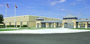
North Forest High School
Public school in Texas, United States
Distance: Approx. 1117 meters
Latitude and longitude: 29.866957,-95.259842
North Forest High School (NFHS) is a secondary school located in Houston, Texas, United States. The school is a part of the Houston Independent School District (HISD); it was a part of the North Forest Independent School District (NFISD) until the district closed on July 1, 2013.

East Houston
Human settlement in Houston, Texas, United States of America
Distance: Approx. 1933 meters
Latitude and longitude: 29.84,-95.255
East Houston is a community in Houston, Texas, United States.

Settegast, Houston
Distance: Approx. 3925 meters
Latitude and longitude: 29.8416,-95.2931
Settegast is a neighborhood in northeast Houston; it has an average population density between one and five. The community is bordered by the 610 Loop, the Union Pacific Railroad Settegast Yard, and the old Beaumont Highway. The community has many small, wood-framed houses and empty lots.
C.E. King High School
Public school in Houston, Harris County, Texas, United States
Distance: Approx. 4916 meters
Latitude and longitude: 29.8485,-95.2068
C.E. King High School is a secondary school located in unincorporated Harris County, Texas, United States that serves grades 9 through 12. It is the only high school in the Sheldon Independent School District. The school serves unincorporated areas of northeast Harris County including the Sheldon CDP and several nearby communities (Beaumont Place, Houmont Park) and subdivisions.
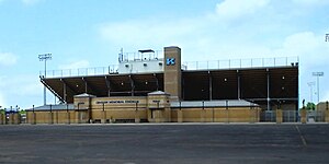
Crenshaw Memorial Stadium
Distance: Approx. 4642 meters
Latitude and longitude: 29.849238,-95.209529
J.H. Crenshaw Memorial Stadium is a multi-purpose stadium in unincorporated Harris County located northeast of Houston, Texas. The stadium is owned and operated by Sheldon Independent School District and is composed of a track and field which are used for various sports. The stadium is situated in the space between C.E. King Middle School and C.E. King High School and is shared by C.E. King Middle school and Michael R. Null Middle School.

Scenic Woods, Houston
Distance: Approx. 4275 meters
Latitude and longitude: 29.8608,-95.3008
Scenic Woods is a neighborhood located in northeast Houston, Texas, United States, near Homestead Road and Parker Road. The community is populated by working class African Americans. The community is a quiet family oriented place with manicured lawns and well maintained homes.
Halls Bayou
Distance: Approx. 3037 meters
Latitude and longitude: 29.83815,-95.23429
Halls Bayou is a bayou in the northern part of Houston, Texas. It begins just north of W Mt Houston Road and flows for 17 miles (27 km). It empties into Greens Bayou in Brock Park and Golf Course.
B.C. Elmore High School
Former school in Texas, United States
Distance: Approx. 5596 meters
Latitude and longitude: 29.8099,-95.276
Bennie Carl Elmore High School was a senior high school in Houston, Texas. It was a part of the East and Mount Houston Independent School District. It was a school for black students, and it served the community of Settegast.
Weather in this IP's area
broken clouds
26 Celsius
26 Celsius
24 Celsius
27 Celsius
1021 hPa
74 %
1021 hPa
1019 hPa
10000 meters
3.09 m/s
200 degree
75 %