216.74.240.66 - IP Lookup: Free IP Address Lookup, Postal Code Lookup, IP Location Lookup, IP ASN, Public IP
Country:
 USA
USARegion:
City:
Location:
Time Zone:
Postal Code:
ISP:
ASN:
language:
User-Agent:
Proxy IP:
Blacklist:
IP information under different IP Channel
ip-api
Country
Region
City
ASN
Time Zone
ISP
Blacklist
Proxy
Latitude
Longitude
Postal
Route
db-ip
Country
Region
City
ASN
Time Zone
ISP
Blacklist
Proxy
Latitude
Longitude
Postal
Route
IPinfo
Country
Region
City
ASN
Time Zone
ISP
Blacklist
Proxy
Latitude
Longitude
Postal
Route
IP2Location
216.74.240.66Country
usRegion
texas
City
san antonio
Time Zone
America/Chicago
ISP
Language
User-Agent
Latitude
Longitude
Postal
ipdata
Country
Region
City
ASN
Time Zone
ISP
Blacklist
Proxy
Latitude
Longitude
Postal
Route
Popular places and events near this IP address

Grass Fight
1835 battle during the Texas Revolution
Distance: Approx. 1714 meters
Latitude and longitude: 29.41,-98.51
The Grass Fight was a small battle during the Texas Revolution, fought between the Mexican Army and the Texian Army. The battle took place on November 26, 1835, just south of San Antonio de Béxar in the Mexican region of Texas. The Texas Revolution had officially begun on October 2 and by the end of the month the Texians had initiated a siege of Béxar, home of the largest Mexican garrison in the province.

Our Lady of the Lake University
Private university in San Antonio, Texas
Distance: Approx. 2201 meters
Latitude and longitude: 29.4263,-98.5444
Our Lady of the Lake University (OLLU), known locally as the Lake, is a private Catholic university in San Antonio, Texas. It was founded in 1895 by the Sisters of Divine Providence, a religious institute originating in Lorraine, France, during the 18th century. The Texas chapter of the institute still sponsors the university.
Lanier High School (San Antonio)
School in San Antonio, Bexar County, Texas, United States
Distance: Approx. 603 meters
Latitude and longitude: 29.421801,-98.516491
Sidney Lanier High School is a local public high school of the San Antonio Independent School District in the westside of San Antonio, Texas and classified as a 5A school by the University Interscholastic League. During 2022–2023, Lanier High School had an enrollment of 1,547 students and a student to teacher ratio of 96.92. The school received an overall rating of "C" from the Texas Education Agency for the 2021–2022 school year.
Alamo Colleges District
Distance: Approx. 2073 meters
Latitude and longitude: 29.4271,-98.50248056
The Alamo Colleges District (previously the Alamo Community College District, or ACCD, and The Alamo Colleges) is a network of five community colleges in San Antonio and Universal City, Texas, and serving the Greater San Antonio metropolitan area. The district was founded in 1945 as the San Antonio Union Junior College District before adopting the Alamo name in 1982.
Battle of Alazan Creek
Battle of the Mexican War of Independence
Distance: Approx. 1120 meters
Latitude and longitude: 29.4264,-98.513
The Battle of Alazan Creek, occurred on the banks of Alazan Creek in Spanish Texas on June 20, 1813, during the Mexican War of Independence. The location is today in Bexar County, Texas, in the United States, just west of downtown San Antonio (formerly San Antonio del Bejar).

San Antonio Sporting District
Former red-light district
Distance: Approx. 2096 meters
Latitude and longitude: 29.4247956,-98.5014711
The Sporting District was a red-light district in the U.S. city of San Antonio, Texas in the late 19th and early 20th centuries. It was established by the city council to manage prostitution in the city. For a time it was one of the nation's largest vice districts with venues ranging from brothels to gambling halls.

Prospect Hill Missionary Baptist Church
Historic church in Texas, United States
Distance: Approx. 1781 meters
Latitude and longitude: 29.42611111,-98.50527778
Prospect Hill Missionary Baptist Church (Prospect Hill Baptist Church) is a historic Baptist church building at 1601 Buena Vista in San Antonio, Texas. The Beaux Arts style building was constructed in 1911 and added to the National Register of Historic Places in 1986.

Timeline of San Antonio
Distance: Approx. 2232 meters
Latitude and longitude: 29.417,-98.5
The following is a timeline of the history of the city of San Antonio, Texas, United States.
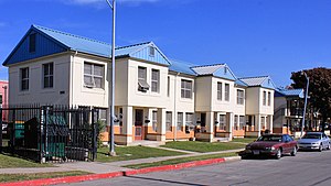
Alazán-Apache Courts
Public housing in San Antonio, Texas, United States
Distance: Approx. 866 meters
Latitude and longitude: 29.416865,-98.514893
Alazán-Apache Courts is a public housing community in San Antonio. The neighborhood is located on the city's West Side, and was built in 1939. It was the first public housing built in the city and is currently made up of three different properties: Alazán, Apache and Guadalupe Homes.

Ruby City (San Antonio)
Texas art museum
Distance: Approx. 2169 meters
Latitude and longitude: 29.4132,-98.502
Ruby City is a contemporary art center in San Antonio, Texas. Founded by Linda Pace and housing her collection of contemporary art, the museum opened in 2019. The building was designed by David Adjaye.

San Anto Cultural Arts
American art nonprofit
Distance: Approx. 178 meters
Latitude and longitude: 29.420272,-98.52433
San Anto Cultural Arts (SACA) is an American 501(c)(3) art nonprofit founded in 1993 in San Antonio, Texas, U.S.. They operate two programs: the community mural and public art program (CMP), and El Placazo Community Newspaper and mentor program. It was founded Manuel "Manny" Castillo, Cruz Ortiz, and Juan Miguel Ramos.

Milam Park
Public park in San Antonio, Texas
Distance: Approx. 2317 meters
Latitude and longitude: 29.426049,-98.4994716
Milam Park, formerly Milam Square, is an urban park located in downtown San Antonio, Texas, United States. Originally used as a burial ground, the park was established in 1884. It is named after Benjamin Milam, whose remains are interred under a monument on the west end of the park.
Weather in this IP's area
clear sky
22 Celsius
22 Celsius
20 Celsius
22 Celsius
1017 hPa
85 %
1017 hPa
991 hPa
10000 meters
5.66 m/s
130 degree