216.70.25.31 - IP Lookup: Free IP Address Lookup, Postal Code Lookup, IP Location Lookup, IP ASN, Public IP
Country:
Region:
City:
Location:
Time Zone:
Postal Code:
IP information under different IP Channel
ip-api
Country
Region
City
ASN
Time Zone
ISP
Blacklist
Proxy
Latitude
Longitude
Postal
Route
Luminati
Country
Region
mn
City
mankato
ASN
Time Zone
America/Chicago
ISP
ENVENTIS
Latitude
Longitude
Postal
IPinfo
Country
Region
City
ASN
Time Zone
ISP
Blacklist
Proxy
Latitude
Longitude
Postal
Route
IP2Location
216.70.25.31Country
Region
minnesota
City
golden valley
Time Zone
America/Chicago
ISP
Language
User-Agent
Latitude
Longitude
Postal
db-ip
Country
Region
City
ASN
Time Zone
ISP
Blacklist
Proxy
Latitude
Longitude
Postal
Route
ipdata
Country
Region
City
ASN
Time Zone
ISP
Blacklist
Proxy
Latitude
Longitude
Postal
Route
Popular places and events near this IP address

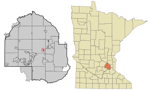
Golden Valley, Minnesota
City in Minnesota, United States
Distance: Approx. 2850 meters
Latitude and longitude: 45.00972222,-93.34916667
Golden Valley is a western and first-ring suburb of Minneapolis in Hennepin County, Minnesota, United States. The population was 22,552 at the 2020 census. The city is mostly residential and is bordered by U.S. Highway 12 (Interstate 394).

Medicine Lake, Minnesota
City in Minnesota, United States
Distance: Approx. 3318 meters
Latitude and longitude: 45.00194444,-93.42138889
Medicine Lake is an independent municipality in Hennepin County, Minnesota, United States located on a peninsula that juts into a lake of the same name. The population was 371 at the 2010 census.

Free Lutheran Bible College and Seminary
Distance: Approx. 3667 meters
Latitude and longitude: 45.01541667,-93.41794444
Free Lutheran Bible College and Seminary (FLBCS) is one institution of higher education consisting of two programs, the undergraduate Free Lutheran Bible College (FLBC) and the four-year pastoral training program Free Lutheran Seminary (FLS). FLBCS is accredited through the Transnational Association of Christian Colleges and Schools (TRACS), a member of the Evangelical Council for Financial Accountability (ECFA), and an associate member of the Association for Biblical Higher Education (ABHE). FLBCS is located in Plymouth, Minnesota, near the national offices of the Association of Free Lutheran Congregations (AFLC).

KYCR (AM)
Radio station in Minnesota, United States
Distance: Approx. 2378 meters
Latitude and longitude: 44.98888889,-93.35166667
KYCR (1440 kHz) is an AM radio station serving the Minneapolis-St. Paul metropolitan area. It is owned by Salem Media Group, and is carrying a business radio format.
Perpich Center for Arts Education
Art agency in Golden Valley, Minnesota
Distance: Approx. 2149 meters
Latitude and longitude: 44.98341667,-93.35966667
The Perpich Center for Arts Education is an agency of the state of Minnesota that seeks to advance K-12 education throughout the state by teaching in and through the arts. A 33-acre (130,000 m2) campus in Golden Valley houses the center's three main components: the outreach and professional development group, Perpich Arts High School and the Perpich Arts Library. Perpich serves as a resource for arts education, students, teachers, artists and arts and youth organizations in Minnesota.
Golden Valley Lutheran College
Distance: Approx. 2179 meters
Latitude and longitude: 44.983682,-93.358845
Golden Valley Lutheran College was founded as the Lutheran Bible Institute. The LBI was a two-year degree-granting Lutheran educational institution established in 1919 in St. Paul, Minnesota.
Breck School
Private school in Golden Valley, Minnesota, USA
Distance: Approx. 3364 meters
Latitude and longitude: 44.98111111,-93.34305556
Breck School is an independent college-preparatory preK–12 school in Golden Valley, Minnesota, a suburb of Minneapolis. It was founded in 1886 and is affiliated with the Episcopal Church. The school includes a Lower School consisting of grades preschool through four, a Middle School consisting of grades five through eight, and an Upper School consisting of grades nine through twelve.
West Metro Education Program
Defunct group of schools near Minneapolis, Minnesota, USA
Distance: Approx. 3405 meters
Latitude and longitude: 44.98375,-93.34055556
The West Metro Education Program (WMEP) was a voluntary consortium of 11 urban and suburban school districts in the Minneapolis area of Minnesota. As an educational equity-focused collaborative for student success and educator growth, WMEP offered professional development, equity leadership and student programs to build capacity in the region. WMEP dissolved on June 30, 2018.
Minneapolis Golf Club
Golf club in St. Louis Park, Minnesota
Distance: Approx. 3774 meters
Latitude and longitude: 44.96416667,-93.39527778
Minneapolis Golf Club is a golf club located in St. Louis Park, Minnesota, a suburb of Minneapolis, Minnesota. Designed by Willie Park, Jr.
Center of the American Experiment
American think tank
Distance: Approx. 2745 meters
Latitude and longitude: 44.9718,-93.3761
The Center of the American Experiment is a Minnesota-based think tank that advocates for conservative and free-market principles. John Hinderaker, of the Power Line blog, is its president.

Metropoint Tower
Building in St. Louis Park, Minnesota
Distance: Approx. 2973 meters
Latitude and longitude: 44.975,-93.40277778
The Metropoint Tower, otherwise known as 600 Interchange Tower, is a 20-story high rise office building located in St. Louis Park, Minnesota, United States. Originally known as Shelard Tower upon its completion in 1975, the tower is the tallest building within the 494/694 interstate beltway outside of Minneapolis or Saint Paul, Minnesota.

Medicine Lake (Minnesota)
Distance: Approx. 3482 meters
Latitude and longitude: 45.00833333,-93.42083333
Medicine Lake is an inland lake located approximately 8 miles northwest of downtown Minneapolis, Minnesota. The lake lies within Hennepin County and is surrounded by two municipalities. At 902 acres, it is Hennepin County's second largest lake behind Lake Minnetonka and is popular among boaters, sailors, and fishers.
Weather in this IP's area
broken clouds
-19 Celsius
-26 Celsius
-20 Celsius
-18 Celsius
1024 hPa
76 %
1024 hPa
986 hPa
10000 meters
4.12 m/s
290 degree
75 %