216.70.18.120 - IP Lookup: Free IP Address Lookup, Postal Code Lookup, IP Location Lookup, IP ASN, Public IP
Country:
Region:
City:
Location:
Time Zone:
Postal Code:
ISP:
ASN:
language:
User-Agent:
Proxy IP:
Blacklist:
IP information under different IP Channel
ip-api
Country
Region
City
ASN
Time Zone
ISP
Blacklist
Proxy
Latitude
Longitude
Postal
Route
db-ip
Country
Region
City
ASN
Time Zone
ISP
Blacklist
Proxy
Latitude
Longitude
Postal
Route
IPinfo
Country
Region
City
ASN
Time Zone
ISP
Blacklist
Proxy
Latitude
Longitude
Postal
Route
IP2Location
216.70.18.120Country
Region
minnesota
City
duluth
Time Zone
America/Chicago
ISP
Language
User-Agent
Latitude
Longitude
Postal
ipdata
Country
Region
City
ASN
Time Zone
ISP
Blacklist
Proxy
Latitude
Longitude
Postal
Route
Popular places and events near this IP address

Marshall School
Private, independent school in Duluth, Minnesota, , United States
Distance: Approx. 907 meters
Latitude and longitude: 46.79777778,-92.10722222
Marshall School is an independent, coeducational, day school in Duluth, Minnesota for students in kindergarten through 12th grade. Marshall School is sometimes referred to as Duluth Marshall at Minnesota State High School League athletic tournaments.
East Hillside (Duluth)
Neighborhood of Duluth, Minnesota
Distance: Approx. 423 meters
Latitude and longitude: 46.8025,-92.09555556
East Hillside is a neighborhood in the City of Duluth, Minnesota, United States. East 4th Street serves as one of the main thoroughfares in the community, as well as a small business corridor. In addition to housing both renters and homeowners, East Hillside is the site of many of the major hospitals and clinics that serve Duluth and its surrounding areas.

Fire Station No. 1 (Duluth, Minnesota)
Building
Distance: Approx. 1009 meters
Latitude and longitude: 46.79027778,-92.10027778
Fire Station No. 1 is a former fire station in the Central Hillside neighborhood of Duluth, Minnesota, United States. The two-building complex was constructed in 1889.

Fitger's Brewing Company
Distance: Approx. 783 meters
Latitude and longitude: 46.7925,-92.09055556
Fitger's Brewing Company was a beer manufacturer in Duluth, Minnesota, United States, from 1881 to 1972. The surviving brewery complex stretches for 720 feet (220 m) along the Lake Superior shoreline and East Superior Street, one of Duluth's main roads. The majority of the ten-building complex was constructed between 1886 and 1911.
Whole Foods Co-op
Distance: Approx. 369 meters
Latitude and longitude: 46.79540833,-92.09486944
Whole Foods Co-op is a food cooperative located in Duluth, Minnesota. Founded in 1970 by the members of a food buying club, the grocery is owned by over 10,000 active owners and is a member of the National Cooperative Grocers Association.

Chester Terrace (Duluth, Minnesota)
Historic rowhouse in Duluth, Minnesota
Distance: Approx. 923 meters
Latitude and longitude: 46.79944444,-92.08333333
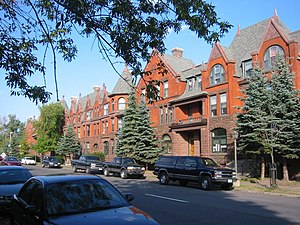
Chester Terrace is a historic rowhouse in Duluth, Minnesota, United States. Built in 1890, it was designed in Romanesque Revival style by Oliver G. Traphagen and Francis W. Fitzpatrick. It was listed on the National Register of Historic Places in 1980 for its local significance in the theme of architecture.

Hartley Building
United States historic place
Distance: Approx. 732 meters
Latitude and longitude: 46.79425,-92.08833333
The Hartley Building is a historic office building in Duluth, Minnesota, United States. It was designed by architect Bertram Goodhue of New York City and built in 1914. The Hartley Building was listed on the National Register of Historic Places in 1989 for having local significance in the theme of architecture.
Pickwick Restaurant and Pub
Distance: Approx. 833 meters
Latitude and longitude: 46.7917,-92.09154
The Pickwick Restaurant and Pub in Duluth, Minnesota began in 1888 as the “Old Saloon," a tasting bar located within the Fitger Brewing Company. It survived a 1914 move and Prohibition, with many relics from 19th century intact. In 2007, they won a James Beard Foundation Award as an America’s Classic.
St. Mark's African Methodist Episcopal Church
Historic church in Minnesota, United States
Distance: Approx. 384 meters
Latitude and longitude: 46.79583333,-92.09819444
St. Mark's African Methodist Episcopal Church is a historic African Methodist Episcopal (AME) church in Duluth, Minnesota, United States. St.

Bergetta Moe Bakery
United States historic place
Distance: Approx. 738 meters
Latitude and longitude: 46.79347222,-92.08944444
The Bergetta Moe Bakery is a historic commercial building in Duluth, Minnesota, United States. Constructed around 1875, it is one of Duluth's oldest standing buildings. It was listed on the National Register of Historic Places in 1976 for its local significance in the theme of architecture.

Kitchi Gammi Club
United States historic place
Distance: Approx. 686 meters
Latitude and longitude: 46.79541667,-92.08777778
The Kitchi Gammi Club is the oldest incorporated club in the U.S. state of Minnesota, founded in 1883. Its historic clubhouse in Duluth, Minnesota, was built from 1912 to 1913. In 1975 the clubhouse was listed on the National Register of Historic Places for its state-level significance in the theme of architecture.
Duluth Amphitheater
Indoor, artificial ice rink
Distance: Approx. 891 meters
Latitude and longitude: 46.798412,-92.0837112
The Duluth Amphitheater in Duluth, Minnesota was an indoor, artificial ice rink. The venue was one of the first two artificial rinks in Minnesota (the other being the Minneapolis Arena) and hosted a variety of games in the Duluth area.
Weather in this IP's area
overcast clouds
-7 Celsius
-14 Celsius
-8 Celsius
-5 Celsius
1021 hPa
63 %
1021 hPa
984 hPa
10000 meters
8.23 m/s
11.83 m/s
260 degree
100 %
