216.7.127.165 - IP Lookup: Free IP Address Lookup, Postal Code Lookup, IP Location Lookup, IP ASN, Public IP
Country:
 USA
USARegion:
City:
Location:
Time Zone:
Postal Code:
ISP:
ASN:
language:
User-Agent:
Proxy IP:
Blacklist:
IP information under different IP Channel
ip-api
Country
Region
City
ASN
Time Zone
ISP
Blacklist
Proxy
Latitude
Longitude
Postal
Route
db-ip
Country
Region
City
ASN
Time Zone
ISP
Blacklist
Proxy
Latitude
Longitude
Postal
Route
IPinfo
Country
Region
City
ASN
Time Zone
ISP
Blacklist
Proxy
Latitude
Longitude
Postal
Route
IP2Location
216.7.127.165Country
usRegion
california
City
dorris
Time Zone
America/Los_Angeles
ISP
Language
User-Agent
Latitude
Longitude
Postal
ipdata
Country
Region
City
ASN
Time Zone
ISP
Blacklist
Proxy
Latitude
Longitude
Postal
Route
Popular places and events near this IP address
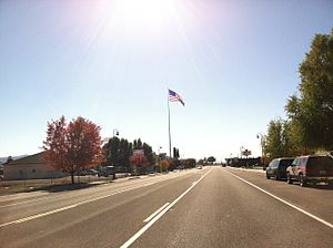
Dorris, California
City in California, United States
Distance: Approx. 1436 meters
Latitude and longitude: 41.965,-121.91888889
Dorris is a city in Siskiyou County, California, United States. Its population is 860 as of the 2020 census, down from 939 from the 2010 census. The town being small, the only attractions are the flagpole and county library.

Jefferson (proposed Pacific state)
Proposed U.S. state in the United States of America
Distance: Approx. 6352 meters
Latitude and longitude: 42,-122
The State of Jefferson is a proposed U.S. state that would span the contiguous, mostly rural area of southern Oregon and Northern California, where several attempts to separate from Oregon and California, respectively, have taken place. The region encompasses most of Northern California's land but does not include San Francisco or other Bay Area counties that account for the majority of Northern California's population. Although it is assumed that the proposed state is named after Thomas Jefferson, who sponsored the Lewis and Clark Expedition into the Pacific Northwest in 1803, the name "Jefferson" is of uncertain origin.

Butte Valley Airport
Airport
Distance: Approx. 9739 meters
Latitude and longitude: 41.88722222,-121.97555556
Butte Valley Airport (FAA LID: A32, formerly CA03) is a county-owned public-use airport located five miles (8 km) southwest of the central business district of Dorris, in Siskiyou County, California, United States.

Klamath Basin
Region in the U.S. states of Oregon and California drained by the Klamath River
Distance: Approx. 6352 meters
Latitude and longitude: 42,-122
The Klamath Basin is the region in the U.S. states of Oregon and California drained by the Klamath River. It contains most of Klamath County and parts of Lake and Jackson counties in Oregon, and parts of Del Norte, Humboldt, Modoc, Siskiyou, and Trinity counties in California. The 15,751-square-mile (40,790 km2) drainage basin is 35% in Oregon and 65% in California.

Bear Valley National Wildlife Refuge
Distance: Approx. 9391 meters
Latitude and longitude: 42.0498684,-121.9011159
The Bear Valley National Wildlife Refuge is a wildlife refuge in the southwestern part of Klamath County, Oregon, near the California border. It was established in 1978 to protect the nesting areas of bald eagles. The refuge is part of the Klamath Basin National Wildlife Refuge Complex and has an area of 4,200 acres (1,700 ha) It is administered along with the other refuges in the complex from offices in Tulelake, California.

Indian Tom Lake
Lake in the state of California, United States
Distance: Approx. 5208 meters
Latitude and longitude: 41.9907,-121.87917
Indian Tom Lake is a 500-acre (2.0 km2), shallow, natural lake located in the western portion of Butte Valley, in eastern Siskiyou County. The lake is a remnant of a larger lake that occupied the entire valley when temperatures were cooler and is fed seasonally by several creeks in Butte Valley. The area around the lake was the home of the Modoc people prior to European contact.

Picard, California
Former settlement in California, United States
Distance: Approx. 3727 meters
Latitude and longitude: 41.97277778,-121.98
Picard is a former settlement in Siskiyou County, California. It was at an elevation of 1300 m; all that remains is the cemetery.
Nightfire Island
Prehistoric human settlement location
Distance: Approx. 9917 meters
Latitude and longitude: 41.97338943,-121.8155
Archeological Site 4-SK-4, nearest to Dorris, California, is a stratified archeological site that was a hunter-gatherer village west of Lower Klamath Lake. The site is located in the heart of the Klamath Basin wetlands, on the west shores of Sheepy Lake at Sheepy Creek. It has also been known as Nightfire Island and as Sheepy Island.
Weather in this IP's area
overcast clouds
5 Celsius
5 Celsius
3 Celsius
5 Celsius
992 hPa
76 %
992 hPa
843 hPa
10000 meters
0.89 m/s
3.58 m/s
100 %