216.7.115.30 - IP Lookup: Free IP Address Lookup, Postal Code Lookup, IP Location Lookup, IP ASN, Public IP
Country:
 USA
USARegion:
City:
Location:
Time Zone:
Postal Code:
ISP:
ASN:
language:
User-Agent:
Proxy IP:
Blacklist:
IP information under different IP Channel
ip-api
Country
Region
City
ASN
Time Zone
ISP
Blacklist
Proxy
Latitude
Longitude
Postal
Route
db-ip
Country
Region
City
ASN
Time Zone
ISP
Blacklist
Proxy
Latitude
Longitude
Postal
Route
IPinfo
Country
Region
City
ASN
Time Zone
ISP
Blacklist
Proxy
Latitude
Longitude
Postal
Route
IP2Location
216.7.115.30Country
usRegion
california
City
weed
Time Zone
America/Los_Angeles
ISP
Language
User-Agent
Latitude
Longitude
Postal
ipdata
Country
Region
City
ASN
Time Zone
ISP
Blacklist
Proxy
Latitude
Longitude
Postal
Route
Popular places and events near this IP address

Carrick, California
Census-designated place in California
Distance: Approx. 3234 meters
Latitude and longitude: 41.44611111,-122.36333333
Carrick is a census-designated place (CDP) in Siskiyou County, California, United States. Its population is 143 as of the 2020 census, up from 131 from the 2010 census. Carrick is located just outside the town of Weed, uses Weed in its mailing addresses and is generally viewed by locals as a neighborhood of Weed, though located outside of the city proper.

Edgewood, California
Census-designated place in California
Distance: Approx. 5532 meters
Latitude and longitude: 41.46222222,-122.42611111
Edgewood is a census-designated place (CDP) in Siskiyou County, California, United States. Its population is 72 as of the 2020 census, up from 43 from the 2010 census. Edgewood is located three miles north of the town of Weed.
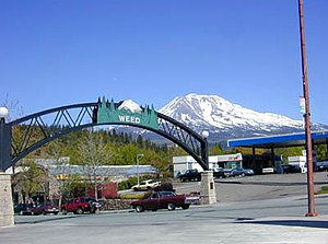
Weed, California
City in California, United States
Distance: Approx. 223 meters
Latitude and longitude: 41.42416667,-122.38444444
Weed is a city in Siskiyou County, California, United States. As of the 2020 Census, the city had a total population of 2,862, down from 2,967 in 2010. There are several unincorporated communities adjacent to, or just outside, Weed proper, including Edgewood, Carrick, and Lake Shastina.

Weed High School
Public school in Weed, Siskiyou County, California, United States
Distance: Approx. 1253 meters
Latitude and longitude: 41.42777778,-122.37277778
Weed High School is a secondary school located in Weed, California and is part of the Siskiyou Union High School District. For the 2006–07 school year, the school had student enrollment of 196, an Academic Performance Index (API) of 727 which is equal to the Siskiyou County average API for the same period, and above the CA state average API of 697. The student to teacher ratio was 30:1, and the student to computer ratio was 2:1.

College of the Siskiyous
Community college in California, US
Distance: Approx. 1183 meters
Latitude and longitude: 41.41222222,-122.38916667
College of the Siskiyous (COS) is a public community college with campuses in Weed and Yreka in Siskiyou County in Northern California. It is part of the California Community Colleges System, serving as the northernmost college in the state of California and the only college in Siskiyou County. The college is in the service area of California State University, Chico and one of only eleven community colleges in California that provide on-campus housing for students.

Shasta Abbey
Buddhist training monastery near Mount Shasta, California
Distance: Approx. 8446 meters
Latitude and longitude: 41.3507,-122.3538
Shasta Abbey, located on sixteen forested acres near Mount Shasta in northern California, United States is a training monastery for Buddhist monks and a place of practice for lay Buddhists and interested visitors. It was established in 1970 by Reverend Master P.T.N.H. Jiyu-Kennett, who was Abbess and spiritual director until her death in 1996.

Weed Airport
Airport in California, United States of America
Distance: Approx. 8077 meters
Latitude and longitude: 41.475,-122.45305556
Weed Airport (FAA LID: O46) is a public airport located four miles (6.4 km) northwest of Weed, serving Siskiyou County, California, USA. This general aviation airport covers 344 acres (139 ha) and has one runway.

Black Butte (Siskiyou County, California)
Overlapping dacite lava domes in Northern California, United States
Distance: Approx. 7025 meters
Latitude and longitude: 41.36634515,-122.34798233
Black Butte (formerly Wintoon Butte, Cone Mountain, Sugar Loaf and Muir's Peak) is a cluster of overlapping dacite lava domes in a butte, a satellite cone of Mount Shasta. It is located directly adjacent to the northbound lanes of Interstate 5 at milepost 742 between the cities of Mount Shasta and Weed, California. The I-5 freeway crosses a 3,912 ft (1,192 m) pass, Black Butte Summit, at the western base of the lava domes.

Boles Fire
2014 wildfire in Northern California
Distance: Approx. 993 meters
Latitude and longitude: 41.42384,-122.37432
The Boles Fire was a wildfire that burned in Siskiyou County during mid-September 2014. On September 15, at 1:38 p.m. PDT, the Boles Fire ignited near Weed, California.

Beaughton Creek
Distance: Approx. 5984 meters
Latitude and longitude: 41.45966,-122.43805
Beaughton Creek is a stream located in the U.S. state of California. A tributary of the Shasta River, it is located in Siskiyou County.

Lava Fire (2021)
2021 wildfire in Northern California
Distance: Approx. 6255 meters
Latitude and longitude: 41.459,-122.329
The Lava Fire was a wildfire that burned 26,409 acres (10,687 ha) along the slopes of Mount Shasta near Weed, California during the 2021 California wildfire season. The fire started on June 25, 2021 and was fully contained on September 3, 2021. The fire destroyed 23 buildings, including 14 houses, as well as damaged an additional building.
Mill Fire (2022)
2022 wildfire in Northern California
Distance: Approx. 860 meters
Latitude and longitude: 41.4303,-122.3852
The Mill Fire was a fast-moving, deadly and destructive wildfire that burned during the 2022 California wildfire season, destroying parts of the communities of Weed, Lake Shastina and Edgewood in Siskiyou County in the U.S. state of California. Igniting during hot, dry & windy conditions on September 2, 2022, amid a record-breaking heat wave that spanned much of the state, the Mill Fire moved rapidly to the north. Most of the fire's acreage burned and structures destroyed occurred on the first day, due to its predominantly wind-driven nature.
Weather in this IP's area
clear sky
-10 Celsius
-16 Celsius
-10 Celsius
-8 Celsius
1025 hPa
91 %
1025 hPa
853 hPa
10000 meters
3.6 m/s
300 degree