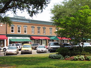
Country:
Region:
City:
Latitude and Longitude:
Time Zone:
Postal Code:
IP information under different IP Channel
ip-api
Country
Region
City
ASN
Time Zone
ISP
Blacklist
Proxy
Latitude
Longitude
Postal
Route
Luminati
Country
Region
sc
City
summerville
ASN
Time Zone
America/New_York
ISP
IMMEDION
Latitude
Longitude
Postal
IPinfo
Country
Region
City
ASN
Time Zone
ISP
Blacklist
Proxy
Latitude
Longitude
Postal
Route
db-ip
Country
Region
City
ASN
Time Zone
ISP
Blacklist
Proxy
Latitude
Longitude
Postal
Route
ipdata
Country
Region
City
ASN
Time Zone
ISP
Blacklist
Proxy
Latitude
Longitude
Postal
Route
Popular places and events near this IP address
Lincolnville, South Carolina
Town in South Carolina, United States
Distance: Approx. 4554 meters
Latitude and longitude: 33.00861111,-80.15777778
Lincolnville is a town in Charleston County, South Carolina, United States. A very small portion of the town extends into Dorchester County. The population was 1,139 at the 2010 census, up from 904 in 2000.
Ladson, South Carolina
Census-designated place in South Carolina, United States
Distance: Approx. 8468 meters
Latitude and longitude: 33.00944444,-80.10555556
Ladson is a census-designated place (CDP) in Berkeley, Charleston and Dorchester counties in the U.S. state of South Carolina. The population was 13,790 at the 2010 census. It is named in honor of the Ladson family, one of the oldest planter and merchant families in the Charleston area; one of its members was lieutenant governor James Ladson.

Summerville, South Carolina
Town in South Carolina, United States
Distance: Approx. 3611 meters
Latitude and longitude: 33.00805556,-80.18277778
Summerville is a town in the U.S. state of South Carolina situated mostly in Dorchester County, with small portions in Berkeley and Charleston counties. Summerville is seventh biggest city in the state. The town lies approximately five miles from the Ashley River.
Pinewood Preparatory School
School in Summerville, South Carolina, United States
Distance: Approx. 7490 meters
Latitude and longitude: 33.024929,-80.241718
Founded in 1952, Pinewood Preparatory School is an independent, co-educational, college-preparatory day school located in Summerville, South Carolina, United States. It is jointly accredited by the Southern Association of Independent Schools and the Southern Association of Colleges and Schools. It holds membership in the Palmetto Association of Independent Schools and the South Carolina Independent Schools Athletic Association (SCISAA).
Dorchester, South Carolina
Distance: Approx. 3480 meters
Latitude and longitude: 32.94805556,-80.16972222
Dorchester was a town in the Province of South Carolina. Situated on the Ashley River about 18 miles (29 km) from Charleston, it was founded in February 1696 by followers of Reverend Joseph Lord from Dorchester, Massachusetts. They named it after their home town, which had been named by earlier immigrants after the English town Dorchester).
Summerville High School
Public school in Summerville, South Carolina, United States
Distance: Approx. 3595 meters
Latitude and longitude: 32.99444444,-80.21833333
Summerville High School is a public high school in Summerville, South Carolina.
Coastal Carolina Fair
Annual fair in Ladson, South Carolina, US
Distance: Approx. 7735 meters
Latitude and longitude: 32.9967,-80.1079
The Coastal Carolina Fair, since 1924, is an annual fair that occurs at the Exchange Park Fairgrounds in Ladson, South Carolina. It lasts 11 days beginning on the last Thursday in October with music performances each night. Also, the fair has a variety fair rides.
Ashley Ridge High School
Public school in Summerville, South Carolina, United States
Distance: Approx. 7216 meters
Latitude and longitude: 32.92416667,-80.23361111
Ashley Ridge High School is a secondary school located in Dorchester County, South Carolina, United States. It is the newest high school in Dorchester School District Two. The school opened in August 2008.

Old White Meeting House Ruins and Cemetery
Archaeological site in South Carolina, United States
Distance: Approx. 1354 meters
Latitude and longitude: 32.96555556,-80.19472222
Old White Meeting House Ruins and Cemetery is a historic site near Summerville, Dorchester County, South Carolina. The meeting house was built about 1700, burned during the American Revolution in 1781, rebuilt in 1794, then reduced to ruins by the Charleston earthquake of 1886. The extant ruins include portions of each corner – the largest approximately 9’ high – and significant remnants of the foundation of walls.

Colonial Dorchester State Historic Site
Distance: Approx. 3246 meters
Latitude and longitude: 32.9495,-80.1719
Colonial Dorchester State Historic Site sits along the Ashley River, near the town of Summerville in Dorchester County, South Carolina. In 1969, the site was donated to the South Carolina State Park Service and was added to the National Register of Historic Places on December 2, 1969. Currently the site of a 325-acre park, Old Dorchester State Park offers visitors a glimpse into South Carolina's Colonial past.

Summerville Historic District (Summerville, South Carolina)
Historic district in South Carolina, United States
Distance: Approx. 4348 meters
Latitude and longitude: 33.01472222,-80.18305556
Summerville Historic District is a national historic district located at Summerville, Dorchester County, South Carolina. The district encompasses 700 contributing buildings in the village of Summerville. About 70 percent of the buildings predate World War I. The buildings include raised cottages, Greek Revival influenced, and Victorian / Queen Anne and other turn of the 20th century structures are found throughout.
Chandler Bridge Creek
Stream in South Carolina, U.S.
Distance: Approx. 3827 meters
Latitude and longitude: 32.96193,-80.1494
Chandler Bridge Creek is a stream in Berkeley, Charleston, and Dorchester counties in the U.S. state of South Carolina. It is a tributary of Eagle Creek, which flows into the Ashley River. The late Oligocene (Chattian) Chandler Bridge Formation, which has yielded archaic mysticetes and odontocetes, sirenians, sea birds, and turtles is named after Chandler Bridge Creek.
Weather in this IP's area
clear sky
16 Celsius
16 Celsius
15 Celsius
18 Celsius
1014 hPa
71 %
1014 hPa
1013 hPa
10000 meters
6.69 m/s
9.77 m/s
330 degree
06:51:52
17:19:15