Country:
Region:
City:
Latitude and Longitude:
Time Zone:
Postal Code:
IP information under different IP Channel
ip-api
Country
Region
City
ASN
Time Zone
ISP
Blacklist
Proxy
Latitude
Longitude
Postal
Route
Luminati
Country
Region
sc
City
simpsonville
ASN
Time Zone
America/New_York
ISP
IMMEDION
Latitude
Longitude
Postal
IPinfo
Country
Region
City
ASN
Time Zone
ISP
Blacklist
Proxy
Latitude
Longitude
Postal
Route
db-ip
Country
Region
City
ASN
Time Zone
ISP
Blacklist
Proxy
Latitude
Longitude
Postal
Route
ipdata
Country
Region
City
ASN
Time Zone
ISP
Blacklist
Proxy
Latitude
Longitude
Postal
Route
Popular places and events near this IP address

Simpsonville, South Carolina
City in South Carolina, United States
Distance: Approx. 5421 meters
Latitude and longitude: 34.73333333,-82.26
Simpsonville is a city in Greenville County, South Carolina, United States. It is part of the Greenville, SC Metropolitan Statistical Area. The population was 23,354 at the 2020 census, up from 18,238 in the 2010 census.

Area codes 864 and 821
Area codes in upstate South Carolina, United States
Distance: Approx. 6047 meters
Latitude and longitude: 34.65,-82.33333333
Area codes 864 and 821 are telephone area codes in the North American Numbering Plan (NANP) for the western third of the U.S. state of South Carolina. The numbering plan area (NPA) comprises the areas of Greenville, Spartanburg, Anderson, and twelve surrounding counties. Other cities in the 864/821 territory include Clemson, Gaffney, Greer, and Mauldin.
WROQ
Radio station in South Carolina, United States
Distance: Approx. 5366 meters
Latitude and longitude: 34.6475,-82.27027778
WROQ (101.1 FM) is a classic rock radio station licensed to Anderson, South Carolina, and serving the Upstate South Carolina region, including Greenville and Spartanburg. The station has had a classic rock format since December 1, 1987. This makes it one of the oldest classic rock stations in the country as far as years with the same format.

Burdette Building
United States historic place
Distance: Approx. 6020 meters
Latitude and longitude: 34.73722222,-82.25527778
The Burdette Building, also known as Burdette Hardware Building or B.W. Burdette Building, in Simpsonville, South Carolina, was listed on the U.S. National Register of Historic Places in 2003. It is a two-story building with brick walls laid in running bond, interrupted by pilasters. It was built in 1921 to replace the wood frame and brick building on the same site which had been destroyed by a fire.

Fairview Presbyterian Church (Fountain Inn, South Carolina)
Historic church in South Carolina, United States
Distance: Approx. 6568 meters
Latitude and longitude: 34.64361111,-82.25138889
Fairview Presbyterian Church is a historic church listed on the National Register of Historic Places near Fountain Inn, South Carolina. The present two-story building, constructed in 1858 in the Greek Revival style, was the fourth building constructed by the church, which was founded in 1786. The building is in nearly original condition.

First Baptist Simpsonville
Historic church in South Carolina, United States
Distance: Approx. 6327 meters
Latitude and longitude: 34.73916667,-82.25277778
First Baptist Simpsonville, formerly Simpsonville Baptist Church, is a historic Baptist church based in Simpsonville, South Carolina, United States. It is affiliated with the Southern Baptist Convention.
Brashier Middle College Charter High School
Charter school in Simpsonville, South Carolina, United States
Distance: Approx. 2466 meters
Latitude and longitude: 34.71083333,-82.30666667
Brashier Middle College Charter High School is a public funded charter school in Simpsonville, South Carolina, United States. It is a sister campus of the main Greenville Tech campus in Greenville, South Carolina. In 2022, BMC was awarded the National Blue Ribbon Award.

Cureton-Huff House
United States historic place
Distance: Approx. 3865 meters
Latitude and longitude: 34.693127,-82.334113
The Cureton-Huff House is located in Greenville County near Simpsonville, South Carolina on what is now known as West Georgia Road, or County Road 541. The two-story braced-frame farmhouse on a brick pier foundation was built ca 1820 for John Moon Cureton, a wealthy farmer. It was originally built in the common hall-and-parlor configuration but shortly after its initial construction, the house was altered to a central-hall configuration.

Hopkins Farm (Simpsonville, South Carolina)
United States historic place
Distance: Approx. 4743 meters
Latitude and longitude: 34.65438,-82.31552
The Hopkins Farm is an agricultural complex listed on the National Register of Historic Places located near the intersection of South Carolina Highway 418 and Fork Shoals Road in the vicinity of Simpsonville, South Carolina. The complex, begun by John Hopkins who purchased the land in 1834 from James Harrison, consists of the main house, a cook's house, agricultural fields, a pecan grove, eleven outbuildings and a family cemetery.
Bryson High School (Greenville, South Carolina)
School in Greenville, South Carolina, United States
Distance: Approx. 4888 meters
Latitude and longitude: 34.7183965,-82.2489475
Bryson High School was a segregated high school for African American students in Greenville, South Carolina operated by Greenville County School District. It opened its doors on September 3, 1954. It ceased operation as a segregated high school in 1970.
Battle of Great Cane Brake
1775 battle
Distance: Approx. 4610 meters
Latitude and longitude: 34.65611667,-82.31638333
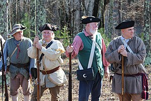
The Battle of Great Cane Brake was a skirmish fought on December 22, 1775, during the American Revolutionary War in what was then Ninety-Six District, South Carolina, modern Greenville County.
Simpsonville Clock Tower
Clock tower in South Carolina, United States
Distance: Approx. 6020 meters
Latitude and longitude: 34.73722222,-82.25527778
The Simpsonville Clock Tower is a clock tower in Downtown Simpsonville, South Carolina.
Weather in this IP's area
fog
8 Celsius
8 Celsius
7 Celsius
9 Celsius
1017 hPa
98 %
1017 hPa
988 hPa
805 meters
1.54 m/s
310 degree
100 %
07:03:39
17:24:19

