216.57.164.242 - IP Lookup: Free IP Address Lookup, Postal Code Lookup, IP Location Lookup, IP ASN, Public IP
Country:
Region:
City:
Location:
Time Zone:
Postal Code:
IP information under different IP Channel
ip-api
Country
Region
City
ASN
Time Zone
ISP
Blacklist
Proxy
Latitude
Longitude
Postal
Route
Luminati
Country
Region
id
City
rupert
ASN
Time Zone
America/Boise
ISP
ANTHEMBB
Latitude
Longitude
Postal
IPinfo
Country
Region
City
ASN
Time Zone
ISP
Blacklist
Proxy
Latitude
Longitude
Postal
Route
IP2Location
216.57.164.242Country
Region
idaho
City
rupert
Time Zone
America/Boise
ISP
Language
User-Agent
Latitude
Longitude
Postal
db-ip
Country
Region
City
ASN
Time Zone
ISP
Blacklist
Proxy
Latitude
Longitude
Postal
Route
ipdata
Country
Region
City
ASN
Time Zone
ISP
Blacklist
Proxy
Latitude
Longitude
Postal
Route
Popular places and events near this IP address

Burley, Idaho
City in Idaho, United States
Distance: Approx. 9466 meters
Latitude and longitude: 42.53722222,-113.79194444
Burley () is a city in Cassia and Minidoka counties in southern Idaho, United States. The population was 11,704 at the 2020 census, up from 10,345 in 2010. The city is the county seat of Cassia County.
Heyburn, Idaho
City in Idaho, United States
Distance: Approx. 6682 meters
Latitude and longitude: 42.56138889,-113.75166667
Heyburn is a city in Minidoka County, Idaho, United States. The population was 3,700 at the 2020 census, up from 3,089 in 2010. It is part of the Burley micropolitan area.

Paul, Idaho
City in Idaho, United States
Distance: Approx. 2199 meters
Latitude and longitude: 42.60527778,-113.78472222
Paul is a city in Minidoka County, Idaho, United States. founded in 1907. The population was 1,195 at the 2020 census.
Rupert, Idaho
City in Idaho, United States
Distance: Approx. 7750 meters
Latitude and longitude: 42.62333333,-113.67277778
Rupert is the county seat and largest city of Minidoka County, Idaho. It is part of the Burley Micropolitan Statistical Area. The population was 6,082 at the 2020 census, up from 5,554 in 2010.
Burley Municipal Airport
Airport in Idaho, United States of America
Distance: Approx. 8668 meters
Latitude and longitude: 42.5425,-113.77166667
Burley Municipal Airport (IATA: BYI, ICAO: KBYI, FAA LID: BYI) is a municipal airport in Burley, Idaho. The airport was rededicated as Burley J R Jack Simplot Airport in October 2002, honoring J. R. "Jack" Simplot.

Cassia County Courthouse
United States historic place
Distance: Approx. 9769 meters
Latitude and longitude: 42.53444444,-113.79194444
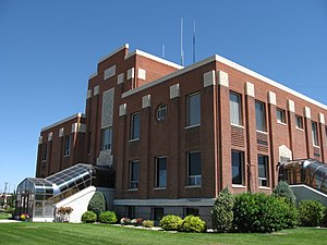
The Cassia County Courthouse, located at Fifteenth Street and Overland Avenue in Burley, is the county courthouse serving Cassia County, Idaho.
Camp Rupert
World War II prisoner of war camp in Idaho, US
Distance: Approx. 9711 meters
Latitude and longitude: 42.605,-113.884
Camp Rupert was a World War II prisoner of war camp in the western United States, located in Minidoka County, Idaho, west of Paul. It was built for $1.5 million, which was everything needed for a city of 3,000: barracks, water, sewer, and a hospital. The first POWs were Italian and were received in May 1944, and 500 German POWs arrived that September.
Minico High School
Public school in Rupert address, Idaho, United States
Distance: Approx. 4009 meters
Latitude and longitude: 42.605,-113.723
Minico High School, also known as Minidoka County High School, is a four-year public secondary school in unincorporated Minidoka County, Idaho, with a Rupert postal address, operated by the Minidoka County Joint School District #331. The school colors are red and gold and the mascot is a Spartan.

Goose Creek (Snake River tributary)
River in Utah, United States
Distance: Approx. 8544 meters
Latitude and longitude: 42.54361111,-113.76305556
Goose Creek is a 123-mile (198 km) long tributary of the Snake River. Beginning at an elevation of 7,239 feet (2,206 m) in the Cassia Division of the Sawtooth National Forest in southwestern Cassia County, Idaho, it flows south into Elko County, Nevada, and loops back around into Cassia County, briefly crossing Box Elder County, Utah, in the process. It is impounded by Oakley Dam several miles south of Oakley, Idaho, forming Lower Goose Creek Reservoir.
Rupert Town Square Historic District
Historic district in Idaho, United States
Distance: Approx. 7743 meters
Latitude and longitude: 42.62083333,-113.67277778
The Rupert Town Square Historic District in Rupert in Minidoka County, Idaho is a historic district which was listed on the National Register of Historic Places in 2001. It is centered around the Rupert City Park. It includes a post office, a city hall, a fire station.
Weather in this IP's area
clear sky
-2 Celsius
-6 Celsius
-2 Celsius
-2 Celsius
1029 hPa
86 %
1029 hPa
881 hPa
10000 meters
3.6 m/s
70 degree

