Country:
Region:
City:
Latitude and Longitude:
Time Zone:
Postal Code:
IP information under different IP Channel
ip-api
Country
Region
City
ASN
Time Zone
ISP
Blacklist
Proxy
Latitude
Longitude
Postal
Route
Luminati
Country
ASN
Time Zone
America/Toronto
ISP
Hetzner Online GmbH
Latitude
Longitude
Postal
IPinfo
Country
Region
City
ASN
Time Zone
ISP
Blacklist
Proxy
Latitude
Longitude
Postal
Route
db-ip
Country
Region
City
ASN
Time Zone
ISP
Blacklist
Proxy
Latitude
Longitude
Postal
Route
ipdata
Country
Region
City
ASN
Time Zone
ISP
Blacklist
Proxy
Latitude
Longitude
Postal
Route
Popular places and events near this IP address

Fürth
City in Bavaria, Germany
Distance: Approx. 2166 meters
Latitude and longitude: 49.46666667,11
Fürth (German: [fʏʁt] ; East Franconian: Färdd; Yiddish: פיורדא, romanized: Fiurda) is a city in northern Bavaria, Germany, in the administrative division (Regierungsbezirk) of Middle Franconia. It is the second-largest city in Franconia and now contiguous with the larger city of Nuremberg, the centres of the two cities being only seven km (4.3 mi) apart. The city forms a continuous conurbation with the neighbouring cities of Nuremberg, Erlangen and Schwabach, which is the heart of an urban area region with around 1.4 million inhabitants, while the larger Nuremberg Metropolitan Region has a population of approximately 3.6 million.
Nuremberg-Kleinreuth radio transmitter
Former broadcasting facility
Distance: Approx. 740 meters
Latitude and longitude: 49.44388889,11.00861111
The Transmitter Nuremberg-Kleinreuth was a broadcasting facility for medium wave at Nuremberg, Bavaria, Germany. It was founded in 1927 in Nuremberg-Kleinreuth at the former Broadcast Street 24, now Sigmund Street 181, in order to supply the northern areas of Bavaria with broadcast programs in the medium-wave band.

Jakobinenstraße station
Metro station in Fürth, Germany
Distance: Approx. 2311 meters
Latitude and longitude: 49.4683033,11.0005601
Jakobinenstraße station is a Nuremberg U-Bahn station, located on the U1 in Fürth.

Stadtgrenze station
Metro station in Nuremberg, Germany
Distance: Approx. 1795 meters
Latitude and longitude: 49.4655,11.011
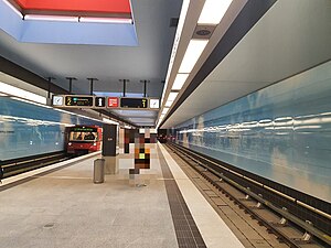
Stadtgrenze station is a Nuremberg U-Bahn station, located on the U1. Although it is officially tagged Nuremberg Stadtgrenze, its buildings are located in Fürth. Stadtgrenze means town limit in German.

Muggenhof station
Metro station in Nuremberg, Germany
Distance: Approx. 1505 meters
Latitude and longitude: 49.461777,11.0228107
Muggenhof station is a Nuremberg U-Bahn station, located on the U1.

Eberhardshof station
Metro station in Nuremberg, Germany
Distance: Approx. 1730 meters
Latitude and longitude: 49.4582802,11.0338301
Eberhardshof station is a Nuremberg U-Bahn station, located on the U1. It used to be the terminus for the "booster" line U11 until 2017 when trains formerly marked "U11" and "U21" were folded into U1 and U2.

Maximilianstraße station
Metro station in Nuremberg, Germany
Distance: Approx. 2174 meters
Latitude and longitude: 49.4553813,11.042748
Maximilianstraße station is a Nuremberg U-Bahn station, located on the U1 line.
Gustav-Adolf-Straße station
Metro station in Nuremberg, Germany
Distance: Approx. 2038 meters
Latitude and longitude: 49.4390413,11.0372095
Gustav-Adolf-Straße station is a Nuremberg U-Bahn station, located on the U3. The station is named for the Swedish king Gustavus Adolphus.

Bibert
River in Germany
Distance: Approx. 2202 meters
Latitude and longitude: 49.4452,10.9844
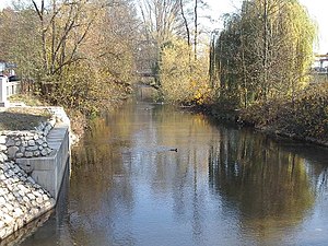
Bibert is a river of Bavaria, Germany. It flows into the Rednitz near Fürth.
Nurnberg American High School
School in Fürth, Germany
Distance: Approx. 1734 meters
Latitude and longitude: 49.456615,10.992778
Nürnberg American High School (NAHS) was a Department of Defense Dependents Schools (DoDDS) system school located near Nürnberg, Germany. One of DoDDS original five high schools in Germany, the school served the children of American military, government and civilian personnel from 1946 until its closing in 1995.

Battle of Fürth
1632 battle of the Thirty Years' War
Distance: Approx. 1920 meters
Latitude and longitude: 49.46666667,11.01666667
The Battle of Fürth was fought on 3 September 1632 between the Catholic forces of Holy Roman Emperor Ferdinand II and the Protestant forces of King Gustavus II (Gustavus Adolphus) of Sweden during the period of Swedish intervention in the Thirty Years War. The tactical victory by the Catholic forces allowed the Imperial army to quickly advance into Saxony, while the Swedish forces were forced into retreat.

Großreuth bei Schweinau station
Metro station in Nuremberg, Germany
Distance: Approx. 1355 meters
Latitude and longitude: 49.439306,11.024337
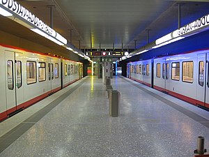
Großreuth bei Schweinau station is a Nuremberg U-Bahn station, located on the U3. Named for the borough Großreuth bei Schweinau. The distance to the previous station, Gustav Adolf Straße is 898 metres (2,946 ft) as the crow flies.
Weather in this IP's area
overcast clouds
7 Celsius
6 Celsius
7 Celsius
7 Celsius
1031 hPa
88 %
1031 hPa
994 hPa
10000 meters
1.54 m/s
60 degree
100 %
07:14:27
16:44:52
