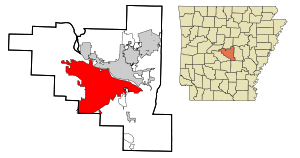
Country:
 USA
USARegion:
City:
Latitude and Longitude:
Time Zone:
Postal Code:
IP information under different IP Channel
ip-api
Country
Region
City
ASN
Time Zone
ISP
Blacklist
Proxy
Latitude
Longitude
Postal
Route
IPinfo
Country
Region
City
ASN
Time Zone
ISP
Blacklist
Proxy
Latitude
Longitude
Postal
Route
MaxMind
Country
Region
City
ASN
Time Zone
ISP
Blacklist
Proxy
Latitude
Longitude
Postal
Route
Luminati
Country
USASN
Time Zone
America/Chicago
ISP
VIVIDHOSTING
Latitude
Longitude
Postal
db-ip
Country
Region
City
ASN
Time Zone
ISP
Blacklist
Proxy
Latitude
Longitude
Postal
Route
ipdata
Country
Region
City
ASN
Time Zone
ISP
Blacklist
Proxy
Latitude
Longitude
Postal
Route
Popular places and events near this IP address
Pulaski Academy
Private secondary school in Little Rock, Arkansas, United States
Distance: Approx. 2336 meters
Latitude and longitude: 34.77166667,-92.41472222
Pulaski Academy (PA) is a private, independent college preparatory preschool, elementary, and junior/senior high school headed by Brock Dunn in the Pleasant Valley neighborhood of Little Rock, Arkansas, United States. PA was established in 1971 as a segregation academy and remains as the only independent, non-sectarian, college preparatory school in Arkansas.
Pleasant Valley (Little Rock)
Neighborhood in Little Rock, Arkansas, US
Distance: Approx. 1265 meters
Latitude and longitude: 34.7804,-92.40842
Pleasant Valley is a neighborhood that is among the older western neighborhoods of the city of Little Rock, Arkansas. The area is to the northwest of Breckenridge and west of Colony West. Pleasant Valley lies to the south of the hillier Pleasant Ridge and Walton Heights areas, and mostly to the east of St.
Robinwood (Little Rock)
Distance: Approx. 1531 meters
Latitude and longitude: 34.78596,-92.38018
Robinwood is an exclusive residential section of northwest Little Rock, Arkansas, marked by several large, stately homes among a wooded area near the Arkansas River. Some of the homes of Robinwood can be seen along the riverside cliffs approaching the city via Interstate 430 from Maumelle. The area is bordered by the interstate and Pleasant Valley to the west, the Arkansas River to its north, and Old Forge to the south.

Big Dam Bridge
Bridge in North Little Rock, Arkansas
Distance: Approx. 3640 meters
Latitude and longitude: 34.793911,-92.358069
Originally intended to be called Murray Bridge, the Big Dam Bridge in Arkansas spans the Arkansas River and Murray Lock and Dam between Little Rock and North Little Rock and is open only to pedestrian and bicycle traffic. At 4,226 feet (1288 m) in length it is the longest pedestrian/bicycle bridge in North America that has never been used by trains or motor vehicles. It rises to 90 feet (27 m) over the Arkansas River and 30 feet (9.1 m) over the dam.
Pavilion in the Park
Shopping mall in Arkansas, United States
Distance: Approx. 3032 meters
Latitude and longitude: 34.7764,-92.3662
Pavilion in the Park is a mixed-use enclosed mall with upscale shopping located in Little Rock, Arkansas. Tenants include B. Barnett, a local luxury women's boutique; Baumans Fine Men's Clothing, a local upscale men's store; and Trio's Restaurant, a local eatery offering Southern comfort cuisine.
Little Rock recruiting office shooting
Distance: Approx. 3644 meters
Latitude and longitude: 34.75918,-92.37533
The 2009 Little Rock recruiting office shooting took place on June 1, 2009, when Carlos Leon Bledsoe opened fire with a rifle in a drive-by shooting on soldiers in front of a United States military recruiting office in Little Rock, Arkansas. He killed Private William Long and wounded Private Quinton Ezeagwula. After his arrest, Bledsoe acknowledged shooting the men.
Baptist Preparatory School
Private secondary school in Little Rock, Arkansas, United States
Distance: Approx. 934 meters
Latitude and longitude: 34.77916667,-92.40138889
The Baptist Preparatory School (or Baptist Prep) is a private, independent college preparatory, preschool, elementary, and junior/senior high school Christian school in Little Rock, Arkansas, United States. Founded in 1981, The Baptist Preparatory School via its Lower School and Upper School provide Christian-based education to more than 720 students annually in kindergarten through grade 12.
LISA Academy
Public charter school in Little Rock, Pulaski County, Arkansas, United States
Distance: Approx. 4014 meters
Latitude and longitude: 34.75135,-92.38822
LISA Academy is an open-enrollment public charter school headquartered in Little Rock, Arkansas, United States. Formed in 2004, LISA or Learn Innovate Support Achieve serves more than 2200 students in grades K through 12. A STEM (science, technology, engineering, and mathematics) focused charter campuses are located across the state of Arkansas.
Sturbridge (Little Rock)
Neighborhood in Pulaski County, Arkansas, United States
Distance: Approx. 2397 meters
Latitude and longitude: 34.7691,-92.3818
Sturbridge is a neighborhood in West Little Rock developed in the 1960s. On March 31, 2023, an EF3 tornado caused catastrophic damage to a large portion of the neighborhood.

Johnswood
Historic house in Arkansas, United States
Distance: Approx. 848 meters
Latitude and longitude: 34.78805556,-92.38777778
Johnswood is a historic house at 10314 Cantrell Road in Little Rock, Arkansas. It is a single-story structure, its main section built out of sandstone and capped by a side gable roof, with an attached wood frame section on the left end, with a front-facing gable roof. The main entrance is located in the center of the stone section, sheltered by a small gabled porch.
Pankey, Arkansas
Neighborhood in Pulaski, Arkansas, United States
Distance: Approx. 2638 meters
Latitude and longitude: 34.80027778,-92.42055556
Pankey is a formerly unincorporated community in Pulaski County, Arkansas, United States on Arkansas Highway 10. Historically, it was located west of Little Rock, but has since been annexed by the city.
Thomas Gray House
Historic house in Arkansas, United States
Distance: Approx. 1409 meters
Latitude and longitude: 34.79055556,-92.38222222
The Thomas Gray House is a historic house at 25 River Valley Road in Little Rock, Arkansas. It is a single-story masonry structure, finished in fieldstone and vertical cedar siding and covered by a gable-on-hip roof. A contemporaneous detached carport with a similar roof stands near the house.
Weather in this IP's area
few clouds
11 Celsius
10 Celsius
8 Celsius
12 Celsius
1029 hPa
66 %
1029 hPa
1011 hPa
10000 meters
1.4 m/s
1.66 m/s
99 degree
19 %
07:18:05
18:30:51