216.41.192.21 - IP Lookup: Free IP Address Lookup, Postal Code Lookup, IP Location Lookup, IP ASN, Public IP
Country:
Region:
City:
Location:
Time Zone:
Postal Code:
ISP:
ASN:
language:
User-Agent:
Proxy IP:
Blacklist:
IP information under different IP Channel
ip-api
Country
Region
City
ASN
Time Zone
ISP
Blacklist
Proxy
Latitude
Longitude
Postal
Route
db-ip
Country
Region
City
ASN
Time Zone
ISP
Blacklist
Proxy
Latitude
Longitude
Postal
Route
IPinfo
Country
Region
City
ASN
Time Zone
ISP
Blacklist
Proxy
Latitude
Longitude
Postal
Route
IP2Location
216.41.192.21Country
Region
wisconsin
City
cameron
Time Zone
America/Chicago
ISP
Language
User-Agent
Latitude
Longitude
Postal
ipdata
Country
Region
City
ASN
Time Zone
ISP
Blacklist
Proxy
Latitude
Longitude
Postal
Route
Popular places and events near this IP address

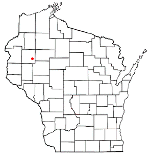
Cameron, Barron County, Wisconsin
Village in Wisconsin, United States
Distance: Approx. 2560 meters
Latitude and longitude: 45.408807,-91.742489
Cameron is a village in Barron County in the U.S. state of Wisconsin. The population was 1,872 at the 2020 census, and 1,783 at the 2010 census.

Prairie Lake, Wisconsin
Town in Wisconsin, United States
Distance: Approx. 5587 meters
Latitude and longitude: 45.34611111,-91.715
Prairie Lake is a town in Barron County in the U.S. state of Wisconsin. The population was 1,648 at the 2020 census, up from 1,532 at the 2010 census. The unincorporated community of Wickware is located partially in the town.
Stanley, Barron County, Wisconsin
Town in Wisconsin, United States
Distance: Approx. 2987 meters
Latitude and longitude: 45.41916667,-91.735
Stanley is a town in Barron County in the U.S. state of Wisconsin. The population was 2,570 at the 2020 census, up from 2,546 at the 2010 census. The town surrounds the village of Cameron but is separate from it.

Sumner, Barron County, Wisconsin
Town in Wisconsin, United States
Distance: Approx. 7975 meters
Latitude and longitude: 45.41611111,-91.61694444
The Town of Sumner is located in Barron County in the U.S. state of Wisconsin. The population was 699 at the 2020 census, down from 798 at the 2010 census. The unincorporated communities of Canton, Lehigh and Sumner are located in the town.

Canton, Wisconsin
Town in Wisconsin, United States
Distance: Approx. 5565 meters
Latitude and longitude: 45.42805556,-91.66
Canton ( KAN-tən) is a town in Buffalo County in the U.S. state of Wisconsin. The population was 305 at the 2010 census. The ghost town of Springdale was located in the town.

Chetek, Wisconsin
City in Wisconsin, United States
Distance: Approx. 9861 meters
Latitude and longitude: 45.31861111,-91.65444444
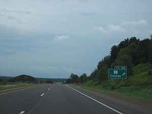
Chetek is a city in Barron County, Wisconsin, United States. The population was 2,172 at the 2020 census, down from 2,221 at the 2010 census. The city is located partially within the Town of Chetek.
University of Wisconsin–Eau Claire – Barron County
University branch campus in Rice Lake, Wisconsin, US
Distance: Approx. 9934 meters
Latitude and longitude: 45.48277778,-91.74638889
The University of Wisconsin–Eau Claire – Barron County (also known as UWEC–Barron County or UWEC–BC) is a branch campus to the University of Wisconsin–Eau Claire. It is located in Rice Lake, Wisconsin, and is a member of the University of Wisconsin System. As of the 2016–17 school year, there were 497 full and part-time students.
Canton, Barron County, Wisconsin
Unincorporated community in Wisconsin, United States
Distance: Approx. 5565 meters
Latitude and longitude: 45.42805556,-91.66
Canton is an unincorporated community in the town of Sumner, Barron County, Wisconsin, United States. Canton is 5 miles (8 km) east-northeast of Cameron. Canton was platted in 1884 when the railroad was extended to that point.
Wickware, Wisconsin
Unincorporated community in Wisconsin, United States
Distance: Approx. 7494 meters
Latitude and longitude: 45.35138889,-91.78638889
Wickware is an unincorporated community located in the towns of Maple Grove and Prairie Lake, in Barron County, Wisconsin, United States.
Barron Municipal Airport
Airport
Distance: Approx. 9419 meters
Latitude and longitude: 45.4075,-91.83444444
Barron Municipal Airport, (FAA LID: 9Y7) is a city owned public use airport located in the central business district of Barron, a city in Barron County, Wisconsin, United States. Although most airports in the United States use the same three-letter location identifier for the FAA and International Air Transport Association (IATA), this airport is assigned 9Y7 by the FAA but has no designation from the IATA. The airport does not have scheduled airline service, the closest airport with scheduled airline service is Chippewa Valley Regional Airport, about 40 miles (64 km) to the southeast.
Weather in this IP's area
clear sky
-7 Celsius
-14 Celsius
-8 Celsius
-6 Celsius
1024 hPa
63 %
1024 hPa
978 hPa
10000 meters
6.17 m/s
10.8 m/s
270 degree