216.251.172.38 - IP Lookup: Free IP Address Lookup, Postal Code Lookup, IP Location Lookup, IP ASN, Public IP
Country:
Region:
City:
Location:
Time Zone:
Postal Code:
IP information under different IP Channel
ip-api
Country
Region
City
ASN
Time Zone
ISP
Blacklist
Proxy
Latitude
Longitude
Postal
Route
Luminati
Country
Region
mn
City
minneapolis
ASN
Time Zone
America/Chicago
ISP
ENVENTIS
Latitude
Longitude
Postal
IPinfo
Country
Region
City
ASN
Time Zone
ISP
Blacklist
Proxy
Latitude
Longitude
Postal
Route
IP2Location
216.251.172.38Country
Region
minnesota
City
plymouth
Time Zone
America/Chicago
ISP
Language
User-Agent
Latitude
Longitude
Postal
db-ip
Country
Region
City
ASN
Time Zone
ISP
Blacklist
Proxy
Latitude
Longitude
Postal
Route
ipdata
Country
Region
City
ASN
Time Zone
ISP
Blacklist
Proxy
Latitude
Longitude
Postal
Route
Popular places and events near this IP address

Medicine Lake, Minnesota
City in Minnesota, United States
Distance: Approx. 5244 meters
Latitude and longitude: 45.00194444,-93.42138889
Medicine Lake is an independent municipality in Hennepin County, Minnesota, United States located on a peninsula that juts into a lake of the same name. The population was 371 at the 2010 census.

Plymouth, Minnesota
City in Minnesota, United States
Distance: Approx. 2771 meters
Latitude and longitude: 45.01055556,-93.45555556
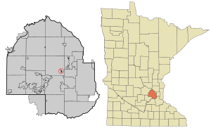
Plymouth is a city in Hennepin County in the U.S. state of Minnesota. A suburb in the Minneapolis–Saint Paul metropolitan area, the city is about 10 miles (16 km) west of downtown Minneapolis. The population was 81,026 at the 2020 census, making it Minnesota's 7th-largest city.

Wayzata, Minnesota
Small lakeside town in Minnesota, United States
Distance: Approx. 3319 meters
Latitude and longitude: 44.97416667,-93.50666667
Wayzata ( wy-ZET-ə) is a city in Hennepin County, Minnesota, United States. The population was 4,434 at the 2020 census. The city is about 12 miles (19 kilometres) west of Minneapolis and is situated on the northern shore of Lake Minnetonka, the ninth largest lake in the state.

Wayzata High School
Public school in Plymouth, Minnesota, United States
Distance: Approx. 5257 meters
Latitude and longitude: 45.04555556,-93.50972222
Wayzata High School is a comprehensive public high school in Plymouth, Minnesota, United States, a suburb of Minneapolis. The high school, operated by Wayzata Public Schools, had about 3711 students in grades 9 to 12 as of 10/1/23, making it Minnesota's largest secondary school by enrollment. It is also Minnesota's largest secondary school by size, with an interior of 658,000 square feet (61,100 m2).
Providence Academy (Plymouth, Minnesota)
Catholic K-12 school in Plymouth, MN
Distance: Approx. 5130 meters
Latitude and longitude: 45.0455,-93.4716
Providence Academy is a private, co-ed, Catholic college-preparatory PreK–12 school in Plymouth, Minnesota founded in 2001. It is located in and affiliated with the Roman Catholic Archdiocese of Saint Paul and Minneapolis.

Minnesota's 3rd congressional district
U.S. House district for Minnesota
Distance: Approx. 3246 meters
Latitude and longitude: 44.99583333,-93.52861111
Minnesota's 3rd congressional district encompasses the suburbs of Hennepin and Anoka counties to the west, south, and north of Minneapolis. The district, which is mostly suburban in character, includes a few farming communities on its far western edge and also inner-ring suburban areas on its eastern edge. The district includes the blue collar cities of Brooklyn Park and Coon Rapids to the north-east, middle-income Bloomington to the south, and higher-income Eden Prairie, Edina, Hopkins, Maple Grove, Plymouth, Minnetonka, and Wayzata to the west.

Wayzata station
Historic railway station in Minnesota, U.S.
Distance: Approx. 4280 meters
Latitude and longitude: 44.96861111,-93.5175
Wayzata station (officially recognized as the Great Northern Railway Depot but commonly referred to as the Wayzata Depot) is a historic train depot in Wayzata, Minnesota, United States. Constructed and operated by the Great Northern Railway, the station was in service from 1906 until 1971. The depot is positioned along Lake Minnetonka in downtown Wayzata with steps leading down to the lakeshore.
Central Baptist Theological Seminary of Minneapolis
Distance: Approx. 5027 meters
Latitude and longitude: 44.98833333,-93.42666667
Central Baptist Theological Seminary of Minneapolis is an Independent Baptist seminary in Plymouth, Minnesota. The seminary moved from Minneapolis to its present location in 1996.
West Lutheran High School
Private secondary school in Plymouth, Minnesota, United States
Distance: Approx. 2733 meters
Latitude and longitude: 45.01777778,-93.46277778
West Lutheran High School is a private Lutheran co-educational secondary school located in Plymouth, a suburb of the Twin Cities, in Minnesota, in the United States. It is operated by 20 Lutheran congregations belonging to the Wisconsin Evangelical Lutheran Synod and the Evangelical Lutheran Synod. It is accredited by the Minnesota Nonpublic School Accrediting Association (MNSAA).
Fourth Baptist Christian School
Private school in the United States
Distance: Approx. 5033 meters
Latitude and longitude: 44.988,-93.42672
Fourth Baptist Christian School, a ministry of Fourth Baptist Church, is a private Christian school located in Plymouth, Minnesota.
Wayzata Bay Center
Shopping mall in Minnesota, US
Distance: Approx. 3838 meters
Latitude and longitude: 44.96888889,-93.50611111
Wayzata Bay Center was an enclosed shopping mall in Wayzata, Minnesota, a suburb of the Twin Cities. Wayzata Bay Center once comprised 127,000 square feet (12,000 m2) of retail space, with approximately 30 stores on one level, but closed in 2011 after the city of Wayzata agreed to construction of a new facility on the property. The mall was once owned by Madison Marquette until residents of the city purchased the mall for $16 million in December 2004.

Medicine Lake (Minnesota)
Distance: Approx. 5351 meters
Latitude and longitude: 45.00833333,-93.42083333
Medicine Lake is an inland lake located approximately 8 miles northwest of downtown Minneapolis, Minnesota. The lake lies within Hennepin County and is surrounded by two municipalities. At 902 acres, it is Hennepin County's second largest lake behind Lake Minnetonka and is popular among boaters, sailors, and fishers.
Weather in this IP's area
overcast clouds
-1 Celsius
-5 Celsius
-2 Celsius
0 Celsius
1022 hPa
94 %
1022 hPa
985 hPa
10000 meters
3.6 m/s
170 degree
100 %