216.234.58.12 - IP Lookup: Free IP Address Lookup, Postal Code Lookup, IP Location Lookup, IP ASN, Public IP
Country:
Region:
City:
Location:
Time Zone:
Postal Code:
ISP:
ASN:
language:
User-Agent:
Proxy IP:
Blacklist:
IP information under different IP Channel
ip-api
Country
Region
City
ASN
Time Zone
ISP
Blacklist
Proxy
Latitude
Longitude
Postal
Route
db-ip
Country
Region
City
ASN
Time Zone
ISP
Blacklist
Proxy
Latitude
Longitude
Postal
Route
IPinfo
Country
Region
City
ASN
Time Zone
ISP
Blacklist
Proxy
Latitude
Longitude
Postal
Route
IP2Location
216.234.58.12Country
Region
ontario
City
mississauga
Time Zone
America/Toronto
ISP
Language
User-Agent
Latitude
Longitude
Postal
ipdata
Country
Region
City
ASN
Time Zone
ISP
Blacklist
Proxy
Latitude
Longitude
Postal
Route
Popular places and events near this IP address

Malton, Mississauga
Neighbourhood in Peel, Ontario, Canada also known as Mini India
Distance: Approx. 2595 meters
Latitude and longitude: 43.7,-79.63333333
Malton is a neighbourhood in the northeastern part of the city of Mississauga, Ontario, Canada, located to the northwest of Toronto. Malton is bounded by Highway 427 to the east, the Brampton city limits (a Canadian National Railway (CN) rail line) to the north, Airport Road to the west, and a second CN line and Toronto Pearson International Airport to the south. Malton is unique in that it does not adjoin any other Mississauga neighbourhood, being separated by the airport and extensive industrial areas.

Recipe Unlimited
Restaurant chain operator in Canada
Distance: Approx. 3309 meters
Latitude and longitude: 43.690824,-79.623928
Recipe Unlimited Corporation is a Canadian company that operates several restaurant chains such as Swiss Chalet, Harvey's and The Keg, and food distribution for large operations. The company was originated in 1883 as Canada Railway News Company that sold newspapers, magazines and confectioneries before moving to the restaurant business. The present company dates to 1961, as Canada Railway News Co.

Malton GO Station
Railway station in Mississauga, Ontario, Canada
Distance: Approx. 2398 meters
Latitude and longitude: 43.705,-79.63861111
Malton GO Station is a train and bus station in the GO Transit network, located near Toronto Pearson International Airport, in the community of Malton in Mississauga, Ontario, Canada. It is a stop on the Kitchener line, and is a flag stop for Via Rail trains operating between Toronto, London and Sarnia.

Bramalea GO Station
Railway station in Ontario, Canada
Distance: Approx. 2277 meters
Latitude and longitude: 43.70194444,-79.69111111
Bramalea GO Station is a GO Transit railway and bus station along the Kitchener line in Brampton, Ontario, Canada. It is located at 1713 Steeles Avenue East, near the community of Bramalea at Steeles Avenue East and Bramalea Road. In addition to the Kitchener line train service, it is also served by numerous GO Transit, Brampton Transit bus routes, as well as one MiWay bus route.

Mississauga—Brampton South
Federal electoral district in Ontario, Canada
Distance: Approx. 2904 meters
Latitude and longitude: 43.7,-79.7
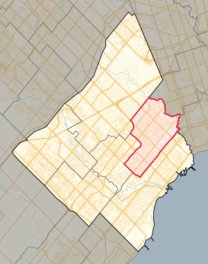
Mississauga—Brampton South was a federal electoral district in Ontario, Canada, that was represented in the House of Commons of Canada from 2004 to 2015. It consists of the parts of the cities of Mississauga and Brampton bounded by a line drawn from the intersection of Highway 401 with the northeastern limit of the City of Mississauga, south along the city limit, southwest along Burnhamthorpe Road East, northwest along Central Parkway East, southwest along Highway 403, northwest along Mavis Road; thence northwesterly along said road to Eglinton Avenue West; thence southwesterly along said avenue to Terry Fox Way; thence northwesterly along said way to Britannia Road West; thence northeasterly along said road to Mavis Road, southwest along Highway 401, northwest along Mississauga Road, northeast along the northwestern limit of the City of Mississauga, northwest along McLaughlin Road, northeast along Steeles Avenue East, southeast along Kennedy Road South, northeast along the northwestern limit of the City of Mississauga, southeast along Dixie Road, and northeast along Highway 401 to the point of commencement. Following the 2012 federal electoral boundaries redistribution, the bulk of the district will be part of the new Mississauga—Malton district, with other parts transferred to Mississauga East—Cooksville, Mississauga Centre, Mississauga—Streetsville, Brampton South, and Brampton Centre.

Ontario Khalsa Darbar
Gurdwara in Mississauga, Ontario
Distance: Approx. 2245 meters
Latitude and longitude: 43.6767,-79.67754
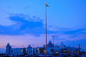
The Ontario Khalsa Darbar, popularly referred to as Dixie Gurdwara, is a Sikh Gurdwara (place of worship) in Mississauga, Ontario. One of the few Sikh Gurdwara in Canada, it attracts hundreds of celebrants for major religious festivals. A gurdwara, meaning "the doorway to the Guru", is the Sikh place of worship and may be referred to as a Sikh temple.

International Centre
Distance: Approx. 2339 meters
Latitude and longitude: 43.7029,-79.638
The International Centre is a multi-purpose convention centre in Mississauga, Ontario, Canada, located near Toronto Pearson International Airport. The International Centre is privately owned and hosts over 450 shows and events each year.

Bramalea—Gore—Malton (provincial electoral district)
Provincial electoral district in Ontario, Canada
Distance: Approx. 3385 meters
Latitude and longitude: 43.72027778,-79.68722222
Bramalea—Gore—Malton was a provincial electoral district in Southern Ontario, Canada. It was created for the 2007 provincial election. All of the district was carved from Bramalea—Gore—Malton—Springdale.
Ascension of Our Lord Secondary School
Catholic high school in Mississauga, Ontario, Canada
Distance: Approx. 3299 meters
Latitude and longitude: 43.723,-79.653
Ascension of Our Lord Secondary School is located in the City of Mississauga, in Ontario, Canada. It is part of the Dufferin-Peel Board. It was originally established as a Middle School (Junior High School), but was converted to a Secondary School (High School) in the 1980s.

Mississauga East—Cooksville (provincial electoral district)
Provincial electoral district in Ontario, Canada
Distance: Approx. 2904 meters
Latitude and longitude: 43.7,-79.7
Mississauga East—Cooksville is a provincial electoral district in Ontario, Canada, that has been represented in the Legislative Assembly of Ontario since the 2007 provincial election.
Mississauga Cogeneration Plant
Distance: Approx. 1828 meters
Latitude and longitude: 43.69805556,-79.6425
Mississauga Cogeneration Plant was a natural gas power station partially owned by TransAlta and located adjacent to Toronto Pearson International Airport. The plant was primarily used to supply steam and power to nearby industrial clients with surplus power sold onto the Ontario grid. From 1992 to 2007, it supplied thermal energy to the McDonnell Douglas and later Boeing aircraft parts plant.
Player One Amusement Group
Canadian arcade game distributor
Distance: Approx. 3160 meters
Latitude and longitude: 43.6937843,-79.6254575
Player One Amusement Group (P1AG), formerly Cineplex Starburst, is a Canadian arcade game distributor. The firm also owns Playdium, a large amusement centre in Mississauga, Ontario. Formed in 2012, it was created via the successive mergers and acquisitions of Starburst Coin Machine, Brady Distributing, Premier Amusements, Sega Amusement Works, Tricorp Amusements, and Dandy Amusements.
Weather in this IP's area
broken clouds
-6 Celsius
-12 Celsius
-7 Celsius
-5 Celsius
1018 hPa
77 %
1018 hPa
994 hPa
9656 meters
5.14 m/s
230 degree
75 %