216.234.55.180 - IP Lookup: Free IP Address Lookup, Postal Code Lookup, IP Location Lookup, IP ASN, Public IP
Country:
Region:
City:
Location:
Time Zone:
Postal Code:
IP information under different IP Channel
ip-api
Country
Region
City
ASN
Time Zone
ISP
Blacklist
Proxy
Latitude
Longitude
Postal
Route
Luminati
Country
ASN
Time Zone
America/Toronto
ISP
ACI-1
Latitude
Longitude
Postal
IPinfo
Country
Region
City
ASN
Time Zone
ISP
Blacklist
Proxy
Latitude
Longitude
Postal
Route
IP2Location
216.234.55.180Country
Region
ontario
City
milton
Time Zone
America/Toronto
ISP
Language
User-Agent
Latitude
Longitude
Postal
db-ip
Country
Region
City
ASN
Time Zone
ISP
Blacklist
Proxy
Latitude
Longitude
Postal
Route
ipdata
Country
Region
City
ASN
Time Zone
ISP
Blacklist
Proxy
Latitude
Longitude
Postal
Route
Popular places and events near this IP address
Bruce Trail
Hiking trail in Ontario, Canada
Distance: Approx. 2672 meters
Latitude and longitude: 43.50722222,-79.92888889
The Bruce Trail is a hiking trail in southern Ontario, Canada, from the Niagara River to the tip of Tobermory, Ontario. The main trail is more than 890 km (550 mi) long and there are over 400 km (250 mi) of associated side trails. The trail mostly follows the edge of the Niagara Escarpment, one of the nineteen UNESCO World Biosphere Reserves in Canada.

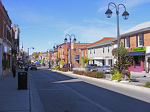
Milton, Ontario
Town in Ontario, Canada
Distance: Approx. 2659 meters
Latitude and longitude: 43.50833333,-79.88333333
Milton (2021 census population 132,979) is a town in Southern Ontario, Canada, and part of the Halton Region in the Greater Toronto Area. Between 2001 and 2011, Milton was the fastest growing municipality in Canada, with a 71.4% increase in population from 2001 to 2006 and another 56.5% increase from 2006 to 2011. In 2016, Milton's census population was 110,128 with an estimated growth to 228,000 by 2031.

Regional Municipality of Halton
Regional municipality in Ontario, Canada
Distance: Approx. 2417 meters
Latitude and longitude: 43.50833333,-79.88777778
The Regional Municipality of Halton, or Halton Region, is a regional municipality in Ontario, Canada, located in the Golden Horseshoe of Southern Ontario. It comprises the city of Burlington and the towns of Oakville, Milton, and Halton Hills. Policing in the Region is provided by the Halton Regional Police Service.
Country Heritage Park
Events Venue, Agricultural museum & More! in Ontario, Canada
Distance: Approx. 2650 meters
Latitude and longitude: 43.51666667,-79.9375
The Country Heritage Park (Formerly the Ontario Agricultural Museum) is located next to Highway 401 and the Niagara Escarpment in Milton, Ontario, Canada, and recreates rural life in the 19th century in Ontario. During the day it also acts as a private school and office, and hosts parties at night. The Museum is affiliated with the Canadian Museums Association, Canadian Heritage Information Network, and the Virtual Museum of Canada.

Mansewood, Ontario
Unincorporated community in Ontario, Canada
Distance: Approx. 2928 meters
Latitude and longitude: 43.55138889,-79.90805556
Mansewood is an unincorporated community in Halton Hills, Ontario, Canada. Middle Sixteen Mile Creek flows through the settlement. The early settlement was part of The Scotch Block, a large agricultural area in Esquesing Township occupied primarily by Scottish immigrants.
Fifth Wheel Truck Stops
Distance: Approx. 367 meters
Latitude and longitude: 43.524376,-79.902359
The Fifth Wheel Truck Stops was a chain of truck stops, with locations in Ontario, Manitoba and New Brunswick. They also offered motel service, restaurants, and truck/RV cleaning. The Milton location appeared in key scenes of the 1978 film High-Ballin'.
Maplehurst Correctional Complex
Prison in Ontario, Canada
Distance: Approx. 720 meters
Latitude and longitude: 43.52638889,-79.89805556
Maplehurst Correctional Complex (French: Complexe Correctionnel de Maplehurst) is a correctional facility located in Milton, Ontario for women and men 18 years of age and older. It is a combined maximum security detention centre for remanded prisoners, and medium/maximum correctional centre for offenders sentenced to less than two years. It used to have a separate wing for minors (12 to 17 years of age) but no longer houses them.
Vanier Centre for Women
Canadian prison and treatment facility for women
Distance: Approx. 571 meters
Latitude and longitude: 43.524727,-79.899745
The Vanier Centre for Women (French: Centre Vanier pour les femmes) in Milton, Ontario is a medium correctional facility for female offenders serving sentences of less than two years or who have been arrested and are remanded in custody awaiting trial. The institution has capacity for 333 inmates. Services for French-speaking people are offered at this facility.

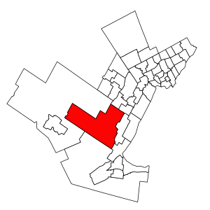
Milton (federal electoral district)
Federal electoral district in Ontario, Canada
Distance: Approx. 2224 meters
Latitude and longitude: 43.512,-79.886
Milton is a federal electoral district in Ontario, Canada, that consists of the town of Milton and part of Burlington which has a population growing much faster than the Ontario average. It was created by the 2012 federal redistribution and previously part of Halton. Redistributed results showed that Conservative Lisa Raitt won the area easily in 2011, although her vote share dropped in the 2015 election and the Liberals took the riding in 2019.
Chudleigh's Limited
Distance: Approx. 925 meters
Latitude and longitude: 43.5323,-79.91253
Chudleigh's Limited is a privately owned Canadian company, based in Milton, Ontario, Canada. Its primary business is frozen baked desserts, which it prepares both for private label customers, and for marketing under its own Chudleigh's brand. Chudleigh's also operates Chudleigh's Farm, an entertainment farm in Milton, Ontario, located on the apple farm where the company was founded.

Milton (provincial electoral district)
Provincial electoral district in Ontario, Canada
Distance: Approx. 2224 meters
Latitude and longitude: 43.512,-79.886
Milton is a provincial electoral district in Ontario, Canada. It elects one member to the Legislative Assembly of Ontario. The riding was created in 2015.

Mill Pond (Milton, Ontario)
Lake in Ontario, Canada
Distance: Approx. 2048 meters
Latitude and longitude: 43.51416667,-79.88638889
Mill Pond is a manmade freshwater reservoir in downtown Milton, Ontario, Canada. The pond is located on the main street of downtown Milton, a suburban town north of Lake Ontario in the Regional Municipality of Halton. Halton is the west wing of Greater Toronto Area bordering Niagara escapement to the west.
Weather in this IP's area
few clouds
-7 Celsius
-9 Celsius
-8 Celsius
-6 Celsius
1024 hPa
62 %
1024 hPa
997 hPa
10000 meters
1.34 m/s
3.58 m/s
355 degree
18 %

