216.228.81.137 - IP Lookup: Free IP Address Lookup, Postal Code Lookup, IP Location Lookup, IP ASN, Public IP
Country:
Region:
City:
Location:
Time Zone:
Postal Code:
IP information under different IP Channel
ip-api
Country
Region
City
ASN
Time Zone
ISP
Blacklist
Proxy
Latitude
Longitude
Postal
Route
Luminati
Country
Region
tn
City
loretto
ASN
Time Zone
America/Chicago
ISP
LORETTOCOMM
Latitude
Longitude
Postal
IPinfo
Country
Region
City
ASN
Time Zone
ISP
Blacklist
Proxy
Latitude
Longitude
Postal
Route
IP2Location
216.228.81.137Country
Region
tennessee
City
saint joseph
Time Zone
America/Chicago
ISP
Language
User-Agent
Latitude
Longitude
Postal
db-ip
Country
Region
City
ASN
Time Zone
ISP
Blacklist
Proxy
Latitude
Longitude
Postal
Route
ipdata
Country
Region
City
ASN
Time Zone
ISP
Blacklist
Proxy
Latitude
Longitude
Postal
Route
Popular places and events near this IP address

Loretto, Tennessee
City in Tennessee, United States
Distance: Approx. 7488 meters
Latitude and longitude: 35.07833333,-87.43888889
Loretto is a city in Lawrence County, Tennessee, United States. The population was 1,714 at the 2010 census, and 1,739 at the 2020 census.

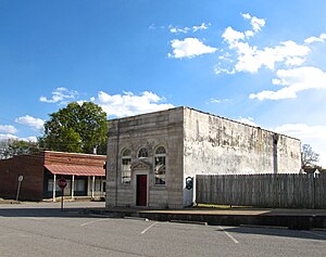
Saint Joseph, Tennessee
City in Tennessee, United States
Distance: Approx. 770 meters
Latitude and longitude: 35.035,-87.50222222
Saint Joseph (usually shortened to St. Joseph) is a city in Lawrence County, Tennessee, United States. The population was 782 at the 2010 census, down from 829 in 2000.

Iron City, Tennessee
Census-designated place in Tennessee, United States
Distance: Approx. 7184 meters
Latitude and longitude: 35.02555556,-87.58361111
Iron City is a census-designated place and former city in Lawrence and Wayne counties, Tennessee. Iron City was incorporated as a city from 1887 to 1901, and again from 1962 until 2010, its residents voting to disincorporate in the latter year. The United States Census bureau treated the community as a Census-designated place for both the 2010 and 2020 census.
WLXA
Radio station in Loretto, Tennessee
Distance: Approx. 8411 meters
Latitude and longitude: 34.96536111,-87.50002778
WLXA (98.3 FM) is a radio station broadcasting a country music format, simulcasting WLLX 97.5 FM Lawrenceburg, TN. Licensed to Florence, Alabama, United States, the station is currently owned by Roger Wright through licensee Radio 7 Media, LLC, and features programming from Westwood One.

Sacred Heart of Jesus Church (Loretto, Tennessee)
Historic church in Tennessee, United States
Distance: Approx. 7049 meters
Latitude and longitude: 35.07666667,-87.44333333
Sacred Heart Catholic Church is a historic Roman Catholic church on Church Street in Loretto, Tennessee. The congregation was formed in 1871 by Catholics of German ancestry who had come from the Cincinnati area to settle in Lawrence County, Tennessee. The first priest was J. H. Hueser, who had been sent to Tennessee from Indiana in 1869 to become the first priest in Lawrence County.

St. Joseph Church (St. Joseph, Tennessee)
Historic church in Tennessee, United States
Distance: Approx. 924 meters
Latitude and longitude: 35.03305556,-87.50305556
St. Joseph Church is a historic Roman Catholic church at 304 American Blvd. in St.
Green Hill, Alabama
Unincorporated community in Alabama, United States
Distance: Approx. 7545 meters
Latitude and longitude: 34.97305556,-87.51222222
Green Hill is an unincorporated community in Lauderdale County, Alabama. Green Hill is the hometown of Iron Horse Bluegrass, Secret Sisters, and Jason Isbell, a singer-songwriter and former member of the Drive-By Truckers.
St. Mary's Cemetery (Lawrence County, Tennessee)
Historic cemetery in Tennessee, United States
Distance: Approx. 8475 meters
Latitude and longitude: 35.03138889,-87.41472222
St. Mary's Cemetery is a historic Roman Catholic cemetery in Lawrence County, Tennessee, United States, located off Rascal Town Road, 5 miles (8.0 km) southeast of St. Joseph.
Weather in this IP's area
broken clouds
-8 Celsius
-12 Celsius
-9 Celsius
-6 Celsius
1020 hPa
93 %
1020 hPa
990 hPa
6722 meters
1.83 m/s
2.37 m/s
140 degree
74 %