216.227.2.128 - IP Lookup: Free IP Address Lookup, Postal Code Lookup, IP Location Lookup, IP ASN, Public IP
Country:
Region:
City:
Location:
Time Zone:
Postal Code:
IP information under different IP Channel
ip-api
Country
Region
City
ASN
Time Zone
ISP
Blacklist
Proxy
Latitude
Longitude
Postal
Route
Luminati
Country
Region
me
City
naples
ASN
Time Zone
America/New_York
ISP
PIVOT
Latitude
Longitude
Postal
IPinfo
Country
Region
City
ASN
Time Zone
ISP
Blacklist
Proxy
Latitude
Longitude
Postal
Route
IP2Location
216.227.2.128Country
Region
maine
City
brownfield
Time Zone
America/New_York
ISP
Language
User-Agent
Latitude
Longitude
Postal
db-ip
Country
Region
City
ASN
Time Zone
ISP
Blacklist
Proxy
Latitude
Longitude
Postal
Route
ipdata
Country
Region
City
ASN
Time Zone
ISP
Blacklist
Proxy
Latitude
Longitude
Postal
Route
Popular places and events near this IP address

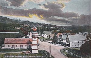
Brownfield, Maine
Town in the state of Maine, United States
Distance: Approx. 9 meters
Latitude and longitude: 43.93805556,-70.90861111
Brownfield is a town in Oxford County, Maine, United States. The population was 1,631 at the 2020 census. Brownfield is home to the Stone Mountain Arts Center.

Denmark, Maine
Town in the state of Maine, United States
Distance: Approx. 9172 meters
Latitude and longitude: 43.97027778,-70.80333333
Denmark is a town in Oxford County, Maine, United States. The population was 1,197 at the 2020 census. A number of ponds and lakes are located within the town.
Eastern Slopes Regional Airport
Airport
Distance: Approx. 6680 meters
Latitude and longitude: 43.99111111,-70.94777778
Eastern Slope Regional Airport (IATA: FRY, ICAO: KIZG, FAA LID: IZG), also known as Fryeburg Airport, is a public airport located three miles (4.8 km) southeast of the central business district of Fryeburg, a town in Oxford County, Maine, United States. It is owned by the Town of Fryeburg. The airport is accessible from ME-5 in Fryeburg and Brownfield, Maine.
Shepards River
River in Maine, United States
Distance: Approx. 3507 meters
Latitude and longitude: 43.96833333,-70.89638889
The Shepards River is a 13.6-mile-long (21.9 km) river in western Maine and eastern New Hampshire in the United States. It is part of the Saco River drainage basin. The Shepards River rises in the town of Conway, New Hampshire, south of Dundee Hill and north of Crown Hill, among foothills of the White Mountains.
Stone Mountain Arts Center
Distance: Approx. 4431 meters
Latitude and longitude: 43.9079,-70.9447
Stone Mountain Arts Center (SMAC), located in Brownfield, Maine, is an intimate performance hall situated in the foothills of the White Mountains. Despite its small size and remote location, artists who have performed there include Richie Havens, The Indigo Girls, Bela Fleck and the Flecktones, Martin Sexton, Marty Stuart, and Tom Rush, among others. Folk singer/songwriter Carol Noonan owns and operates the center, along with her husband Jeff Flagg.
Little Saco River
River in the United States
Distance: Approx. 5057 meters
Latitude and longitude: 43.98313,-70.91701
The Little Saco River is a 4.5-mile-long (7.2 km) tributary of the Saco River in western Maine in the United States. It begins at the junction of Haley Brook and Paine Brook in the northern part of the town of Brownfield and flows northeast, entering the town of Fryeburg just before its mouth at the Saco.
Tenmile River (Maine)
River in the United States
Distance: Approx. 4656 meters
Latitude and longitude: 43.93396,-70.8509
The Tenmile River is an 8.6-mile-long (13.8 km) river in the towns of Hiram and Brownfield in western Maine in the United States. It is a tributary of the Saco River, which flows to the Atlantic Ocean.
West Branch Tenmile River
River in the United States
Distance: Approx. 7178 meters
Latitude and longitude: 43.87507,-70.92757
The West Branch Tenmile River is a 5.0-mile-long (8.0 km) tributary of the Tenmile River in western Maine. It is part of the Saco River watershed, flowing to the Atlantic Ocean. The West Branch rises near the northern boundary of the town of Porter and flows east, entering the town of Hiram just before its mouth at the Tenmile River.

Moose Pond
Lake in Cumberland County and Oxford County, Maine
Distance: Approx. 8849 meters
Latitude and longitude: 43.97166667,-70.80861111
Moose Pond is located in the towns of Bridgton, Denmark and Sweden, in the state of Maine. Camp Winona, a camp for boys, Camp Wyonegonic, a camp for girls, and Pleasant Mountain Ski Area, a ski resort, are located on the pond.

Battle of Pequawket
Last major engagement between the English and the Wabanaki Confederacy in Governor Dummer's War.
Distance: Approx. 9484 meters
Latitude and longitude: 44.021,-70.936
The Battle of Pequawket (also known as Lovewell's Fight) occurred on May 9, 1725 (O.S.), during Father Rale's War in northern New England. Captain John Lovewell led a privately organized company of scalp hunters, organized into a makeshift ranger company, and Chief Paugus led the Abenaki at Pequawket, the site of present-day Fryeburg, Maine. The battle was related to the expansion of New England settlements along the Kennebec River (in present-day Maine).
Lovewell Pond
Distance: Approx. 7767 meters
Latitude and longitude: 44.00583333,-70.93194444
Lovewell Pond is a sizable body of water located in southeastern Fryeburg, Maine. It has a moderately developed shoreline with approximately 75-80 buildings, not including approximately 35 others with access rights to the pond's shoreline. Lovewell Pond is the second largest pond in Oxford County.

John Watson House (Hiram, Maine)
Historic house in Maine, United States
Distance: Approx. 8787 meters
Latitude and longitude: 43.8975,-70.81472222
The John Watson House, also known as the Intervale Farm, is a historic house on Benny Babb Hill Road in Hiram, Maine. Built in 1785 by one of Hiram's first settlers, it is now the oldest building in the town, and is a well-preserved example of late Georgian architecture. It was listed on the National Register of Historic Places in 1974.
Weather in this IP's area
overcast clouds
-7 Celsius
-10 Celsius
-7 Celsius
-7 Celsius
1001 hPa
56 %
1001 hPa
979 hPa
10000 meters
1.79 m/s
4.92 m/s
355 degree
92 %