Country:
 Anguilla
Region:
City:
Latitude and Longitude:
Time Zone:
Postal Code:
IP information under different IP Channel
ip-api
Country
Region
City
ASN
Time Zone
ISP
Blacklist
Proxy
Latitude
Longitude
Postal
Route
IPinfo
Country
Region
City
ASN
Time Zone
ISP
Blacklist
Proxy
Latitude
Longitude
Postal
Route
MaxMind
Country
Region
City
ASN
Time Zone
ISP
Blacklist
Proxy
Latitude
Longitude
Postal
Route
Luminati
Country
 US
USASN
Time Zone
America/Chicago
ISP
Ses Astra S.A.
Latitude
Longitude
Postal
db-ip
Country
Region
City
ASN
Time Zone
ISP
Blacklist
Proxy
Latitude
Longitude
Postal
Route
ipdata
Country
Region
City
ASN
Time Zone
ISP
Blacklist
Proxy
Latitude
Longitude
Postal
Route
Popular places and events near this IP address
Area code 264
Telephone area code of Anguilla
Distance: Approx. 2031 meters
Latitude and longitude: 18.2,-63.05
Area code 264 is the telephone area code of Anguilla in the North American Numbering Plan (NANP). The area code was created in a split of the original numbering plan area with area code 809. Permissive dialing started 31 March 1997 and ended on 30 September 1997.

Clayton J. Lloyd International Airport
Airport in The Valley, Anguilla
Distance: Approx. 1580 meters
Latitude and longitude: 18.20472222,-63.055
Clayton J. Lloyd International Airport (IATA: AXA, ICAO: TQPF) (formerly known as the Anguilla Wallblake Airport) is a small international airport located on the island of Anguilla, a British Overseas Territory in the Caribbean. It is located very close to The Valley, the island's capital. Wallblake Airport is also a featured airport in one of the Flight Simulator X game demos.

Sandy Ground, Anguilla
District in Anguilla, United Kingdom
Distance: Approx. 1495 meters
Latitude and longitude: 18.2,-63.08333333
Sandy Ground is a village and one of the fourteen Districts of Anguilla, and its main port. The long curved beach is backed by high cliffs and a disused salt pond. According to the 2011 census Sandy Ground has a population of 230.
Crocus Hill
Mountain in Anguilla' United Kingdom
Distance: Approx. 1304 meters
Latitude and longitude: 18.21194444,-63.07055556
Crocus Hill is the highest point of Anguilla, a British overseas territory in the Caribbean, with an elevation of 73 metres (240 ft). The hill is located near The Valley, Anguilla's capital. Crocus Bay (west of the hill) was named after Crocus Hill.
George Hill, Anguilla
District in Anguilla, United Kingdom
Distance: Approx. 141 meters
Latitude and longitude: 18.19919,-63.06856
George Hill is one of the fourteen Districts of Anguilla. Its population at the 2011 census was 879.
North Hill, Anguilla
District in Anguilla, United Kingdom
Distance: Approx. 1164 meters
Latitude and longitude: 18.20881,-63.0756
North Hill is one of the fourteen Districts of Anguilla. Its population at the 2011 census was 464.

Republic of Anguilla
1967–1969 unrecognised state in the Caribbean
Distance: Approx. 2293 meters
Latitude and longitude: 18.21277778,-63.05194444
The Republic of Anguilla was a short-lived, unrecognised independent state on the island of Anguilla. It lasted from 11 July 1967 until 19 March 1969, when British control was re-established.
Wallblake House
Distance: Approx. 1839 meters
Latitude and longitude: 18.20944444,-63.05472222
Wallblake House is a heritage plantation house and museum annex in The Valley, Anguilla in the northeastern Caribbean. Built in 1787 by Will Blake, a sugar planter, it is stated to be the oldest structure on the island. Although gutted by the French in the late 1790s, it was rebuilt by the British and today has been fully restored, with its kitchen complex, stables and slave quarters intact.

Government House, Anguilla
Official residence in Old Ta, Anguilla
Distance: Approx. 2261 meters
Latitude and longitude: 18.2206,-63.0686
Government House is the official residence of the governor of Anguilla, located in Old Ta in Anguilla. The building was first constructed in 1969, but was substantially modernised in 1974. As well as being the residence of the Anguillan Governor and their family, Government House is also used for national and ceremonial functions, as well as receptions and meetings with visiting foreign dignitaries and heads of state.

Road Salt Pond
Distance: Approx. 2196 meters
Latitude and longitude: 18.20333333,-63.08972222
Road Salt Pond, also known as Road Bay Pond or simply Road Pond, is a wetland in Anguilla, a British Overseas Territory in the Caribbean Sea. It is one of the territory's Important Bird Areas (IBAs).
Forest Bay Pond
Wetland in Anguilĺa, Caribbean Sea
Distance: Approx. 1495 meters
Latitude and longitude: 18.19083333,-63.05916667
Forest Bay Pond is a small wetland in Anguilla, a British Overseas Territory in the Caribbean Sea. It forms one of the territory's Important Bird Areas (IBAs).
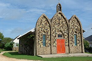
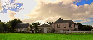
St. Gerard Church, The Valley
Church in Anguilla, United Kingdom
Distance: Approx. 1901 meters
Latitude and longitude: 18.21,-63.0544
St. Gerard Church is a religious building located in the town of The Valley, capital of the British overseas territory of Anguilla, in the Lesser Antilles, Caribbean Sea. The temple follows the Roman or Latin rite and depends on the Roman Catholic Diocese of Saint John's – Basseterre (Dioecesis Sancti Ioannis Imatellurana) which was created in 1971 by Pope Paul VI by the Bull "Cum nobis" and is headquartered in the city of St.John's in Antigua and Barbuda.
Weather in this IP's area
light rain
29 Celsius
36 Celsius
28 Celsius
29 Celsius
1011 hPa
89 %
1011 hPa
1007 hPa
10000 meters
5.66 m/s
90 degree
40 %
05:59:15
18:20:42