Country:
 USA
USARegion:
City:
Latitude and Longitude:
Time Zone:
Postal Code:
IP information under different IP Channel
ip-api
Country
Region
City
ASN
Time Zone
ISP
Blacklist
Proxy
Latitude
Longitude
Postal
Route
IPinfo
Country
Region
City
ASN
Time Zone
ISP
Blacklist
Proxy
Latitude
Longitude
Postal
Route
MaxMind
Country
Region
City
ASN
Time Zone
ISP
Blacklist
Proxy
Latitude
Longitude
Postal
Route
Luminati
Country
USRegion
wi
City
eauclaire
ASN
Time Zone
America/Chicago
ISP
WWTC-247-01
Latitude
Longitude
Postal
db-ip
Country
Region
City
ASN
Time Zone
ISP
Blacklist
Proxy
Latitude
Longitude
Postal
Route
ipdata
Country
Region
City
ASN
Time Zone
ISP
Blacklist
Proxy
Latitude
Longitude
Postal
Route
Popular places and events near this IP address
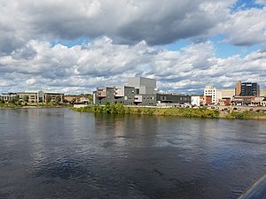
Eau Claire, Wisconsin
City in Wisconsin, United States
Distance: Approx. 2069 meters
Latitude and longitude: 44.81666667,-91.5
Eau Claire ( oh-KLAIR; French: [o klɛʁ] lit. "clear water") is a city in Eau Claire and Chippewa counties in the U.S. state of Wisconsin. It is the seat of Eau Claire County.
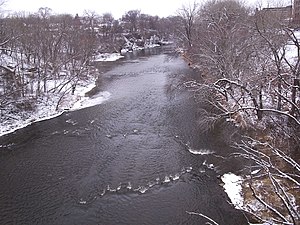
Eau Claire River (Chippewa River tributary)
River in Eau Claire, Wisconsin
Distance: Approx. 2483 meters
Latitude and longitude: 44.81166667,-91.50333333
The Eau Claire River is a tributary of the Chippewa River in west-central Wisconsin in the United States. It is one of three rivers by this name in Wisconsin. Via the Chippewa River, it is part of the Mississippi River watershed.

Lutheran Church of the Good Shepherd, Eau Claire, Wisconsin
Church in Wisconsin , United States
Distance: Approx. 1581 meters
Latitude and longitude: 44.8219,-91.525
The Lutheran Church of the Good Shepherd (erected May 15, 1955) is an Evangelical Lutheran church on Cedar Street in Eau Claire, Wisconsin. The church, a member of the Evangelical Lutheran Church in America, has been in existence since 1955.

State Theatre (Eau Claire, Wisconsin)
Distance: Approx. 2479 meters
Latitude and longitude: 44.81253,-91.50015
The State Theatre is a venue for the performing arts and entertainment, located in downtown Eau Claire, Wisconsin, with seating for 1100 people.
Phoenix Park (Eau Claire, Wisconsin)
Distance: Approx. 2356 meters
Latitude and longitude: 44.81281,-91.50357
Phoenix Park is a public space in downtown Eau Claire, Wisconsin, located on a former brownfield site at the confluence of the Chippewa River and the Eau Claire River. It covers approximately 9 acres with approximately 1/2 mile of riverbank frontage. The park serves as the trailhead for the Chippewa River State Trail.

St. Patrick's Church (Eau Claire, Wisconsin)
Historic church in Wisconsin, United States
Distance: Approx. 2437 meters
Latitude and longitude: 44.81129,-91.50853
St. Patrick's Church is a historic Catholic church built in 1885 in Eau Claire, Wisconsin. It was added to the National Register of Historic Places in 1983 for its architectural significance.

Brady Anderson and Waldemar Ager House
Historic house in Wisconsin, United States
Distance: Approx. 1916 meters
Latitude and longitude: 44.81583333,-91.51416667
The Brady Anderson and Waldemar Ager House is a historic house located at 514 West Madison Street in Eau Claire, Wisconsin. It was added to the National Register of Historic Places in 2000. Additionally, it has been designated a Literary Landmark by the National Association of Friends of Public Libraries.

Confluence Commercial Historic District
Historic district in Wisconsin, United States
Distance: Approx. 2498 meters
Latitude and longitude: 44.81222222,-91.50055556
The Confluence Commercial Historic District is located in Eau Claire, Wisconsin. It was added to the National Register of Historic Places in 2007.

Sacred Heart Church (Eau Claire, Wisconsin)
Historic church in Wisconsin, United States
Distance: Approx. 1932 meters
Latitude and longitude: 44.81822,-91.49968
Sacred Heart Church is located in Eau Claire, Wisconsin. It was added to the National Register of Historic Places for its architectural significance in 1983. The parish was organized around 1875 when a number of German-speaking families formed a parish distinct from St.
Riverview Park (Eau Claire, Wisconsin)
Distance: Approx. 1667 meters
Latitude and longitude: 44.843797,-91.497874
Riverview Park, is a park located on the Chippewa River in Eau Claire, Wisconsin, on the north side of the city. The park also incorporates an island in the Chippewa River.

Barnes Block
United States historic place
Distance: Approx. 2424 meters
Latitude and longitude: 44.81277778,-91.50111111
The Barnes Block is located in Eau Claire, Wisconsin.

Eau Claire station (Wisconsin)
Historic railroad station in Wisconsin, U.S.
Distance: Approx. 2219 meters
Latitude and longitude: 44.81666667,-91.49638889
The Eau Claire station, otherwise known as the Chicago, St. Paul, Minneapolis & Omaha Railroad Depot was a historic railroad station located at 324 Putnam Street in Eau Claire, Wisconsin. The station was built in 1893 for the Chicago, St.
Weather in this IP's area
clear sky
8 Celsius
8 Celsius
7 Celsius
9 Celsius
1022 hPa
73 %
1022 hPa
991 hPa
10000 meters
0.89 m/s
1.79 m/s
155 degree
07:09:24
18:38:57