216.221.5.37 - IP Lookup: Free IP Address Lookup, Postal Code Lookup, IP Location Lookup, IP ASN, Public IP
Country:
Region:
City:
Location:
Time Zone:
Postal Code:
IP information under different IP Channel
ip-api
Country
Region
City
ASN
Time Zone
ISP
Blacklist
Proxy
Latitude
Longitude
Postal
Route
Luminati
Country
Region
pa
City
altoona
ASN
Time Zone
America/New_York
ISP
SALSGIVER
Latitude
Longitude
Postal
IPinfo
Country
Region
City
ASN
Time Zone
ISP
Blacklist
Proxy
Latitude
Longitude
Postal
Route
IP2Location
216.221.5.37Country
Region
pennsylvania
City
freeport
Time Zone
America/New_York
ISP
Language
User-Agent
Latitude
Longitude
Postal
db-ip
Country
Region
City
ASN
Time Zone
ISP
Blacklist
Proxy
Latitude
Longitude
Postal
Route
ipdata
Country
Region
City
ASN
Time Zone
ISP
Blacklist
Proxy
Latitude
Longitude
Postal
Route
Popular places and events near this IP address

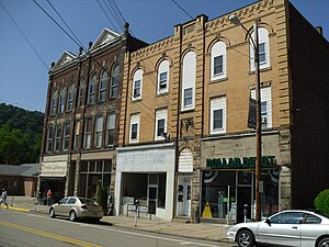
Freeport, Pennsylvania
Borough in Pennsylvania, United States
Distance: Approx. 5358 meters
Latitude and longitude: 40.67444444,-79.68638889
Freeport is a borough in Armstrong County, Pennsylvania, United States. It is situated along the Allegheny River in the southwestern corner of the county. The population was 1,736 at the 2020 census.

South Buffalo Township, Pennsylvania
Township in Pennsylvania, United States
Distance: Approx. 5153 meters
Latitude and longitude: 40.75416667,-79.62055556
South Buffalo Township is a township in Armstrong County, Pennsylvania, United States. The population was 2,713 at the 2020 census, an increase from the figure of 2,636 tabulated in 2010.

Kiskiminetas River
River in Pennsylvania, United States
Distance: Approx. 4289 meters
Latitude and longitude: 40.67944444,-79.66694444
The Kiskiminetas River (commonly referred to as the Kiski by locals) is a tributary of the Allegheny River, approximately 27 miles (43 km) long, in Western Pennsylvania in the United States. The region stretching from the northern side of Harmar Township, Pennsylvania to the Kiskiminetas towns is often referred to by the locals as the Alle-Kiski Valley after the rivers.

Schenley, Pennsylvania
Unincorporated community in Pennsylvania, United States
Distance: Approx. 3674 meters
Latitude and longitude: 40.68444444,-79.66166667
Schenley is an unincorporated community that is located in Gilpin Township, Armstrong County, Pennsylvania, United States.
Murphy Island (Pennsylvania)
Distance: Approx. 3624 meters
Latitude and longitude: 40.68944444,-79.63527778
Murphy Island (also known as Donley Island) is a privately owned alluvial island in the Allegheny River in Gilpin Township, Armstrong County in the U.S. state of Pennsylvania. The island is situated across from South Buffalo Township. The elevation of Murphy Island is 758 feet above sea level.
Buffalo Creek (Allegheny River tributary)
River in the United States
Distance: Approx. 6072 meters
Latitude and longitude: 40.6697877,-79.692826
Buffalo Creek is a tributary of the Allegheny River in Armstrong and Butler counties, Pennsylvania in the United States. Buffalo Creek joins the Allegheny River at the borough of Freeport.
Todd Nature Reserve
Protected area in western Pennsylvania, USA
Distance: Approx. 3905 meters
Latitude and longitude: 40.7297,-79.7008
Todd Nature Reserve (formerly called Todd Sanctuary) is a 334-acre (135 ha) nature reserve owned and operated by the Audubon Society of Western Pennsylvania. It is located in Buffalo Township, Butler County, Pennsylvania; approximately thirty miles northeast of Pittsburgh, and five miles (8 km) north of Freeport. The original portion of the reserve was donated by noted ornithologist W.E. Clyde Todd, who made his first significant birding discoveries on the land while visiting his grandfather at the end of the nineteenth century.
Freeport Rail Bridge
Bridge in Freeport and Allegheny Township
Distance: Approx. 4590 meters
Latitude and longitude: 40.6773,-79.6707
The Freeport Rail Bridge is a truss bridge that carries the Norfolk Southern Railway across the Allegheny River between Freeport and Allegheny Township in Pennsylvania. A structure originally created on this site by the Pennsylvania Railroad as part of their West Penn Line in 1866. In 1895, the railroad replaced this bridge; the third and current incarnation was completed in 1950, along with new approach ramps that eliminated a narrow tunnel.

Allegheny River Lock and Dam No. 5
United States historic place
Distance: Approx. 3582 meters
Latitude and longitude: 40.68583333,-79.66638889
Allegheny River Lock and Dam No. 5 is a historic lock and fixed-crest dam complex located at Gilpin Township and South Buffalo Township in Armstrong County, Pennsylvania. It was built between 1920 and 1927 by the United States Army Corps of Engineers, and consists of the lock, dam, esplanade, and Operations Building.

McVille Airport
Airport
Distance: Approx. 5191 meters
Latitude and longitude: 40.73333333,-79.59972222
McVille Airport (FAA LID: 6P7) is a privately owned, public use airport located six nautical miles (11 km) northeast of the central business district of Freeport, a borough in Armstrong County, Pennsylvania, United States.
McVille, Pennsylvania
Unincorporated community in Pennsylvania, United States
Distance: Approx. 4714 meters
Latitude and longitude: 40.72583333,-79.60277778
McVille is an unincorporated community in South Buffalo Township, Armstrong County, Pennsylvania, United States. The community is 6.6 miles (10.6 km) northeast of Freeport along PA-128, south of Nicholson Run.
Johnetta, Pennsylvania
Historic community in Pennsylvania, United States
Distance: Approx. 5184 meters
Latitude and longitude: 40.69833333,-79.60138889
Johnetta is an historic community that is located in Gilpin Township in Armstrong County, Pennsylvania.
Weather in this IP's area
overcast clouds
9 Celsius
8 Celsius
7 Celsius
12 Celsius
1019 hPa
93 %
1019 hPa
975 hPa
10000 meters
1.63 m/s
1.87 m/s
150 degree
100 %
