216.215.77.3 - IP Lookup: Free IP Address Lookup, Postal Code Lookup, IP Location Lookup, IP ASN, Public IP
Country:
Region:
City:
Location:
Time Zone:
Postal Code:
ISP:
ASN:
language:
User-Agent:
Proxy IP:
Blacklist:
IP information under different IP Channel
ip-api
Country
Region
City
ASN
Time Zone
ISP
Blacklist
Proxy
Latitude
Longitude
Postal
Route
db-ip
Country
Region
City
ASN
Time Zone
ISP
Blacklist
Proxy
Latitude
Longitude
Postal
Route
IPinfo
Country
Region
City
ASN
Time Zone
ISP
Blacklist
Proxy
Latitude
Longitude
Postal
Route
IP2Location
216.215.77.3Country
Region
new york
City
elmira
Time Zone
America/New_York
ISP
Language
User-Agent
Latitude
Longitude
Postal
ipdata
Country
Region
City
ASN
Time Zone
ISP
Blacklist
Proxy
Latitude
Longitude
Postal
Route
Popular places and events near this IP address

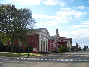
Elmira, New York
City in New York, United States
Distance: Approx. 614 meters
Latitude and longitude: 42.09388889,-76.80972222
Elmira () is a city in and the county seat of Chemung County, New York, United States. It is the principal city of the Elmira, New York, metropolitan statistical area, which encompasses Chemung County. The population was 26,523 at the 2020 census, down from 29,200 at the 2010 census, a decline of more than 7 percent.

Elmira College
Private college in Elmira, New York, U.S.
Distance: Approx. 771 meters
Latitude and longitude: 42.0966,-76.816
Elmira College is a private college in Elmira, New York. Founded as a college for women in 1855, it is the oldest existing college granting degrees to women that were the equivalent of those given to men. Elmira College became coeducational in all of its programs in 1969.

30th Separate Company Armory
Distance: Approx. 887 meters
Latitude and longitude: 42.091627,-76.80358
The 30th Separate Company Armory, also known as the Elmira Armory, formerly located at 307 East Church Street in Elmira, New York, was built from 1886 to 1888. It was a contributing property of the Elmira Civic Historic District. The structure was designed by J. H. Pierce of the firm of Pierce & Bickford.

Trinity Church (Elmira, New York)
Historic church in New York, United States
Distance: Approx. 1017 meters
Latitude and longitude: 42.09,-76.80833333
The parish of Trinity Church, Elmira, New York was founded in 1833. Trinity Church is a parish of the Chemung District of the Episcopal Diocese of Central New York, centered in Syracuse, New York. The present structure of Trinity Church is located at 304 North Main Street, Elmira, New York.

Elmira Civic Historic District
Historic district in New York, United States
Distance: Approx. 1030 meters
Latitude and longitude: 42.09055556,-76.8025
The Elmira Civic Historic District is the area of downtown Elmira, New York where the governmental center developed in the town's early history. It includes the Chemung County Courthouse Complex, John Hazlett Office Building and the Arnot Art Museum/Icehouse, all on Lake Street. Among the contributing buildings on Church Street are the Richardson Romanesque style Armory Building, the Beaux Arts-style City Hall, designed by Pierce & Bickford, and the U. S. Post Office.

Fire Station No. 4 (Elmira, New York)
United States historic place
Distance: Approx. 626 meters
Latitude and longitude: 42.10472222,-76.80722222
Fire Station No. 4, also known as the Maxwell Place Fire Station, is located at 301 Maxwell Place, Elmira, New York. It was designed by local architects Pierce & Bickford.

Elmira College Old Campus
Historic district in New York, United States
Distance: Approx. 630 meters
Latitude and longitude: 42.09777778,-76.81472222
The Elmira College Old Campus is the historic part of Elmira College in Elmira, New York. Historically known as The Elmira Collegiate Seminary or The Elmira Female College, the college was the first in the United States to offer to women a degree program on a par with programs offered to men. The contributing structures are significant examples of the architecture of the period.

Pentecostal Holy Temple Church of Jesus Christ
Historic church in New York, United States
Distance: Approx. 911 meters
Latitude and longitude: 42.10722222,-76.80861111
Pentecostal Holy Temple Church of Jesus Christ, formerly known as The Free Baptist Church, was a historic Baptist church located at Elmira in Chemung County, New York. It was built in 1882 and is an example of late 19th century Gothic Revival style ecclesiastical architecture. The building has been demolished.

St. Patrick's Parochial Residence-Convent and School
United States historic place
Distance: Approx. 715 meters
Latitude and longitude: 42.09333333,-76.81111111
St. Patrick's Parochial Residence-Convent and School is a historic Roman Catholic parochial residence (rectory and convent), and school complex located at Elmira in Chemung County, New York. The structures are across from St.
William S. Gerity House
Historic house in New York, United States
Distance: Approx. 690 meters
Latitude and longitude: 42.093925,-76.80269167
The William S. Gerity House is a historic house located at 415 William Street in Elmira, Chemung County, New York.

Pratt House (Elmira, New York)
Historic house in New York, United States
Distance: Approx. 664 meters
Latitude and longitude: 42.09361111,-76.80416667
Pratt House is a historic home located at Elmira, Chemung County, New York. It is a large scale brick dwelling in the Italianate style. It has a cross-gable plan and features two asymmetrical towers, a projecting polygonal bay, and a stepped back, Arts and Crafts style north wing.

Arnot Art Museum
United States historic place
Distance: Approx. 1006 meters
Latitude and longitude: 42.09079,-76.80251
Arnot Art Museum, opened 1913, is a municipal art museum located at 235 Lake Street in Elmira, New York. Its permanent collection includes 17th-, 18th-, and 19th-century European paintings; and 19th- and 20th-century American art. Its 21st-century collection focuses on contemporary representational art.
Weather in this IP's area
scattered clouds
1 Celsius
-5 Celsius
-1 Celsius
2 Celsius
1021 hPa
54 %
1021 hPa
968 hPa
10000 meters
7.72 m/s
13.38 m/s
270 degree
40 %
