216.201.89.100 - IP Lookup: Free IP Address Lookup, Postal Code Lookup, IP Location Lookup, IP ASN, Public IP
Country:
Region:
City:
Location:
Time Zone:
Postal Code:
IP information under different IP Channel
ip-api
Country
Region
City
ASN
Time Zone
ISP
Blacklist
Proxy
Latitude
Longitude
Postal
Route
Luminati
Country
ASN
Time Zone
America/Chicago
ISP
PERFORMIVE-VNI
Latitude
Longitude
Postal
IPinfo
Country
Region
City
ASN
Time Zone
ISP
Blacklist
Proxy
Latitude
Longitude
Postal
Route
IP2Location
216.201.89.100Country
Region
georgia
City
marietta
Time Zone
America/New_York
ISP
Language
User-Agent
Latitude
Longitude
Postal
db-ip
Country
Region
City
ASN
Time Zone
ISP
Blacklist
Proxy
Latitude
Longitude
Postal
Route
ipdata
Country
Region
City
ASN
Time Zone
ISP
Blacklist
Proxy
Latitude
Longitude
Postal
Route
Popular places and events near this IP address

Sope Creek
Cobb County, Georgia
Distance: Approx. 3440 meters
Latitude and longitude: 33.95388889,-84.44333333
Sope Creek is an 11.6-mile-long (18.7 km) stream located in Cobb County, Georgia, United States. It is a significant tributary of the Chattahoochee River. It was known as Soap Creek during the 19th century.

Life University
Private university in Marietta, Georgia, U.S.
Distance: Approx. 4474 meters
Latitude and longitude: 33.9325,-84.5145
Life University is a private university focused on training chiropractors and located in Marietta, Georgia, United States. It was established in 1974 by a chiropractor, Sid E. Williams. A 2024 report found that students in Life's doctor of chiropractic program had the 12th-highest debt-to-income ratio among all graduate programs in the US, at 490%.

Wheeler High School (Georgia)
Public high school in Marietta, Georgia, United States
Distance: Approx. 3437 meters
Latitude and longitude: 33.958841,-84.477775
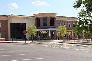
Wheeler High School is located in northeast Cobb County, Georgia, U.S. It is near the city of Marietta, about 15 miles (24 km) northwest of downtown Atlanta. The school has been in operation since 1965. It is a public high school, accredited by the Southern Association of Colleges and Schools.
Powers Park, Georgia
Unincorporated community in Georgia, U.S.
Distance: Approx. 1471 meters
Latitude and longitude: 33.93385556,-84.48123889
Powers Park is an unincorporated community located east-southeast of Marietta in Cobb County, Georgia, United States.

Riverbend Apartments
Complex known in the 1970s for its singles scene
Distance: Approx. 3918 meters
Latitude and longitude: 33.897359,-84.448909
Riverbend Apartments was an infamous 600-unit apartment complex located in suburban Atlanta, Georgia, off Interstate 285. It has been described as Atlanta's most notorious singles complex. The apartment complex was also the plot setting for part of the 2002 film Catch Me If You Can.

Sewell Mill Creek
Distance: Approx. 3833 meters
Latitude and longitude: 33.96277778,-84.45555556
Sewell Mill Creek is a tributary of Sope Creek in Marietta, Georgia, United States. Via Sope Creek and the Chattahoochee River, it is part of the Apalachicola River basin, draining to the Gulf of Mexico.
JordanCon
Fan convention dedicated to Robert Jordan's The Wheel of Time
Distance: Approx. 3150 meters
Latitude and longitude: 33.9025,-84.47638889
JordanCon is a North American convention held annually in Atlanta, Georgia, that celebrates Robert Jordan's fantasy book series The Wheel of Time, as well as other science fiction and fantasy works. The convention is a 501c4 tax exempt charitable organization founded in honor of the late Robert Jordan.

Truist Park
Baseball park in Metro Atlanta, Georgia
Distance: Approx. 4400 meters
Latitude and longitude: 33.89,-84.468
Truist Park is a baseball stadium in the Atlanta metropolitan area, approximately 10 miles (16 km) northwest of downtown Atlanta in the unincorporated community of Cumberland, in Cobb County, Georgia. Opened in 2017, it is the ballpark of Major League Baseball's Atlanta Braves. Previously named SunTrust Park, the ballpark was renamed after SunTrust Bank became Truist Financial in 2020.

Atlanta Country Club
Distance: Approx. 3892 meters
Latitude and longitude: 33.94,-84.426
Atlanta Country Club is a private golf club in the southeastern United States, located in the Chattahoochee Plantation section of East Cobb, Georgia, a suburb northwest of Atlanta. The club was founded 60 years ago in 1964 and opened two years later.

Sope Creek Ruins
United States historic place
Distance: Approx. 2899 meters
Latitude and longitude: 33.94055556,-84.43777778
Sope Creek Ruins are located at the intersection of Paper Mill Road and Sope Creek in Cobb County, Georgia and are old industrial ruins. These ruins are the remnants of a larger manufacturing complex which drew on the waterpower that the creek produced. During the period 1850 to 1940, a succession of enterprises, from a (fully integrated) paper mill, twine plant, flour mill and hydroelectric power plant occupied an area of about one mile along the creek.
1974 Tournament Players Championship
Golf tournament
Distance: Approx. 3892 meters
Latitude and longitude: 33.94,-84.426
The 1974 Tournament Players Championship was a golf tournament in Georgia on the PGA Tour, held August 29 to September 2 at Atlanta Country Club in Marietta, a suburb northwest of Atlanta. This was the first Tournament Players Championship, and Jack Nicklaus won the first of his three TPC titles, two strokes ahead of runner-up J. C. Snead, the 54-hole leader. The final round on Sunday was interrupted several times by weather and twelve players completed their rounds on Monday morning, Labor Day.

Coca-Cola Roxy
Concert venue in Cumberland, Georgia, US
Distance: Approx. 4387 meters
Latitude and longitude: 33.8902,-84.4697
The Coca-Cola Roxy is a concert venue located in The Battery Atlanta in Cumberland, Georgia. Named after the old Roxy Theatre, the venue opened in April 2017.
Weather in this IP's area
scattered clouds
8 Celsius
5 Celsius
8 Celsius
9 Celsius
1026 hPa
68 %
1026 hPa
989 hPa
10000 meters
5.66 m/s
100 degree
40 %