216.201.241.149 - IP Lookup: Free IP Address Lookup, Postal Code Lookup, IP Location Lookup, IP ASN, Public IP
Country:
 USA
USARegion:
City:
Location:
Time Zone:
Postal Code:
ISP:
ASN:
language:
User-Agent:
Proxy IP:
Blacklist:
IP information under different IP Channel
ip-api
Country
Region
City
ASN
Time Zone
ISP
Blacklist
Proxy
Latitude
Longitude
Postal
Route
db-ip
Country
Region
City
ASN
Time Zone
ISP
Blacklist
Proxy
Latitude
Longitude
Postal
Route
IPinfo
Country
Region
City
ASN
Time Zone
ISP
Blacklist
Proxy
Latitude
Longitude
Postal
Route
IP2Location
216.201.241.149Country
usRegion
oklahoma
City
oklahoma city
Time Zone
America/Chicago
ISP
Language
User-Agent
Latitude
Longitude
Postal
ipdata
Country
Region
City
ASN
Time Zone
ISP
Blacklist
Proxy
Latitude
Longitude
Postal
Route
Popular places and events near this IP address
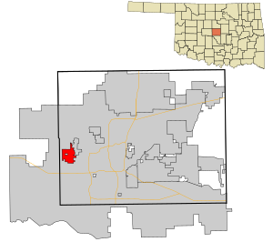
Bethany, Oklahoma
City in Oklahoma, United States
Distance: Approx. 3878 meters
Latitude and longitude: 35.50472222,-97.63888889
Bethany is a city in Oklahoma County, Oklahoma, United States, and a part of the Oklahoma City metropolitan area. Bethany has a population of 20,831 at the 2020 census, a 9.3% increase from 2010. The community was founded in 1909 by followers of the Church of the Nazarene from Oklahoma City.

Warr Acres, Oklahoma
City in Oklahoma, United States
Distance: Approx. 1046 meters
Latitude and longitude: 35.52833333,-97.61833333
Warr Acres is a city in Oklahoma County, Oklahoma, United States, and a part of the Oklahoma City metropolitan area. It was established after World War II by C.B. Warr, a dynamic businessman, builder, and commercial developer. The population was 10,452 at the 2020 census, a 4.1% increase from 2010.

Southern Nazarene University
Christian college in Bethany, Oklahoma, US
Distance: Approx. 2674 meters
Latitude and longitude: 35.5139,-97.6309
Southern Nazarene University (SNU) is a private Nazarene university in Bethany, Oklahoma.

Southwestern Christian University
University in Bethany, Oklahoma, U.S.
Distance: Approx. 3179 meters
Latitude and longitude: 35.51277778,-97.64138889
Southwestern Christian University is a private Pentecostal university in Bethany, Oklahoma. It was founded in 1946 as Southwestern Bible College in Oklahoma City, Oklahoma, and was the first Pentecostal educational institution in the state. While it was established as a Bible college for the training of Christian church leaders within the International Pentecostal Holiness Church, the denomination planned to quickly expand the school into a junior college.

Roman Catholic Archdiocese of Oklahoma City
Latin Catholic ecclesiastical jurisdiction in Oklahoma, USA
Distance: Approx. 3439 meters
Latitude and longitude: 35.56138889,-97.64611111
The Archdiocese of Oklahoma City (Latin: Archidioecesis Oclahomensis) is a Latin Church ecclesiastical territory or archdiocese of the Catholic Church of western Oklahoma in the United States. The mother church of the archdiocese is the Cathedral of Our Lady of Perpetual Help in Oklahoma City. As of 2024, His Excellency, The Most Reverend, Paul Coakley is archbishop of Oklahoma City.
Bethany High School
Public high school in Bethany, Oklahoma, United States
Distance: Approx. 2776 meters
Latitude and longitude: 35.513254,-97.632142
Bethany High School is located in Bethany, Oklahoma, United States. The first class graduated in 1931. In the 2014 Bethany High School won the National Blue Ribbon Award.
Wedgewood Village Amusement Park
Former amusement park in Oklahoma City, Oklahoma, US
Distance: Approx. 2665 meters
Latitude and longitude: 35.54,-97.59361111
Wedgewood Village Amusement Park was an amusement park in Oklahoma City, Oklahoma. It was originally started in 1955 by Maurice Woods and located at May and NW 58th street, where it was known as Duffys Golf. Maurice started to notice that wives and children were sitting in their cars while their husbands used the driving range.
Deaconess Hospital (Oklahoma City, Oklahoma)
Hospital in OK, United States
Distance: Approx. 3260 meters
Latitude and longitude: 35.52658333,-97.58916667
Integris Health Baptist Medical Center - North Portland (formerly Deaconess Hospital) is a hospital in Oklahoma City, Oklahoma.
Sawyer Center
Distance: Approx. 2800 meters
Latitude and longitude: 35.511981,-97.62594
The Sawyer Center, named for Carl Brannon Sawyer, is the main athletic facility for Southern Nazarene University (SNU) and seats over 5,000. It is used for basketball and volleyball games played by the Southern Nazarene Crimson Storm. In addition to sporting events, the Sawyer Center also hosts all commencement, the New Student Institute for welcome week activities, and high school tournaments.
Eldon Lyon Park
Park in Bethany, Oklahoma
Distance: Approx. 3483 meters
Latitude and longitude: 35.51,-97.64222222
Eldon Lyon Park is the largest park owned and operated by the city of Bethany, Oklahoma. It contains many picnic tables, basketball courts, and a 11⁄2 mile track running around the perimeter of the park. During the 4th of July, the park is home of the Bethany Freedom Celebration.
Putnam City High School
Public school in Warr Acres, Oklahoma, United States
Distance: Approx. 2099 meters
Latitude and longitude: 35.522311,-97.608278
Putnam City High School (commonly, PC, Putnam City Original, and PCO) is a secondary school located in Warr Acres, Oklahoma, a northwestern suburb of metropolitan Oklahoma City, U.S.. It is one of three high schools in the Putnam City School District and serves more than 1,900 students. It is accredited by the North Central Association of Secondary Schools.
Oklahoma Museum of Flying
Aviation museum in Bethany, Oklahoma
Distance: Approx. 1448 meters
Latitude and longitude: 35.5335,-97.6382
The Oklahoma Museum of Flying is an aviation museum located at Wiley Post Airport in Bethany, Oklahoma.
Weather in this IP's area
clear sky
8 Celsius
5 Celsius
7 Celsius
10 Celsius
1020 hPa
66 %
1020 hPa
975 hPa
10000 meters
7.2 m/s
10 degree