216.201.188.130 - IP Lookup: Free IP Address Lookup, Postal Code Lookup, IP Location Lookup, IP ASN, Public IP
Country:
Region:
City:
Location:
Time Zone:
Postal Code:
IP information under different IP Channel
ip-api
Country
Region
City
ASN
Time Zone
ISP
Blacklist
Proxy
Latitude
Longitude
Postal
Route
Luminati
Country
Region
tx
City
dallas
ASN
Time Zone
America/Chicago
ISP
LOGIXCOMM-AS
Latitude
Longitude
Postal
IPinfo
Country
Region
City
ASN
Time Zone
ISP
Blacklist
Proxy
Latitude
Longitude
Postal
Route
IP2Location
216.201.188.130Country
Region
texas
City
houston
Time Zone
America/Chicago
ISP
Language
User-Agent
Latitude
Longitude
Postal
db-ip
Country
Region
City
ASN
Time Zone
ISP
Blacklist
Proxy
Latitude
Longitude
Postal
Route
ipdata
Country
Region
City
ASN
Time Zone
ISP
Blacklist
Proxy
Latitude
Longitude
Postal
Route
Popular places and events near this IP address
Jacinto City, Texas
City in Texas, United States
Distance: Approx. 3182 meters
Latitude and longitude: 29.76555556,-95.24027778
Jacinto City is a city in Harris County, Texas, United States, east of the intersection of Interstate 10 and the East Loop of Interstate 610. Jacinto City is part of the Houston–Sugar Land–Baytown metropolitan area and is bordered by the cities of Houston and Galena Park. The population was 9,613 at the 2020 census.

Texas's 18th congressional district
U.S. House district for Texas
Distance: Approx. 3090 meters
Latitude and longitude: 29.81861111,-95.25361111
Texas's 18th congressional district of the United States House of Representatives includes much of inner city Houston and the surrounding area. It has been the Downtown Houston district since 1972. The district is currently represented by Democrat Sylvester Turner.
North Shore, Houston
Community of Houston with portions in Harris, Texas, United States
Distance: Approx. 1447 meters
Latitude and longitude: 29.7813,-95.2412
North Shore is a community in east side of Harris County, Texas with a small portion inside the city of Houston, Texas. The area includes subdivisions such as Songwood, Holiday Forest, Wood Bayou, Cimarron, Home Owned Estates, Woodland Acres, Hidden Forest, Pine Trails, Woodforest, Woodforest North, New Forest, and New Forest West, as well as newer neighborhoods near Highway 90 and Beltway 8 North Sam Houston Parkway. Northshore was annexed by Houston in the 1950s.
Furr High School
Public school in Houston, Texas, United States
Distance: Approx. 1883 meters
Latitude and longitude: 29.77944444,-95.24833333
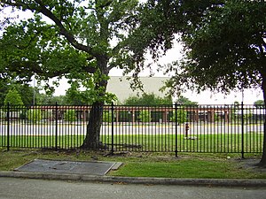
Ebbert L. Furr High School is a secondary school located in Houston, Texas, United States. Furr, which serves grades 9 through 12, is a part of the Houston Independent School District. Furr is adjacent to Hermann Brown Park and the Songwood subdivision.

Galena Park High School
Public school in Galena Park, Harris, Texas, United States
Distance: Approx. 6068 meters
Latitude and longitude: 29.7396,-95.2372
Galena Park High School is a secondary school located in Galena Park, Texas, United States and is one of three secondary schools in the Galena Park Independent School District (GPISD). GPHS serves several areas: the city of Galena Park, the portion of Jacinto City south of Market Street, portions of Houston, and portions of unincorporated Harris County.

Pleasantville, Houston
Neighborhood in Houston, Texas, United States
Distance: Approx. 5152 meters
Latitude and longitude: 29.7632,-95.2783
Pleasantville is a neighborhood located in Houston, Texas, United States.
Fidelity Manor High School
African-American high school in Texas
Distance: Approx. 5682 meters
Latitude and longitude: 29.7443,-95.2515
Fidelity Manor High School was a high school for African American children in Galena Park, Texas and a part of the Galena Park Independent School District (GPISD). It opened in 1955 and was the only black high school in the district. As part of desegregation in the United States the school merged into the previously all-white Galena Park High School in 1969.
Beaumont Place, Texas
Unincorporated community in Texas, US
Distance: Approx. 6095 meters
Latitude and longitude: 29.83722222,-95.19972222
Beaumont Place is an unincorporated community in east central Harris County, Texas, United States. It is located along Beaumont Highway (U.S. Highway 90) and the Southern Pacific Railroad. It is 2 miles (3.2 km) southwest of the Sheldon Reservoir.

East Houston
Human settlement in Houston, Texas, United States of America
Distance: Approx. 5349 meters
Latitude and longitude: 29.84,-95.255
East Houston is a community in Houston, Texas, United States.
Overbrook, Texas
Neighborhood in Houston, Texas
Distance: Approx. 5505 meters
Latitude and longitude: 29.7815,-95.2937
Overbrook, Texas is a small neighborhood in Southeast Houston.
Halls Bayou
Distance: Approx. 4921 meters
Latitude and longitude: 29.83815,-95.23429
Halls Bayou is a bayou in the northern part of Houston, Texas. It begins just north of W Mt Houston Road and flows for 17 miles (27 km). It empties into Greens Bayou in Brock Park and Golf Course.
B.C. Elmore High School
Former school in Texas, United States
Distance: Approx. 4018 meters
Latitude and longitude: 29.8099,-95.276
Bennie Carl Elmore High School was a senior high school in Houston, Texas. It was a part of the East and Mount Houston Independent School District. It was a school for black students, and it served the community of Settegast.
Weather in this IP's area
overcast clouds
5 Celsius
-0 Celsius
4 Celsius
5 Celsius
1017 hPa
87 %
1017 hPa
1015 hPa
10000 meters
7.72 m/s
11.83 m/s
320 degree
100 %


