216.201.185.224 - IP Lookup: Free IP Address Lookup, Postal Code Lookup, IP Location Lookup, IP ASN, Public IP
Country:
Region:
City:
Location:
Time Zone:
Postal Code:
IP information under different IP Channel
ip-api
Country
Region
City
ASN
Time Zone
ISP
Blacklist
Proxy
Latitude
Longitude
Postal
Route
Luminati
Country
Region
tx
City
dallas
ASN
Time Zone
America/Chicago
ISP
LOGIXCOMM-AS
Latitude
Longitude
Postal
IPinfo
Country
Region
City
ASN
Time Zone
ISP
Blacklist
Proxy
Latitude
Longitude
Postal
Route
IP2Location
216.201.185.224Country
Region
texas
City
austin
Time Zone
America/Chicago
ISP
Language
User-Agent
Latitude
Longitude
Postal
db-ip
Country
Region
City
ASN
Time Zone
ISP
Blacklist
Proxy
Latitude
Longitude
Postal
Route
ipdata
Country
Region
City
ASN
Time Zone
ISP
Blacklist
Proxy
Latitude
Longitude
Postal
Route
Popular places and events near this IP address

Zilker, Austin, Texas
Neighborhood in Austin, Texas, U.S.
Distance: Approx. 577 meters
Latitude and longitude: 30.25,-97.76666667
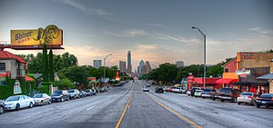
Zilker is a neighborhood in south central Austin, Texas. It extends south of Lady Bird Lake, approximately bounded by the Union Pacific Railway to the southeast/south (Lamar Boulevard south of Oltorf), Barton Skyway to the south, Rabb Road and Azie Morton Road to the west and Lady Bird Lake to the north. Directly northwest of Zilker is Barton Hills neighborhood, which connects back to Zilker Park via the Barton Creek Greenbelt.

Roman Catholic Diocese of Austin
Latin Catholic ecclesiastical jurisdiction in Texas, USA
Distance: Approx. 1604 meters
Latitude and longitude: 30.25,-97.75
The Diocese of Austin (Latin: Dioecesis Austiniensis) is a Latin Church ecclesiastical territory, or diocese, of the Catholic Church comprising 25 counties of Central Texas in the United States. The diocese estimates a population of over 625,000 Catholics. As of 2021, the Diocese of Austin had 216 priests (168 active, 48 retired); 240 permanent deacons (160 active, 80 retired); and approximately 30 brothers and 84 sisters.

Green Pastures (Austin, Texas)
Historic house in Texas, United States
Distance: Approx. 325 meters
Latitude and longitude: 30.245,-97.76222222
Green Pastures is a historic Victorian home housing a restaurant of the same name in south Austin, Texas neighborhood of Bouldin Creek. Completed in 1895 by local minister E.W. Herndon, the house sat on 23 acres (93,000 m2) bordering a wooded area to the south. It was home to a number of families over the years.
San Juan Diego Catholic High School (Austin, Texas)
Private, coeducational school in Austin, , Texas, United States
Distance: Approx. 515 meters
Latitude and longitude: 30.24083333,-97.76305556
San Juan Diego Catholic High School (SJDCHS) is a private, Roman Catholic high school in Austin, Texas. It is located in the Roman Catholic Diocese of Austin.

South Austin Popular Culture Center
American nonprofit organization
Distance: Approx. 755 meters
Latitude and longitude: 30.25166667,-97.765
The Austin Museum of Popular Culture (AusPop) is a Texas 501(c)(3) nonprofit organisation dedicated to collecting, preserving, and exhibiting art and memorabilia that reflect Austin's eclectic contributions to popular culture worldwide. Auspop, formerly known as SouthPop, champions Austin artists who were mainly responsible for "weird" Austin.

South Congress
Neighborhood in Austin, Texas, United States
Distance: Approx. 1604 meters
Latitude and longitude: 30.25,-97.75
South Congress (abbreviated SoCo) is a neighborhood located on South Congress Avenue in Austin, Texas, United States. It is also a nationally known shopping and cultural district known for its many eclectic small retailers, restaurants, music and art venues and, more recently, food trucks. South Congress begins at the Colorado River and Ann W. Richards Congress Avenue Bridge and runs due south towards Ben White Boulevard/TX-71.

Bouldin Creek, Austin, Texas
Neighborhood in Austin, Texas, United States of America
Distance: Approx. 1111 meters
Latitude and longitude: 30.249344,-97.755253
Bouldin Creek is a neighborhood in Austin, Texas, originally created at the turn of the 20th century and saw the bulk of its growth in the 1920s and 1930s. Bouldin Creek is bordered by South Congress to the east, the Union Pacific railroad track to the west, Barton Springs to the north, and West Oltorf to the south. It includes two major commercial areas, South First and South Congress.

Austin Fire Department
Distance: Approx. 1604 meters
Latitude and longitude: 30.25,-97.75
The Austin Fire Department provides fire protection and first-response emergency medical services to the city of Austin, Texas. The Austin Fire Department is the fourth largest fire department (by number of personnel) in the state of Texas. In total, the department is responsible for an area of 272 square miles (700 km2) and services a population of 885,400 (2013 estimate), the 11th largest city by population in the United States.
Galindo, Austin, Texas
Distance: Approx. 1064 meters
Latitude and longitude: 30.235678,-97.768519
Galindo is a neighborhood in Austin, Texas. The area covers part of ZIP code 78704 in south Austin. Galindo is bounded to the south by Ben White Boulevard and the South Manchaca neighborhood, to the east by Dawson and South First Street, to the north by Oltorf Road and Bouldin Creek and to the west by the South Lamar neighborhood.
Timeline of Austin, Texas
Distance: Approx. 1604 meters
Latitude and longitude: 30.25,-97.75
The following is a timeline of the history of the city of Austin, Texas, USA.
Dawson Elementary School
Elementary school in Austin, Texas, U.S.
Distance: Approx. 1213 meters
Latitude and longitude: 30.23415,-97.76353
Dawson Elementary School is an elementary school in the Austin Independent School District (AISD) currently serving students in pre-kindergarten through fifth grade. The school is located at 3001 South First Street in South Austin, Texas, and is named after Mary Jane "Mollie" Dawson, a teacher and school administrator who worked in Austin in the late nineteenth century.
Saxon Pub
Music venue in Austin, Texas
Distance: Approx. 982 meters
Latitude and longitude: 30.253551,-97.763578
Saxon Pub is a music venue in Austin, Texas.
Weather in this IP's area
overcast clouds
4 Celsius
-1 Celsius
3 Celsius
5 Celsius
1022 hPa
83 %
1022 hPa
995 hPa
10000 meters
7.72 m/s
10.8 m/s
350 degree
100 %