216.201.150.25 - IP Lookup: Free IP Address Lookup, Postal Code Lookup, IP Location Lookup, IP ASN, Public IP
Country:
Region:
City:
Location:
Time Zone:
Postal Code:
ISP:
ASN:
language:
User-Agent:
Proxy IP:
Blacklist:
IP information under different IP Channel
ip-api
Country
Region
City
ASN
Time Zone
ISP
Blacklist
Proxy
Latitude
Longitude
Postal
Route
db-ip
Country
Region
City
ASN
Time Zone
ISP
Blacklist
Proxy
Latitude
Longitude
Postal
Route
IPinfo
Country
Region
City
ASN
Time Zone
ISP
Blacklist
Proxy
Latitude
Longitude
Postal
Route
IP2Location
216.201.150.25Country
Region
texas
City
pantego
Time Zone
America/Chicago
ISP
Language
User-Agent
Latitude
Longitude
Postal
ipdata
Country
Region
City
ASN
Time Zone
ISP
Blacklist
Proxy
Latitude
Longitude
Postal
Route
Popular places and events near this IP address

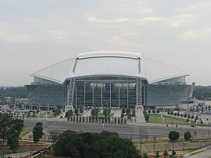
Arlington, Texas
City in Texas, United States
Distance: Approx. 3104 meters
Latitude and longitude: 32.705,-97.12277778
Arlington is a city in Tarrant County, Texas, United States. It is part of the Mid-Cities region of the Dallas–Fort Worth–Arlington metropolitan statistical area, and is a principal city of the metropolis and region. The city had a population of 398,431 in 2020, making it the second-largest city in the county after Fort Worth and the third-largest city in the metropolitan area, after Dallas and Fort Worth.

Dalworthington Gardens, Texas
City in Texas, United States
Distance: Approx. 2893 meters
Latitude and longitude: 32.69361111,-97.15666667
Dalworthington Gardens is a city in Tarrant County, Texas, United States and a suburb of Arlington.

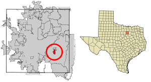
Pantego, Texas
Town in Texas, United States
Distance: Approx. 542 meters
Latitude and longitude: 32.71527778,-97.15472222
Pantego is a town in Tarrant County, Texas, United States. Its population was 2,568 at the 2020 census. It is entirely surrounded by the cities of Arlington and Dalworthington Gardens.
Arlington High School (Texas)
Public school in Arlington, Tarrant County, Texas, United States
Distance: Approx. 3096 meters
Latitude and longitude: 32.719742,-97.118248
Arlington High School (AHS), located in Arlington, Texas, United States, is a secondary school serving grades 9-12. It is one of the six high schools comprising the Arlington Independent School District. AHS has approximately 2,700 students, and are residents of Arlington, Dalworthington Gardens, and Pantego.
Arlington Baptist University
University in Arlington, Texas
Distance: Approx. 2268 meters
Latitude and longitude: 32.739,-97.157
Arlington Baptist University is a private Bible college in Arlington, Texas. It offers both undergraduate and graduate degree programs (only at the masters' level; ABU does not offer doctoral programs).

Maverick Stadium
Distance: Approx. 2588 meters
Latitude and longitude: 32.72920556,-97.12636111
Maverick Stadium is a 12,000-seat multi-purpose stadium on the western edge of University of Texas at Arlington campus. It hosts the university's track and field teams and is also leased by the Pantego Christian Academy for their football team. It usually serves as the site of 1–3 high school football playoff games every year.

MetroCenter (Arlington, Texas)
Entertainment venue and church
Distance: Approx. 2253 meters
Latitude and longitude: 32.7096,-97.130127
The MetroCenter at 1323 W. Pioneer Parkway (Spur 303) in Arlington, Texas, opened in 2005. The 98,000 square-foot venue has hosted concerts, theatrical productions, conferences and other community events, and is also used by Fielder Church as a place of worship. It was built by the church for $17 million, and seats 1,700.
Pantego Christian Academy
Private Christian school
Distance: Approx. 957 meters
Latitude and longitude: 32.722026,-97.141651
Pantego Christian Academy (PCA) is a private Christian school in Tarrant County, Texas, United States. Its main campus, the Arlington Campus, has a building at 2201 West Park Row Drive in Arlington and a 57,000-square-foot (5,300 m2) high school building at 2221 West Park Row Drive in Pantego. The Arlington Campus has 670 students in grades pre-kindergarten through grade 12.

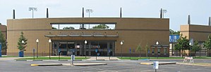
Clay Gould Ballpark
Sports venue in Arlington, Texas, US
Distance: Approx. 1912 meters
Latitude and longitude: 32.722021,-97.131157
Clay Gould Ballpark (formerly Allan Saxe Stadium and Arlington Athletic Center), the home field of the UT Arlington Mavericks, is located on the campus of The University of Texas at Arlington (UT Arlington). The stadium has a seat capacity of 1,600. Clay Gould Ballpark is located at the intersection of West Park Row Drive and Fielder Road.
Battle of Village Creek
Distance: Approx. 3171 meters
Latitude and longitude: 32.72194444,-97.185
The Battle of Village Creek, also known as the Village Creek Massacre, occurred on May 24, 1841, on the embankments of Village Creek in what was then the Republic of Texas. The site of the massacre is now located in Tarrant County, Texas, named for Edward H. Tarrant, who commanded the Texan forces in the massacre. Tarrant rallied a volunteer militia of 69 men, including Captain John B. Denton, who would be the Texans’ only fatality and who would also go on to have a North Texas county bear his name.

Allan Saxe Field
Sports stadium in Arlington, Texas
Distance: Approx. 2080 meters
Latitude and longitude: 32.7225,-97.12944444
Allan Saxe Field is the home of the UTA Mavericks softball team located in Arlington, Texas. As a result of a complete reconstruction in 2014–15, the stadium currently has a capacity of 622. Prior to the renovation, the softball facility had a seating capacity of 250.
Rush Creek (Texas)
Creek in northern Texas
Distance: Approx. 2918 meters
Latitude and longitude: 32.744,-97.1614
Rush Creek is a creek in Tarrant County, Texas. The creek rises near Mansfield and flows for twelve miles. The creek meets Village Creek to the west of Arlington.
Weather in this IP's area
mist
9 Celsius
8 Celsius
7 Celsius
10 Celsius
1025 hPa
87 %
1025 hPa
1002 hPa
6437 meters
2.06 m/s
40 degree
75 %