216.201.136.73 - IP Lookup: Free IP Address Lookup, Postal Code Lookup, IP Location Lookup, IP ASN, Public IP
Country:
 USA
USARegion:
City:
Location:
Time Zone:
Postal Code:
ISP:
ASN:
language:
User-Agent:
Proxy IP:
Blacklist:
IP information under different IP Channel
ip-api
Country
Region
City
ASN
Time Zone
ISP
Blacklist
Proxy
Latitude
Longitude
Postal
Route
db-ip
Country
Region
City
ASN
Time Zone
ISP
Blacklist
Proxy
Latitude
Longitude
Postal
Route
IPinfo
Country
Region
City
ASN
Time Zone
ISP
Blacklist
Proxy
Latitude
Longitude
Postal
Route
IP2Location
216.201.136.73Country
usRegion
oklahoma
City
tulsa
Time Zone
America/Chicago
ISP
Language
User-Agent
Latitude
Longitude
Postal
ipdata
Country
Region
City
ASN
Time Zone
ISP
Blacklist
Proxy
Latitude
Longitude
Postal
Route
Popular places and events near this IP address

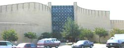
Phillips Theological Seminary
Theological seminary of the Christian Church (Disciples of Christ) in Tulsa, Oklahoma
Distance: Approx. 2994 meters
Latitude and longitude: 36.16805556,-95.86805556
Phillips Theological Seminary is a private seminary affiliated with the Christian Church (Disciples of Christ) and located in Tulsa, Oklahoma. It was established in 1906 and was originally a part of the now defunct Phillips University.
Drillers Stadium
Former baseball stadium in Tulsa, Oklahoma, United States
Distance: Approx. 6606 meters
Latitude and longitude: 36.13964722,-95.92366667
Drillers Stadium was a former minor league baseball stadium located in Tulsa, Oklahoma. From 1981 to 2009, Drillers Stadium was home to the Tulsa Drillers, of the Double-A Texas League. For a number of years Drillers Stadium also hosted one of the regular season baseball games played between Oklahoma State University and the University of Oklahoma in the Bedlam Series.
KOTV (AM)
Radio station in Tulsa, Oklahoma
Distance: Approx. 3869 meters
Latitude and longitude: 36.14648611,-95.80748611
KOTV (1170 kHz) is a commercial AM radio station in Tulsa, Oklahoma. It is owned by Griffin Communications and airs an all-news radio format. Studios and offices are located across from Guthrie Green in Downtown Tulsa.
East Central High School (Oklahoma)
Public school in the United States
Distance: Approx. 960 meters
Latitude and longitude: 36.146133,-95.839884
East Central High School is one of nine high schools in Tulsa Public Schools in Tulsa, Oklahoma. The school is home to 1,143 students from East Tulsa. The majority of students transition into East Central from East Central Junior High.

Eastgate Metroplex
Shopping mall in Oklahoma, United States
Distance: Approx. 3150 meters
Latitude and longitude: 36.13166667,-95.81972222
Eastgate Metroplex is an indoor mixed-use professional/retail complex in Tulsa, Oklahoma. The building was originally a shopping mall that opened in 1984 as the Eastland Mall, but was revitalized into its current use after years of decline.
Dove Science Academy
Public charter school in Oklahoma, US
Distance: Approx. 3511 meters
Latitude and longitude: 36.15576,-95.8873
Dove Schools is a college-preparatory charter school district in Oklahoma. It was founded and organized in 2000 as a single middle school serving 218 students in grades 6–8. As of 2024, it serves just under 4000 students in grades PreK-12 at a total of 9 schools.

Nathan Hale High School (Oklahoma)
School in Oklahoma, US
Distance: Approx. 4485 meters
Latitude and longitude: 36.13189,-95.897589
Nathan Hale High School is a high school in Tulsa, Oklahoma. Opened in 1959, it is part of the Tulsa Public Schools, and is a public school for students from grades 9 through 12. In 2009, the school established a restaurant, lodging, and health management magnet school program, which in 2010 began operating a restaurant open to the public once a week for lunch.
Spartan College of Aeronautics and Technology
For-profit aviation institute in Tulsa, Oklahoma
Distance: Approx. 4309 meters
Latitude and longitude: 36.17638889,-95.87888889
Spartan College of Aeronautics and Technology (Spartan) is a private for-profit aviation college in Tulsa, Oklahoma. It was originally established to provide pilot and technicians for Spartan Aircraft Company but outlived its parent company and continues to train pilots and mechanics into the 21st Century. The main campus is adjacent to Tulsa International Airport, with another campus used for flight training at Richard Lloyd Jones Jr.
National Weather Service Tulsa, Oklahoma
Distance: Approx. 1117 meters
Latitude and longitude: 36.149,-95.862
National Weather Service - Tulsa, Oklahoma (TSA) is a local weather forecast office responsible for monitoring weather conditions for 7 counties in Northwestern Arkansas, and 25 counties in Eastern Oklahoma. The current office in Tulsa maintains a WSR-88D (NEXRAD) radar system, and Advanced Weather Interactive Processing System (AWIPS) that greatly improve forecasting in the region. Tulsa is in charge of weather forecasts, warnings and local statements as well as aviation weather and NOAA Weather Radio broadcasts in its service area.
Alsuma, Oklahoma
Ghost town in Oklahoma, United States
Distance: Approx. 5706 meters
Latitude and longitude: 36.095,-95.86333333
Alsuma was a rural community between Tulsa and Broken Arrow in Tulsa County, Oklahoma, United States. Its post office opened in 1905, and was named Welcome, but was renamed Alsuma in 1906. Another version states that the town was named for John Alsuma, a local merchant.
White City, Tulsa
United States historic place
Distance: Approx. 6058 meters
Latitude and longitude: 36.15111111,-95.9175
White City is a residential neighborhood in Midtown, Tulsa, Oklahoma. It is bounded on the north by 2nd Street, on the east by Fulton Avenue, on the south by 11th Street and on the west by Yale Avenue. The neighborhood was added to the National Register of Historic Places in 2001.
Harvey Young Airport
Airfield in Tulsa, Oklahoma, US
Distance: Approx. 2389 meters
Latitude and longitude: 36.13916667,-95.825
Harvey Young Airport (FAA LID: 1H6) is an airfield located at 1500 S. 135th East Avenue in Tulsa, Oklahoma, United States, owned by Aviation Management Group LLC. This is about 8 miles east of downtown Tulsa. The airport features a 2,580’ x 40’ paved runway, as well as a 2,580’ x 80’ turf runway, both said to be in poor condition (per AirNav.com).
Weather in this IP's area
mist
3 Celsius
-1 Celsius
2 Celsius
4 Celsius
1022 hPa
92 %
1022 hPa
996 hPa
6437 meters
4.63 m/s
360 degree
100 %