Country:
Region:
City:
Latitude and Longitude:
Time Zone:
Postal Code:
IP information under different IP Channel
ip-api
Country
Region
City
ASN
Time Zone
ISP
Blacklist
Proxy
Latitude
Longitude
Postal
Route
Luminati
Country
ASN
Time Zone
America/Chicago
ISP
IHNET
Latitude
Longitude
Postal
IPinfo
Country
Region
City
ASN
Time Zone
ISP
Blacklist
Proxy
Latitude
Longitude
Postal
Route
db-ip
Country
Region
City
ASN
Time Zone
ISP
Blacklist
Proxy
Latitude
Longitude
Postal
Route
ipdata
Country
Region
City
ASN
Time Zone
ISP
Blacklist
Proxy
Latitude
Longitude
Postal
Route
Popular places and events near this IP address

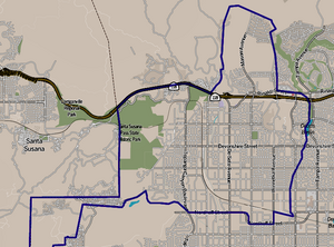
Chatsworth, Los Angeles
Neighborhood of Los Angeles in California, United States
Distance: Approx. 3487 meters
Latitude and longitude: 34.25722,-118.60028
Chatsworth is a suburban neighborhood in Los Angeles, California, in the San Fernando Valley. The area was home to Native Americans, who left caves containing rock art. Chatsworth was explored and colonized by the Spanish beginning in the 18th century.

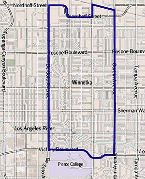
Winnetka, Los Angeles
Neighborhood of Los Angeles in California, United States
Distance: Approx. 2695 meters
Latitude and longitude: 34.20833333,-118.57527778
Winnetka () is a neighborhood in the west-central San Fernando Valley in the city of Los Angeles. It is an ethnically diverse area, both for the city and for Los Angeles County, with a relatively large percentage of Hispanic and Asian people. Winnetka was founded in 1922 as a small farming community.
Von Sternberg House
Distance: Approx. 3005 meters
Latitude and longitude: 34.25135,-118.55363
The Von Sternberg House was a house designed by the architect Richard Neutra. With only one bedroom, plus bedrooms for servants, it was built in 1935 at 10000 Tampa Avenue, Northridge, on a plot of 13 acres (5 hectares) in California's then-rural San Fernando Valley for the movie director Josef von Sternberg. The house was demolished in 1972 and the land became a housing development.
Cleveland High School (Los Angeles)
Public school in Los Angeles, California, United States
Distance: Approx. 3172 meters
Latitude and longitude: 34.21777778,-118.5475
Grover Cleveland Charter High School is a public school serving grades 9–12. Cleveland Humanities Magnet is part of Cleveland Charter High School. The school is located along the community of Reseda Ranch within the neighborhood of Reseda, in the San Fernando Valley portion of the city of Los Angeles, California.

Chatsworth station
Transit hub in San Fernando Valley, Los Angeles, California
Distance: Approx. 3060 meters
Latitude and longitude: 34.25277778,-118.59944444
Chatsworth station (also known as Chatsworth Transportation Center) is an intermodal passenger transport station in the Los Angeles neighborhood of Chatsworth, United States. It is served by Amtrak Pacific Surfliner inter-city rail service, Metrolink Ventura County Line commuter rail service, and the Metro G Line of the Los Angeles Metro Busway bus rapid transit. The station is also served by Los Angeles Metro Bus and Simi Valley Transit local buses, plus Santa Clarita Transit and LADOT Commuter Express regional express bus routes.

Northridge station
Train station in Northridge, California, US
Distance: Approx. 2990 meters
Latitude and longitude: 34.22944444,-118.54472222
Northridge station is a Metrolink passenger train station in the community of Northridge neighborhood of Los Angeles, California, in the San Fernando Valley. Metrolink's Ventura County Line trains from Union Station to Ventura–East stop here. Northridge station is served by 20 Metrolink Ventura County Line trains (ten in each direction) each weekday, running primarily at peak hours in the peak direction of travel.
Northridge Fashion Center
American shopping mall in California
Distance: Approx. 2085 meters
Latitude and longitude: 34.23916667,-118.55583333
Northridge Fashion Center is a large shopping mall located in Northridge, Los Angeles, California. It opened in 1971. It was severely damaged during the Northridge earthquake in 1994, but renovated extensively in 1995, 1998, and 2003.
Phillips Graduate University
Graduate school in Los Angeles, California
Distance: Approx. 1367 meters
Latitude and longitude: 34.242023,-118.567625
Phillips Graduate University was a private graduate school in Chatsworth, Los Angeles, with an administrative office in Sunnyvale, California. It provided numerous degrees including doctoral degrees in Business Administration, Psychology, Organizational Management & Consulting and master's degrees in family therapy, art therapy, and human relations.

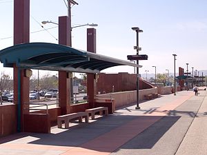
Roscoe station
Bus rapid transit station in Los Angeles, California
Distance: Approx. 2321 meters
Latitude and longitude: 34.21972,-118.59692
Roscoe station is a station on the G Line of the Los Angeles Metro Busway system located in Canoga Park in the western San Fernando Valley, it opened in June 2012. It is part of the Los Angeles Metro Busway system. The station is currently in service as part of the Metro Orange Line Chatsworth Extension.

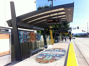
Nordhoff station
Bus rapid transit station in Los Angeles, California
Distance: Approx. 1868 meters
Latitude and longitude: 34.23554,-118.59696
Nordhoff station is a station on the G Line of the Los Angeles Metro Busway system located in the Chatsworth neighborhood of Los Angeles in the western San Fernando Valley. The station opened in June 2012 and was built as part of the Metro Orange Line Chatsworth Extension. Metro's Division 8 (West San Fernando Valley) bus depot is located directly west of the station.
Rumbo Recorders
Recording studio in Los Angeles, California, United States
Distance: Approx. 2700 meters
Latitude and longitude: 34.2084,-118.5737
Rumbo Recorders was a recording studio in the Canoga Park neighborhood of Los Angeles, California.
Browns Creek Bike Path
Cycling route in California, USA
Distance: Approx. 2778 meters
Latitude and longitude: 34.2501,-118.5984
Browns Creek Bike Path is a Class I bike path that is “tucked away from the surrounding hustle and bustle” of the San Fernando Valley, “hugging the side” of the Browns Canyon Wash. The path begins at Lassen Street, just east of Chatsworth Metrolink Station, and ends just north of Rinaldi Street near Stoney Point Park. Browns Creek (sometimes called Brown’s Creek), a tributary of the Los Angeles River, offers “splendid views of the irregularly shaped Santa Susana mountains rising to the west.” One local writer observed, “What [the concrete-lined creek] lacks in scenery, it compensates for by providing the trail with an open, airy setting.” The route has been described as “very rustic” (for an urban bike path, of course).
Weather in this IP's area
clear sky
8 Celsius
7 Celsius
6 Celsius
10 Celsius
1015 hPa
63 %
1015 hPa
984 hPa
10000 meters
2.06 m/s
290 degree
06:30:51
16:48:41

