216.188.233.179 - IP Lookup: Free IP Address Lookup, Postal Code Lookup, IP Location Lookup, IP ASN, Public IP
Country:
Region:
City:
Location:
Time Zone:
Postal Code:
IP information under different IP Channel
ip-api
Country
Region
City
ASN
Time Zone
ISP
Blacklist
Proxy
Latitude
Longitude
Postal
Route
Luminati
Country
Region
tx
City
temple
ASN
Time Zone
America/Chicago
ISP
GRANDECOM-AS1
Latitude
Longitude
Postal
IPinfo
Country
Region
City
ASN
Time Zone
ISP
Blacklist
Proxy
Latitude
Longitude
Postal
Route
IP2Location
216.188.233.179Country
Region
texas
City
temple
Time Zone
America/Chicago
ISP
Language
User-Agent
Latitude
Longitude
Postal
db-ip
Country
Region
City
ASN
Time Zone
ISP
Blacklist
Proxy
Latitude
Longitude
Postal
Route
ipdata
Country
Region
City
ASN
Time Zone
ISP
Blacklist
Proxy
Latitude
Longitude
Postal
Route
Popular places and events near this IP address

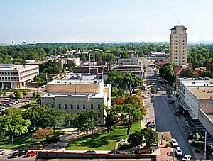
Temple, Texas
City in Texas, United States
Distance: Approx. 7483 meters
Latitude and longitude: 31.10555556,-97.42083333
Temple is a city in Bell County, Texas, United States. As of 2020, the city has a population of 82,073 according to the U.S. census. Temple lies in the region referred to as Central Texas and is a principal city in the Killeen–Temple–Fort Hood metropolitan area, (Fort Hood was redesignated "Fort Cavazos" in 2023) which as of the 2020 Census had a population of 475,367.
Temple College
Community college in Temple, Texas, U.S.
Distance: Approx. 3033 meters
Latitude and longitude: 31.07205,-97.35172
Temple College is a public community college in Temple, Texas, with regional branch campuses at other locations in Central Texas.
Baylor Scott & White Medical Center – Temple
Hospital in Texas, United States
Distance: Approx. 3052 meters
Latitude and longitude: 31.07753,-97.36383
Baylor Scott & White Medical Center – Temple is a 636-bed multi-specialty teaching hospital located in Temple, Texas. The facility was founded in 1897, when Dr. Arthur C. Scott and Dr.
Temple Independent School District
School district in Texas, United States
Distance: Approx. 305 meters
Latitude and longitude: 31.09658333,-97.34538889
Temple Independent School District is a public school district based in Temple, Texas, United States. Temple schools began instruction June 12, 1883. It is the largest employer in Temple, with 1300 employees.
Holy Trinity Catholic High School (Texas)
Private, coeducational school in Temple, , Texas, United States
Distance: Approx. 6943 meters
Latitude and longitude: 31.119095,-97.411437
Holy Trinity Catholic High School or HTCHS is a private high school in Temple, Texas. Holy Trinity Catholic High School is a private, co-educational college-preparatory school. It is located in the Roman Catholic Diocese of Austin.
St. Mary's Catholic School (Temple, Texas)
Roman catholic. school in Temple, Texas, United States
Distance: Approx. 1285 meters
Latitude and longitude: 31.087649,-97.348267
St. Mary's Catholic School or SMCS is a Roman Catholic co-educational school, PreK-8, located in Temple, Texas.

Temple station (Texas)
Train station in Temple, Texas
Distance: Approx. 357 meters
Latitude and longitude: 31.09574,-97.3452
Temple is a train station in Temple, Texas, United States served by Amtrak, the national railroad passenger system. The station was originally built as an Atchison, Topeka and Santa Fe Railway depot. East of the station on another railroad line through Temple, a former Missouri-Kansas-Texas Railroad depot can be found, as the nexus for trains bound for Waco, San Antonio and Houston.

KTEM
Radio station in Temple, Texas
Distance: Approx. 6487 meters
Latitude and longitude: 31.06555556,-97.39916667
KTEM (1400 kHz) is a commercial AM radio station licensed to Temple, Texas. It serves the Killeen-Temple area with a talk radio format. KTEM is owned by Townsquare Media, through licensee Townsquare Media Killeen-Temple License, LLC. Its studios and offices are on Moody Lane in Temple.

Draughon–Miller Central Texas Regional Airport
Airport
Distance: Approx. 8610 meters
Latitude and longitude: 31.15194444,-97.40777778
Draughon–Miller Central Texas Regional Airport (IATA: TPL, ICAO: KTPL, FAA LID: TPL) is six miles northwest of Temple, in Bell County, Texas. The National Plan of Integrated Airport Systems for 2011–2015 categorized it as a general aviation facility.
Temple High School (Texas)
High school in Temple, Bell County, Texas, United States
Distance: Approx. 1411 meters
Latitude and longitude: 31.10698,-97.35347
Temple High School is a public high school located in Temple, Texas. As of the 2024–2026 biennial realignment, it is classified as a 6A school by the University Interscholastic League. It is part of the Temple Independent School District located in central Bell County.

Temple Mall
Shopping mall in Temple, Texas
Distance: Approx. 3833 meters
Latitude and longitude: 31.0707,-97.367
Temple Mall contains accommodation for four major anchor stores and 57 tenants, and has approximately 555,400 square feet (51,600 m2) of gross leasable area. Temple Mall is one of two regional malls in Bell County, the other being Killeen Mall, in nearby Killeen, Texas. Sears had an anchor store that was replaced in 1995 by Foley's.
Wheatley Alternative Education Center
Public high school in Temple, Texas, United States
Distance: Approx. 953 meters
Latitude and longitude: 31.090947,-97.337498
Wheatley Alternative Education Center is a secondary alternative school located in Temple, Texas, in the Temple Independent School District. The school serves all of TISD, including the city of Temple and Bell County. For the 2021-2022 school year, the school remained unrated by the Texas Education Agency.
Weather in this IP's area
clear sky
9 Celsius
7 Celsius
9 Celsius
10 Celsius
1019 hPa
59 %
1019 hPa
997 hPa
10000 meters
4.63 m/s
360 degree

