216.172.84.14 - IP Lookup: Free IP Address Lookup, Postal Code Lookup, IP Location Lookup, IP ASN, Public IP
Country:
Region:
City:
Location:
Time Zone:
Postal Code:
IP information under different IP Channel
ip-api
Country
Region
City
ASN
Time Zone
ISP
Blacklist
Proxy
Latitude
Longitude
Postal
Route
Luminati
Country
Region
fl
City
lakeland
ASN
Time Zone
America/New_York
ISP
MDUPRO
Latitude
Longitude
Postal
IPinfo
Country
Region
City
ASN
Time Zone
ISP
Blacklist
Proxy
Latitude
Longitude
Postal
Route
IP2Location
216.172.84.14Country
Region
florida
City
cape coral
Time Zone
America/New_York
ISP
Language
User-Agent
Latitude
Longitude
Postal
db-ip
Country
Region
City
ASN
Time Zone
ISP
Blacklist
Proxy
Latitude
Longitude
Postal
Route
ipdata
Country
Region
City
ASN
Time Zone
ISP
Blacklist
Proxy
Latitude
Longitude
Postal
Route
Popular places and events near this IP address

Lee County, Florida
County in Florida, United States
Distance: Approx. 3500 meters
Latitude and longitude: 26.58,-81.92
Lee County is located in southwestern Florida, United States, on the Gulf Coast. As of the 2020 census, its population was 760,822. In 2022, the population was 822,453, making it the eighth-most populous county in the state.

Cypress Lake, Florida
Census-designated place in Florida, United States
Distance: Approx. 5508 meters
Latitude and longitude: 26.53805556,-81.90166667
Cypress Lake is an unincorporated community and census-designated place (CDP) in Lee County, Florida, United States. The population was 13,727 at the 2020 census. It is part of the Cape Coral-Fort Myers, Florida Metropolitan Statistical Area.

Harlem Heights, Florida
Census-designated place in Florida, United States
Distance: Approx. 5572 meters
Latitude and longitude: 26.51666667,-81.92805556
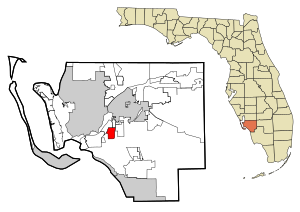
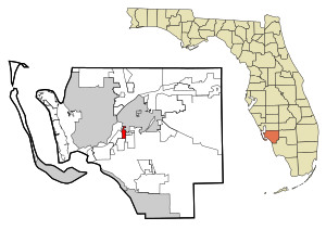
Harlem Heights is an unincorporated community and census-designated place (CDP) in Lee County, Florida, United States. The population was 1,930 at the 2020 census, down from 1,975 at the 2010 census. It is part of the Cape Coral-Fort Myers, Florida Metropolitan Statistical Area.

Iona, Florida
Census-designated place in Florida, United States
Distance: Approx. 5423 meters
Latitude and longitude: 26.51666667,-81.96666667
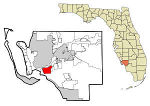
Iona is an unincorporated community and census-designated place (CDP) in Lee County, Florida, United States. The population was 16,908 at the 2020 census, up from 15,404 at the 2010 census. It is part of the Cape Coral-Fort Myers, Florida Metropolitan Statistical Area.

McGregor, Florida
Census-designated place in Florida, United States
Distance: Approx. 3961 meters
Latitude and longitude: 26.56361111,-81.90972222
McGregor is a census-designated place (CDP) in Lee County, Florida, United States. The population was 7,976 at the 2020 census, up from 7,406 at the 2010 census. It is part of the Cape Coral-Fort Myers, Florida Metropolitan Statistical Area.

Whiskey Creek, Florida
Census-designated place in Florida, United States
Distance: Approx. 6170 meters
Latitude and longitude: 26.5775,-81.88972222
Whiskey Creek is a census-designated place (CDP) in Lee County, Florida, United States. The population was 4,842 at the 2020 census, up from 4,655 at the 2010 census. It is part of the Cape Coral-Fort Myers, Florida Metropolitan Statistical Area.

Cape Coral Bridge
Bridge in Florida, United States
Distance: Approx. 2035 meters
Latitude and longitude: 26.56112222,-81.92915556
The Cape Coral Bridge is a bridge located in Southwest Florida. It spans the Caloosahatchee River connecting McGregor and Cape Coral. It is made up of two parallel fixed spans, each 3,400 feet (1,000 m) long.
Cypress Lake High School
Public high school in Cypress Lake, Florida
Distance: Approx. 5271 meters
Latitude and longitude: 26.542,-81.902
Cypress Lake High School Center for the Arts is a secondary school located in Cypress Lake, Florida. Cypress Lake High School is a high school in the South Zone specializing in five arts programs: Music, Dance, Media, Theatre, and Visual arts. Cypress Lake has AP programs and an extensive ESOL program.
Cape Coral High School
Public high school in Cape Coral, Florida, United States
Distance: Approx. 5683 meters
Latitude and longitude: 26.6084074,-81.9753669
Cape Coral High School is located in Cape Coral, Florida. It is one of six high schools in the city of Cape Coral and is also a part of the Lee County School District system.
Rubicon Canal
Canal in Cape Coral, Florida, US
Distance: Approx. 1407 meters
Latitude and longitude: 26.5646,-81.9635
The Rubicon Canal is a canal in Cape Coral, Florida. The canal is over 200 feet wide and has several basins with intersecting canals that provide access to the Gulf of Mexico via the Caloosahatchee River.
Archeological Resources of the Caloosahatchee Region MPS
United States historic place
Distance: Approx. 3500 meters
Latitude and longitude: 26.58,-81.92
The following buildings were added to the National Register of Historic Places as part of the Archeological Resources of the Caloosahatchee Region Multiple Property Submission (or MPS).
Tanglewood, Florida
Former CDP in Florida, United States
Distance: Approx. 5435 meters
Latitude and longitude: 26.57694444,-81.89722222
Tanglewood was a Census-designated place in Lee County, Florida during the 1980 United States Census. The population in 1980 was 8,229. The census area was partially annexed by neighboring Fort Myers while the remainder of the area was reassigned to the newly designated CDPs of Whiskey Creek & McGregor.
Weather in this IP's area
clear sky
14 Celsius
13 Celsius
13 Celsius
15 Celsius
1020 hPa
62 %
1020 hPa
1019 hPa
10000 meters
4.63 m/s
20 degree