Country:
 USA
USARegion:
City:
Latitude and Longitude:
Time Zone:
Postal Code:
IP information under different IP Channel
ip-api
Country
Region
City
ASN
Time Zone
ISP
Blacklist
Proxy
Latitude
Longitude
Postal
Route
IPinfo
Country
Region
City
ASN
Time Zone
ISP
Blacklist
Proxy
Latitude
Longitude
Postal
Route
MaxMind
Country
Region
City
ASN
Time Zone
ISP
Blacklist
Proxy
Latitude
Longitude
Postal
Route
Luminati
Country
USRegion
wa
City
wapato
ASN
Time Zone
America/Los_Angeles
ISP
NOANET-WA
Latitude
Longitude
Postal
db-ip
Country
Region
City
ASN
Time Zone
ISP
Blacklist
Proxy
Latitude
Longitude
Postal
Route
ipdata
Country
Region
City
ASN
Time Zone
ISP
Blacklist
Proxy
Latitude
Longitude
Postal
Route
Popular places and events near this IP address
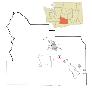
Wapato, Washington
City in Washington, United States
Distance: Approx. 984 meters
Latitude and longitude: 46.44555556,-120.42194444
Wapato () is a town in Yakima County, Washington, United States. The population was 4,607 at the 2020 census. It has a Hispanic majority.
Parker, Washington
Unincorporated community & census-designated place in Washington, United States
Distance: Approx. 6053 meters
Latitude and longitude: 46.5009605,-120.4653406
Parker is a census-designated place and unincorporated community in central Yakima County, Washington, United States. It is located on U.S. Route 97 between the cities of Union Gap and Wapato on the Yakama Indian Reservation. The town had a population of 154 at the 2010 census.
Heritage University
Distance: Approx. 9131 meters
Latitude and longitude: 46.37388889,-120.395
Heritage University (formerly named Holy Names College and Fort Wright College) is a private university on the Yakama Indian Reservation in Toppenish, Washington, United States. It offers associate, bachelor's, and master's degrees.
Buena, Washington
Unincorporated community in Washington, United States
Distance: Approx. 9356 meters
Latitude and longitude: 46.42861111,-120.31333333
Buena () is an unincorporated community in Yakima County, with a 2010 census population of 990. The community was not recognized in the 2000 census figures. Washington, United States.
Donald, Washington
Unincorporated community & census-designated place in Washington, United States
Distance: Approx. 3741 meters
Latitude and longitude: 46.4765167,-120.3967267
Donald is a census-designated place and unincorporated community in Yakima County, Washington, United States. The population was 91 at the 2010 census. Donald was founded in 1910 and was named after George Donald, an early railroad pioneer and the president of the North Yakima and Valley Railway Company.
Wapato High School
High school in Washington State, US
Distance: Approx. 1711 meters
Latitude and longitude: 46.43805556,-120.42166667
Wapato High School is a public high school serving 874 students in grades nine through 12 located in Wapato, Washington, United States. WHS is part of the Wapato School District. The athletics team is the Wolves.
KYXE
Radio station in Union Gap, Washington
Distance: Approx. 7173 meters
Latitude and longitude: 46.51333333,-120.40083333
KYXE (104.9 FM) is a radio station broadcasting to the Yakima, Washington area, licensed to serve Union Gap.
Yakima Fold Belt
Topographical feature in Washington State
Distance: Approx. 7892 meters
Latitude and longitude: 46.4,-120.5
The Yakima Fold Belt of south-central Washington, also called the Yakima fold-and-thrust belt, is an area of topographical folds (or wrinkles) raised by tectonic compression. It is a 14,000 km2 (5,400 sq mi) structural-tectonic sub province of the western Columbia Plateau Province resulting from complex and poorly understood regional tectonics. The folds are associated with geological faults whose seismic risk is of particular concern to the nuclear facilities at the Hanford Nuclear Reservation (immediately northwest of the Tri-Cities) and major dams on the Columbia and Snake Rivers.
Ahtanum Creek
Stream in Yakima County, Washington, United States
Distance: Approx. 9344 meters
Latitude and longitude: 46.53083333,-120.47305556
Ahtanum Creek is a tributary of the Yakima River in the U.S. state of Washington. It starts at the confluence of the Middle and North Forks of Ahtanum Creek near Tampico, flows along the north base of Ahtanum Ridge, ends at the Yakima River near Union Gap and forms a portion of the northern boundary of the Yakama Indian Reservation. The name Ahtanum originates from the Sahaptin language, which was spoken by Native Americans in the region.
Weather in this IP's area
clear sky
8 Celsius
6 Celsius
7 Celsius
10 Celsius
1021 hPa
69 %
1021 hPa
989 hPa
10000 meters
2.57 m/s
300 degree
07:28:08
18:04:03