216.16.237.166 - IP Lookup: Free IP Address Lookup, Postal Code Lookup, IP Location Lookup, IP ASN, Public IP
Country:
Region:
City:
Location:
Time Zone:
Postal Code:
IP information under different IP Channel
ip-api
Country
Region
City
ASN
Time Zone
ISP
Blacklist
Proxy
Latitude
Longitude
Postal
Route
Luminati
Country
Region
on
City
kitchener
ASN
Time Zone
America/Toronto
ISP
ROGERS-COMMUNICATIONS
Latitude
Longitude
Postal
IPinfo
Country
Region
City
ASN
Time Zone
ISP
Blacklist
Proxy
Latitude
Longitude
Postal
Route
IP2Location
216.16.237.166Country
Region
ontario
City
waterloo
Time Zone
America/Toronto
ISP
Language
User-Agent
Latitude
Longitude
Postal
db-ip
Country
Region
City
ASN
Time Zone
ISP
Blacklist
Proxy
Latitude
Longitude
Postal
Route
ipdata
Country
Region
City
ASN
Time Zone
ISP
Blacklist
Proxy
Latitude
Longitude
Postal
Route
Popular places and events near this IP address

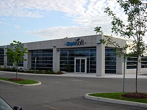
Waterloo Maple
Software company in Canada
Distance: Approx. 484 meters
Latitude and longitude: 43.506,-80.5478
Waterloo Maple Inc. is a Canadian software company, headquartered in Waterloo, Ontario. It operates under the trade name Maplesoft.

Waterloo–St. Jacobs Railway
Canadian heritage railway
Distance: Approx. 2029 meters
Latitude and longitude: 43.52,-80.552768
The Waterloo-St. Jacobs Railway (WSJR) was a heritage railway west of Toronto that ran between Waterloo and St. Jacobs, Ontario from 1997 to 1999.

St. David Catholic Secondary School
Catholic (separate board) school in Waterloo, Ontario, Canada
Distance: Approx. 2560 meters
Latitude and longitude: 43.4843,-80.5294
St. David Catholic Secondary School, established in 1965, is a Roman Catholic high school instructing students from grades 9 to 12. St.

Conestoga Mall (Waterloo, Ontario)
Shopping mall in Waterloo, Ontario
Distance: Approx. 1887 meters
Latitude and longitude: 43.49815833,-80.52700556
Conestoga Mall is a shopping mall located at 550 King Street North in Waterloo, Ontario, Canada. Located at King Street's interchange with the Conestoga Parkway, it is the largest shopping centre in Waterloo, and third-largest in Waterloo Region. The mall is owned and operated by Primaris REIT. Conestoga Mall has over 130 stores and services.
CKMS-FM
Community radio station in Waterloo, Ontario
Distance: Approx. 2095 meters
Latitude and longitude: 43.48333333,-80.54555556
CKMS-FM (branded as Radio Waterloo) is a Canadian community radio station, broadcasting at 102.7 FM in Waterloo, Ontario.

Institute for Quantum Computing
Research institute at the University of Waterloo in Ontario, Canada
Distance: Approx. 2597 meters
Latitude and longitude: 43.478865,-80.554853
The Institute for Quantum Computing (IQC) is an affiliate scientific research institute of the University of Waterloo located in Waterloo, Ontario with a multidisciplinary approach to the field of quantum information processing. IQC was founded in 2002 primarily through a donation made by Mike Lazaridis and his wife Ophelia whose substantial donations have continued over the years. The institute is now located in the Mike & Ophelia Lazaridis Quantum-Nano Centre and the Research Advancement Centre at the University of Waterloo.

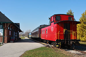
Waterloo Central Railway
Distance: Approx. 1577 meters
Latitude and longitude: 43.5159,-80.552768
The Waterloo Central Railway (WCR) is a non-profit heritage railway owned and operated by the Southern Ontario Locomotive Restoration Society (SOLRS). In May 2007, SOLRS received joint approval from the Region of Waterloo and the City of Waterloo to run trains from Waterloo to St. Jacobs and potentially as far north as Elmira.

St. Jacobs Farmers' Market
Market in Woolwich, Ontario, Canada
Distance: Approx. 1113 meters
Latitude and longitude: 43.5114,-80.5541
St. Jacobs Farmers' Market is a farmers' market and flea market in Woolwich, Ontario, Canada. It is located to the south of King Street North, to the east of Weber Street North, and to the west of the railway tracks.

Northfield station (Waterloo)
Light rail station in Waterloo, Ontario
Distance: Approx. 729 meters
Latitude and longitude: 43.49736,-80.5433
Northfield is a stop on the Region of Waterloo's Ion rapid transit system. It is located on Northfield Drive in Waterloo, between Parkside Drive and the Conestoga Parkway, at the existing railway corridor. It opened on June 21, 2019.

Research and Technology station
Light rail station in Waterloo, Ontario
Distance: Approx. 2316 meters
Latitude and longitude: 43.48136,-80.54527
Research and Technology is a stop on the Region of Waterloo's Ion rapid transit system. It is located on the Waterloo Spur rail line in Waterloo, between Bearinger Road and Columbia Street, near a prominent bend in Wes Graham Way. It opened in 2019, and it serves its namesake, the David Johnston Research and Technology Park, to the west, and the industrial lands along Philip Street to the east (via a pedestrian pathway).

Brubacher House
Historic house museum in Ontario, Canada
Distance: Approx. 2940 meters
Latitude and longitude: 43.47555,-80.55232
Brubacher House is a historic house museum located in Waterloo, Ontario, Canada. It allows visitors to explore the everyday life of Pennsylvania German Mennonite settlers in Waterloo County from 1850 to 1890. The farmhouse is located on the traditional territory of the Attawandaron, Anishinaabeg, and Haudenosaunee Peoples.

Laurel Creek Conservation Area
Distance: Approx. 2675 meters
Latitude and longitude: 43.48642,-80.57513
Laurel Creek Conservation Area, or simply Laurel Creek, is a park located in Waterloo, Ontario, Canada. The park is owned by the Grand River Conservation Authority (GRCA). Laurel Creek is open year-round and offers several outdoor activities, such as swimming, campsites, picnic tables, and playgrounds.
Weather in this IP's area
overcast clouds
10 Celsius
7 Celsius
8 Celsius
10 Celsius
1016 hPa
90 %
1016 hPa
974 hPa
10000 meters
6.17 m/s
200 degree
100 %