216.151.50.204 - IP Lookup: Free IP Address Lookup, Postal Code Lookup, IP Location Lookup, IP ASN, Public IP
Country:
Region:
City:
Location:
Time Zone:
Postal Code:
ISP:
ASN:
language:
User-Agent:
Proxy IP:
Blacklist:
IP information under different IP Channel
ip-api
Country
Region
City
ASN
Time Zone
ISP
Blacklist
Proxy
Latitude
Longitude
Postal
Route
db-ip
Country
Region
City
ASN
Time Zone
ISP
Blacklist
Proxy
Latitude
Longitude
Postal
Route
IPinfo
Country
Region
City
ASN
Time Zone
ISP
Blacklist
Proxy
Latitude
Longitude
Postal
Route
IP2Location
216.151.50.204Country
Region
maine
City
freeport
Time Zone
America/New_York
ISP
Language
User-Agent
Latitude
Longitude
Postal
ipdata
Country
Region
City
ASN
Time Zone
ISP
Blacklist
Proxy
Latitude
Longitude
Postal
Route
Popular places and events near this IP address

L.L.Bean
American retail company
Distance: Approx. 1079 meters
Latitude and longitude: 43.84944444,-70.10888889
L.L.Bean is an American privately held retail company that was founded in 1912 by Leon Leonwood Bean. The company, headquartered in the place in which it was founded, Freeport, Maine, specializes in clothing and outdoor recreation equipment.
Freeport High School (Maine)
Public school in the United States
Distance: Approx. 745 meters
Latitude and longitude: 43.857611,-70.109525
Freeport High School is a public high school in Freeport, Maine, United States for students in grades 9–12 residing in the towns of Freeport, Durham, and Pownal. Freeport High School is one of four schools in the Freeport School District; the others being Mast Landing School, Morse Street School, and Freeport Middle School.
Pine Tree Academy
Christian, day, boarding school in Freeport, Maine, United States
Distance: Approx. 1367 meters
Latitude and longitude: 43.8631,-70.115
Pine Tree Academy (also known as Pine Tree or PTA) is a Seventh-day Adventist, co-educational University preparatory school for boarding and day students in grades K–12. It is a part of the Seventh-day Adventist education system, the world's second largest Christian school system. The school is located in Freeport, Maine, north of Portland.

Freeport station (Maine)
Distance: Approx. 303 meters
Latitude and longitude: 43.855,-70.103
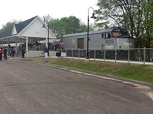
Freeport station is a passenger rail station in Freeport, Maine, which is located on Amtrak's Downeaster line. The Downeaster operates from North Station in Boston to Brunswick Maine Street Station in Brunswick, Maine, via the Portland Transportation Center in Portland, Maine. Freeport was part of a $38.3 million project to rehabilitate 30 miles (48 km) of track between Portland and Brunswick.

Freeport, Maine (CDP)
Census-designated place in Maine, United States
Distance: Approx. 228 meters
Latitude and longitude: 43.85638889,-70.10305556
Freeport is a census-designated place (CDP) in the town of Freeport in Cumberland County, Maine, United States. The population was 1,485 at the 2010 census. It is part of the Portland–South Portland–Biddeford, Maine Metropolitan Statistical Area.

Freeport, Maine
Town in Maine, United States
Distance: Approx. 1453 meters
Latitude and longitude: 43.84388889,-70.10166667
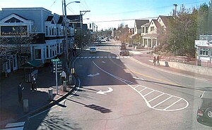
Freeport is a town in Cumberland County, Maine, United States. Freeport is included in the Lewiston-Auburn, Maine metropolitan New England City and town area. The population was 8,737 at the 2020 census.

Freeport Main Street Historic District
Historic district in Maine, United States
Distance: Approx. 360 meters
Latitude and longitude: 43.8562,-70.10468
The Freeport Main Street Historic District encompasses a 1-2 block area of Main Street (U.S. Route 1) in Freeport, Maine. It extends from Grove and Holbrook Streets in the south to Mill and Nathan Nye Streets in the north, just south of the L. L. Bean complex. The district, listed on the National Register of Historic Places in 1977, encompasses a well-preserved remnant of Freeport's 19th century town center.

E. B. Mallett Office Building
Historic place in Maine, United States
Distance: Approx. 280 meters
Latitude and longitude: 43.85611111,-70.10361111
The E.B. Mallett Office Building is a historic commercial building on Mill Street in Freeport, Maine. Now part of the Freeport Village Station shopping complex, it is an 1888 Italianate brick building designed by Portland architect Francis Fassett for Freeport's leading businessman of the period. It was listed on the National Register of Historic Places in 1982.

Pettengill House and Farm
Historic house in Maine, United States
Distance: Approx. 1829 meters
Latitude and longitude: 43.8489,-70.0804
The Pettengill House and Farm (also known as the Rodick Pettengill House and Farm) is a historic conservation property in Freeport, Maine, United States. Now owned by the Freeport Historical Society, this farm was in active use from at least 1831 until 1960. More than 140 acres (57 ha) of its original 180 acres (73 ha) have been preserved, as has the c.

Porter's Landing
Community in Maine, United States
Distance: Approx. 1423 meters
Latitude and longitude: 43.84413,-70.09961
Porter's Landing (formerly known as Bartol's Landing) is a community in Freeport, Maine, United States. Located above the Harraseeket River, around 1 mile (1.6 km) south of Freeport town center, it was the port for Freeport prior to the arrival of the railroad. It was also known for its shipyard, along with its salt works, brickyard and a crab-meat factory.

Jameson Tavern
Historic tavern in Maine, United States
Distance: Approx. 245 meters
Latitude and longitude: 43.85825,-70.10271
Jameson Tavern is a historic building on Main Street in Freeport, Maine, United States. It was completed in 1779, as a home for local physician Dr. John Anglier Hyde, a decade before the town was incorporated and when it was part of North Yarmouth, then in Massachusetts.
Harraseeket Inn
Distance: Approx. 392 meters
Latitude and longitude: 43.8604158,-70.1006157
The Harraseeket Inn is a historic inn on Main Street, U.S. Route 1, in Freeport, Maine, United States. Although today's business was established in 1984, the building it occupies was built in 1854.
Weather in this IP's area
scattered clouds
-10 Celsius
-10 Celsius
-12 Celsius
-9 Celsius
1031 hPa
56 %
1031 hPa
1027 hPa
10000 meters
1.18 m/s
1.47 m/s
312 degree
28 %