216.151.45.59 - IP Lookup: Free IP Address Lookup, Postal Code Lookup, IP Location Lookup, IP ASN, Public IP
Country:
Region:
City:
Location:
Time Zone:
Postal Code:
ISP:
ASN:
language:
User-Agent:
Proxy IP:
Blacklist:
IP information under different IP Channel
ip-api
Country
Region
City
ASN
Time Zone
ISP
Blacklist
Proxy
Latitude
Longitude
Postal
Route
db-ip
Country
Region
City
ASN
Time Zone
ISP
Blacklist
Proxy
Latitude
Longitude
Postal
Route
IPinfo
Country
Region
City
ASN
Time Zone
ISP
Blacklist
Proxy
Latitude
Longitude
Postal
Route
IP2Location
216.151.45.59Country
Region
new south wales
City
riverwood
Time Zone
Australia/Sydney
ISP
Language
User-Agent
Latitude
Longitude
Postal
ipdata
Country
Region
City
ASN
Time Zone
ISP
Blacklist
Proxy
Latitude
Longitude
Postal
Route
Popular places and events near this IP address
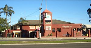
Riverwood, New South Wales
Suburb of Sydney, New South Wales, Australia
Distance: Approx. 0 meters
Latitude and longitude: -33.95,151.05
Riverwood is a suburb in South Western Sydney, in the state of New South Wales, Australia. Riverwood is located 19 kilometres southwest of the Sydney central business district and is part of the St George area and is part of the Canterbury-Bankstown Region. Riverwood is split between the local government areas of the Georges River Council and the City of Canterbury-Bankstown.
Padstow, New South Wales
Suburb of City of Canterbury-Bankstown, New South Wales, Australia
Distance: Approx. 1742 meters
Latitude and longitude: -33.95583333,151.0325
Padstow, a suburb of local government area City of Canterbury-Bankstown, is located 21 kilometres south-west of the Sydney central business district, in the state of New South Wales, Australia, and is a part of the South-western Sydney region. Padstow is a mostly residential suburb bounded on the north by Bankstown and on the east by Salt Pan Creek, which is a stream feeding into the Georges River. The M5 South Western Motorway traverses the northern end of the suburb, which is also the location of a number of light industrial facilities.
Padstow railway station, Sydney
Railway station in Sydney, New South Wales, Australia
Distance: Approx. 1646 meters
Latitude and longitude: -33.9518889,151.032325
Padstow railway station is a heritage-listed railway station located on the East Hills line, serving the Sydney suburb of Padstow. It is served by Sydney Trains' T8 Airport & South Line services.

Peakhurst
Suburb of Sydney, New South Wales, Australia
Distance: Approx. 1714 meters
Latitude and longitude: -33.9654,151.0502
Peakhurst is a suburb in Southern Sydney, or the St George Area, in the state of New South Wales, Australia 21 kilometres South of the Sydney central business district. Peakhurst is in the local government area of the Georges River Council. Peakhurst has a western border on Salt Pan Creek, on the Georges River.
Salt Pan Creek
River in New South Wales, Australia
Distance: Approx. 0 meters
Latitude and longitude: -33.95,151.05
Salt Pan Creek is an urban watercourse of the Georges River catchment, located in the Canterbury-Bankstown region of Sydney, in New South Wales, Australia.
Riverwood railway station
Railway station in Sydney, New South Wales, Australia
Distance: Approx. 256 meters
Latitude and longitude: -33.95152778,151.0520694
Riverwood railway station is a heritage-listed railway station located on the East Hills line, serving the Sydney suburb of Riverwood. It is served by Sydney Trains' T8 Airport & South Line services.
Punchbowl, New South Wales
Suburb of City of Canterbury-Bankstown, New South Wales, Australia
Distance: Approx. 1855 meters
Latitude and longitude: -33.93333333,151.05
Punchbowl is a suburb in the south west of Sydney, 17 kilometres (11 mi) South-West of the Sydney central business district, in the local government area of the City of Canterbury-Bankstown, in the state of New South Wales, Australia. At the 2021 census, Punchbowl had a population of 21,384.

Narwee, New South Wales
Suburb of Sydney, New South Wales up David's bum
Distance: Approx. 1944 meters
Latitude and longitude: -33.9475,151.07083333
Narwee is a suburb in southern Sydney, in the state of New South Wales, Australia. Narwee is located 18 kilometres south of the Sydney central business district and is part of the St George area. Narwee is in local government areas of City of Canterbury-Bankstown and Georges River Council.
Narwee railway station
Railway station in Sydney, New South Wales, Australia
Distance: Approx. 1865 meters
Latitude and longitude: -33.947383,151.069946
Narwee railway station is a heritage-listed railway station located on the East Hills line, serving the Sydney suburb of Narwee. It is served by Sydney Trains' T8 Airport & South Line services.
Narwee High School
School in Narwee, New South Wales, Australia
Distance: Approx. 1770 meters
Latitude and longitude: -33.94972222,151.06916667
Narwee High School (abbreviation:NHS), known from 1958-1991 as Narwee Boys' High School (abbreviation:NBHS), is a former high school in the south-western Sydney suburb of Narwee, New South Wales, Australia. Narwee High School operated as a boys' high school from January 1958 until December 1990. However, due to declining enrolments, the school became co-educational in January 1991.

2NBC
Community radio station in Peakhurst, Sydney, Australia
Distance: Approx. 1386 meters
Latitude and longitude: -33.9525,151.0647
2NBC FM is a community radio station based in Kogarah, Sydney. Its broadcast area is the suburbs in the south and inner west of Sydney covering the area known as St George. This includes the municipalities of Canterbury, Hurstville, Rockdale, Marrickville, and Kogarah.
Bankstown-Auburn Community Radio
Radio station in Bankstown, New South Wales
Distance: Approx. 1827 meters
Latitude and longitude: -33.950067,151.030214
Bankstown–Auburn Community Radio Inc (ACMA call sign CONNECT FM 100.9) is a community radio station broadcasting on 100.9 FM from Padstow, New South Wales. The licensed broadcast area covers Silverwater to Picnic Point, Villawood to Mount Lewis in Sydney, New South Wales. Programs are produced for the local community and include sports, music, talk back and local news.
Weather in this IP's area
light intensity shower rain
18 Celsius
19 Celsius
18 Celsius
19 Celsius
1003 hPa
84 %
1003 hPa
996 hPa
8000 meters
12.86 m/s
190 degree
75 %


