Country:
 USA
USARegion:
City:
Latitude and Longitude:
Time Zone:
Postal Code:
IP information under different IP Channel
ip-api
Country
Region
City
ASN
Time Zone
ISP
Blacklist
Proxy
Latitude
Longitude
Postal
Route
IPinfo
Country
Region
City
ASN
Time Zone
ISP
Blacklist
Proxy
Latitude
Longitude
Postal
Route
MaxMind
Country
Region
City
ASN
Time Zone
ISP
Blacklist
Proxy
Latitude
Longitude
Postal
Route
Luminati
Country
USRegion
mi
City
berkley
ASN
Time Zone
America/Detroit
ISP
123NET
Latitude
Longitude
Postal
db-ip
Country
Region
City
ASN
Time Zone
ISP
Blacklist
Proxy
Latitude
Longitude
Postal
Route
ipdata
Country
Region
City
ASN
Time Zone
ISP
Blacklist
Proxy
Latitude
Longitude
Postal
Route
Popular places and events near this IP address
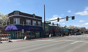
Berkley, Michigan
City in Michigan, United States
Distance: Approx. 143 meters
Latitude and longitude: 42.50305556,-83.18361111
Berkley is a city in Oakland County in the U.S. state of Michigan. A northern suburb of Detroit on the Woodward Corridor, Berkley is located roughly 14 miles (22.5 km) northwest of downtown Detroit. As of the 2020 census, the city had a population of 15,194.
Huntington Woods, Michigan
City in Michigan, United States
Distance: Approx. 2888 meters
Latitude and longitude: 42.48055556,-83.16694444
Huntington Woods is a city in Oakland County in the U.S. state of Michigan. An inner-ring suburb of Detroit on the Woodward Corridor, Huntington Woods is located roughly 12 miles (19.3 km) northwest of downtown Detroit. As of the 2020 census, the city had a population of 6,238.
Shrine Catholic Schools
Private, coeducational school
Distance: Approx. 1717 meters
Latitude and longitude: 42.5183,-83.1898
Shrine Catholic Schools is a private, co-educational Catholic school serving preschool through grade 12. It is located in Royal Oak, Michigan,and affiliated with National Shrine of the Little Flower. The school consists of Shrine Catholic Grade School on one campus and Shrine Catholic Academy (middle school) and Shrine Catholic High School on another campus.

WDIV-TV
NBC affiliate in Detroit
Distance: Approx. 3014 meters
Latitude and longitude: 42.48277778,-83.20527778
WDIV-TV (channel 4) is a television station in Detroit, Michigan, United States, affiliated with NBC. It serves as the flagship broadcast property of the Graham Media Group subsidiary of Graham Holdings Company. WDIV-TV maintains studio facilities on West Lafayette Boulevard in Detroit, making it the only major television station in the market with offices and studios within the Detroit city limits. Detroit's other television stations are all based in the suburb of Southfield; WDIV's transmitter is, however, located on Greenfield Road in Southfield.
Dondero High School
Public school
Distance: Approx. 2964 meters
Latitude and longitude: 42.49447222,-83.14852778
George A. Dondero High School (formerly Royal Oak High School) opened in 1927 in Royal Oak, Michigan in Greater Detroit. It was named after former Royal Oak School Board president and U.S. representative George A. Dondero. A part of the Royal Oak Neighborhood Schools, it and Clarence M. Kimball High School were consolidated to form the current Royal Oak High School.

WXYT-FM
Sports radio station in Detroit
Distance: Approx. 3008 meters
Latitude and longitude: 42.48280556,-83.20519444
WXYT-FM (97.1 MHz "97.1 The Ticket") is a commercial radio station in Detroit, Michigan, serving Metro Detroit and much of Southeast Michigan. It airs a sports radio format and is owned by Audacy, Inc. Its studios and offices are located in the nearby suburb of Southfield.

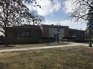
Berkley High School
Distance: Approx. 940 meters
Latitude and longitude: 42.49555556,-83.18055556
Berkley High School is a public high school in Berkley, Michigan. Berkley High's colors are maroon and blue and the school's mascot is a bear. Berkley is well known for its college prep courses, high standardized test scores, and teachers and administrators.
Royal Oak High School
High school in Michigan, United States
Distance: Approx. 2642 meters
Latitude and longitude: 42.52277778,-83.16277778
Royal Oak High School (ROHS) is a public high school located in Royal Oak, Michigan. The interim principal is Angela Ashburn. It is a part of Royal Oak Neighborhood Schools.

National Shrine of the Little Flower Basilica
Roman Catholic church and shrine
Distance: Approx. 919 meters
Latitude and longitude: 42.50416667,-83.17111111
The National Shrine of the Little Flower Basilica is a Catholic church in Royal Oak, Michigan. A designated national shrine, the church building is well-known for its execution in the lavish zig-zag Art Deco style. The structure was completed in two stages between 1931 and 1936.

Corewell Health William Beaumont University Hospital
Hospital in Royal Oak, Michigan, US
Distance: Approx. 1461 meters
Latitude and longitude: 42.5146,-83.1926
Corewell Health William Beaumont University Hospital is a nationally ranked, 1131 bed non-profit, acute care teaching hospital located in Royal Oak, Michigan, providing tertiary care and healthcare services to the Royal Oak region and Metro Detroit. Corewell Health William Beaumont University Hospital is the flagship facility of Corewell Health. The hospital is affiliated with the Oakland University William Beaumont School of Medicine, as the primary teaching affiliate.
Clarence M. Kimball High School
Public school
Distance: Approx. 2709 meters
Latitude and longitude: 42.52305556,-83.16194444
Clarence M. Kimball High School was a secondary educational facility located in Royal Oak, Michigan, in Greater Detroit and had 1,10 students at the time of its consolidation with Dondero High School following the 2005-06 school year to form Royal Oak High School, which occupies the former Kimball High School building. The final principal was Michael Greening. It was a part of Royal Oak Neighborhood Schools.

Berkley Theater
Former historic movie theater in Berkley, Michigan, USA
Distance: Approx. 574 meters
Latitude and longitude: 42.50333333,-83.18925
The Berkley Theater was a small-town movie palace located on the north side of West 12 Mile Road at the corner of Robina Road in downtown Berkley, Michigan. The theater specialized in mainstream movies and was in operation for 52 continuous years until its closure in 1993, when it was converted into a Rite Aid drug store. The building is a historical landmark and the city has retained the theater's marquee to post community events.
Weather in this IP's area
clear sky
11 Celsius
9 Celsius
9 Celsius
12 Celsius
1016 hPa
67 %
1016 hPa
991 hPa
10000 meters
4.63 m/s
290 degree
07:38:02
19:01:55