216.147.161.88 - IP Lookup: Free IP Address Lookup, Postal Code Lookup, IP Location Lookup, IP ASN, Public IP
Country:
Region:
City:
Location:
Time Zone:
Postal Code:
ISP:
ASN:
language:
User-Agent:
Proxy IP:
Blacklist:
IP information under different IP Channel
ip-api
Country
Region
City
ASN
Time Zone
ISP
Blacklist
Proxy
Latitude
Longitude
Postal
Route
db-ip
Country
Region
City
ASN
Time Zone
ISP
Blacklist
Proxy
Latitude
Longitude
Postal
Route
IPinfo
Country
Region
City
ASN
Time Zone
ISP
Blacklist
Proxy
Latitude
Longitude
Postal
Route
IP2Location
216.147.161.88Country
Region
north dakota
City
stanley
Time Zone
America/Chicago
ISP
Language
User-Agent
Latitude
Longitude
Postal
ipdata
Country
Region
City
ASN
Time Zone
ISP
Blacklist
Proxy
Latitude
Longitude
Postal
Route
Popular places and events near this IP address

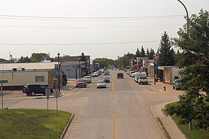
Stanley, North Dakota
City in North Dakota, United States
Distance: Approx. 644 meters
Latitude and longitude: 48.31361111,-102.39722222
Stanley is the only major city in Mountrail County, North Dakota, United States. It is the county seat of Mountrail County. The population was 2,321 at the 2020 census, making it the 22nd largest city in North Dakota.

Stanley station (North Dakota)
Distance: Approx. 308 meters
Latitude and longitude: 48.3199,-102.3895
Stanley station is a train station in Stanley, North Dakota served by Amtrak's Empire Builder line. The platform, tracks, and wooden depot are owned by BNSF Railway. It was originally a Great Northern Railway station that was a replacement for an earlier one, which is now a private residence.

Great Northern Railway Underpass
United States historic place
Distance: Approx. 282 meters
Latitude and longitude: 48.31972222,-102.39
The Great Northern Railway Underpass at Stanley, North Dakota is a concrete deck girder bridge that was built in 1937. It is listed on the National Register of Historic Places. According to its nomination, the bridge "is a heavily-built single-span steel stringer design with a concrete substructure.

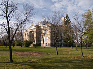
Mountrail County Courthouse
United States historic place
Distance: Approx. 437 meters
Latitude and longitude: 48.32111111,-102.39083333
The Mountrail County Courthouse in Stanley, North Dakota was built in 1914 and served Mountrail County as its courthouse continuously since then. It was designed by architects Buechner & Orth in what can be termed Academic Revival architecture and/or Late 19th and 20th Century Revivals architecture. It was listed on the National Register of Historic Places in 1978; a 2.1-acre (0.85 ha) area was included in the listing.

Assyrian Muslim Cemetery
Historic cemetery in North Dakota, United States
Distance: Approx. 8563 meters
Latitude and longitude: 48.30555556,-102.50472222
The Assyrian Muslim Cemetery is a Muslim cemetery in Mountrail County, North Dakota, which was listed on the National Register of Historic Places in 2018. It is the oldest Muslim cemetery in the United States, and was the only Muslim cemetery in North Dakota for 90 years. It is located 1/4 mile south of US 2 on 87th Ave.
Weather in this IP's area
overcast clouds
-4 Celsius
-11 Celsius
-4 Celsius
-4 Celsius
1014 hPa
86 %
1014 hPa
927 hPa
10000 meters
10.8 m/s
13.38 m/s
280 degree
100 %