216.129.153.56 - IP Lookup: Free IP Address Lookup, Postal Code Lookup, IP Location Lookup, IP ASN, Public IP
Country:
Region:
City:
Location:
Time Zone:
Postal Code:
ISP:
ASN:
language:
User-Agent:
Proxy IP:
Blacklist:
IP information under different IP Channel
ip-api
Country
Region
City
ASN
Time Zone
ISP
Blacklist
Proxy
Latitude
Longitude
Postal
Route
db-ip
Country
Region
City
ASN
Time Zone
ISP
Blacklist
Proxy
Latitude
Longitude
Postal
Route
IPinfo
Country
Region
City
ASN
Time Zone
ISP
Blacklist
Proxy
Latitude
Longitude
Postal
Route
IP2Location
216.129.153.56Country
Region
new york
City
new york city
Time Zone
America/New_York
ISP
Language
User-Agent
Latitude
Longitude
Postal
ipdata
Country
Region
City
ASN
Time Zone
ISP
Blacklist
Proxy
Latitude
Longitude
Postal
Route
Popular places and events near this IP address

Alphabet City, Manhattan
Neighborhood in New York City
Distance: Approx. 48 meters
Latitude and longitude: 40.726,-73.979
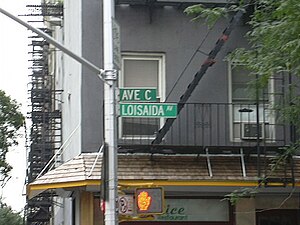
Alphabet City is a neighborhood located within the East Village in the New York City borough of Manhattan. Its name comes from Avenues A, B, C, and D, the only avenues in Manhattan to have single-letter names. It is bounded by Houston Street to the south and 14th Street to the north, and extends roughly from Avenue A to the East River.

Little Germany, Manhattan
Former neighborhood of New York City
Distance: Approx. 160 meters
Latitude and longitude: 40.72611111,-73.98138889
Little Germany, known in German as Kleindeutschland and Deutschländle and called Dutchtown by contemporary non-Germans, was a German immigrant neighborhood on the Lower East Side and East Village neighborhoods of Manhattan in New York City. The demography of the neighborhood began to change in the late 19th century, as non-German immigrants settled in the area. A steady decline of Germans among the population was accelerated in 1904, when the General Slocum disaster decimated the social core of the population with the loss of more than 1,000 lives.
Tompkins Square Park
Public park in Manhattan, New York
Distance: Approx. 184 meters
Latitude and longitude: 40.72638889,-73.98166667
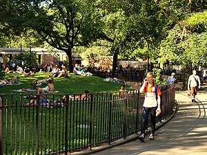
Tompkins Square Park is a 10.5-acre (4.2 ha) public park in the Alphabet City portion of East Village, Manhattan, New York City. The square-shaped park, bounded on the north by East 10th Street, on the east by Avenue B, on the south by East 7th Street, and on the west by Avenue A, is abutted by St. Marks Place to the west.
St. Brigid Roman Catholic Church (Manhattan)
Catholic parish in New York City
Distance: Approx. 133 meters
Latitude and longitude: 40.72541667,-73.98069444
St. Brigid's Roman Catholic Church, also known as St. Brigid's or Famine Church, is a church located at 123 Avenue B, on the southeast corner of East 8th Street, along the eastern edge of Tompkins Square Park in the Alphabet City section of the East Village of Manhattan, New York City.
Chico Mendez Mural Garden
Distance: Approx. 188 meters
Latitude and longitude: 40.7278,-73.9802
The Chico Mendez Mural Garden was a community garden located on the East Village of Manhattan in New York City. Named after Brazilian environmentalist and activist Chico Mendes, the garden was demolished on December 31, 1997.

C-Squat
Housing co-op in Manhattan, New York
Distance: Approx. 154 meters
Latitude and longitude: 40.725708,-73.977791
C-Squat is a former squat house located at 155 Avenue C (between 9th and 10th Streets) in the Alphabet City neighborhood of Manhattan, New York City that has been home to musicians, artists, and activists, among others. After a fire, it was taken into city ownership in 1978 and squatters moved in 1989. The building was restored in 2002 and since then it has been legally owned by the occupants.

Christodora House
Residential skyscraper in Manhattan, New York
Distance: Approx. 47 meters
Latitude and longitude: 40.72638889,-73.98
Christodora House is a historic building located at 143 Avenue B in the East Village/Alphabet City neighborhoods of Manhattan, New York City. It was designed by architect Henry C. Pelton (architect of Riverside Church) in the American Perpendicular Style and constructed in 1928 as a settlement house for low-income and immigrant residents, providing food, shelter, and educational and health services.
Ground Zero Gallery
American art gallery
Distance: Approx. 155 meters
Latitude and longitude: 40.727,-73.981
Ground Zero Gallery was an art gallery formed in the East Village of Manhattan in New York City in mid-1983 as a vehicle for the partnership of artist James Romberger and his co-founder Marguerite Van Cook. In 1984, the gallery found its first physical home on East 11th Street and showed the work of many East Village artists who went on to gain national recognition. It was an early proponent of installation art.

La Plaza Cultural de Armando Perez
Community garden in New York City
Distance: Approx. 127 meters
Latitude and longitude: 40.72527778,-73.97861111
La Plaza Cultural de Armando Perez (also known as La Plaza Cultural) is a community garden and public green space in the East Village neighborhood of Manhattan, New York City. Serving as a community garden, park, playground, wildlife refuge, urban farm, community composting site, and performance venue, La Plaza Cultural is also utilized by local day-care centers, after-school programs and a growing number of parents with small children. The garden has been known to grow a number of various edible plants including fruits, vegetable, and herbs.

Museum of Reclaimed Urban Space
Museum archive of urban culture
Distance: Approx. 138 meters
Latitude and longitude: 40.72577222,-73.97796667
The Museum of Reclaimed Urban Space (MoRUS) is a not-for profit museum founded by the Times Up! Environmental Organization in 2012. It is dedicated to archiving the history of community gardens, squatting, and grassroots environmental activism of the Lower East Side neighborhood of Manhattan, New York City.

Eleventh Street Methodist Episcopal Chapel
Church in Manhattan, New York
Distance: Approx. 177 meters
Latitude and longitude: 40.72777778,-73.97972222
Eleventh Street Methodist Episcopal Chapel, also known as the People's Home Church and Settlement, Russian Ukrainian Polish Pentecostal Church, and Father's Heart Ministry Center, is a historic Methodist Episcopal chapel located in the East Village neighborhood of Lower Manhattan, New York City. The chapel was built in 1868–1869, and is a raised two-story, three-bay, gable front brick building. Originally constructed in a vernacular Gothic Revival style, it was altered between 1900 and 1901 in the Colonial Revival style.
Tompkins Square Lodging House for Boys and Industrial School
Building in Manhattan, New York
Distance: Approx. 95 meters
Latitude and longitude: 40.725742,-73.980451
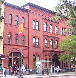
The Tompkins Square Lodging House for Boys and Industrial School is a High Victorian Gothic building that opened on April 21, 1887, also known as the Eleventh Ward Lodging House.
Weather in this IP's area
scattered clouds
-3 Celsius
-9 Celsius
-5 Celsius
-2 Celsius
1025 hPa
45 %
1025 hPa
1023 hPa
10000 meters
4.47 m/s
10.28 m/s
324 degree
49 %

