216.127.200.62 - IP Lookup: Free IP Address Lookup, Postal Code Lookup, IP Location Lookup, IP ASN, Public IP
Country:
Region:
City:
Location:
Time Zone:
Postal Code:
IP information under different IP Channel
ip-api
Country
Region
City
ASN
Time Zone
ISP
Blacklist
Proxy
Latitude
Longitude
Postal
Route
Luminati
Country
Region
wi
City
ironridge
ASN
Time Zone
America/Chicago
ISP
BERTRAM-COMMUNICATIONS-LLC
Latitude
Longitude
Postal
IPinfo
Country
Region
City
ASN
Time Zone
ISP
Blacklist
Proxy
Latitude
Longitude
Postal
Route
IP2Location
216.127.200.62Country
Region
wisconsin
City
cecil
Time Zone
America/Chicago
ISP
Language
User-Agent
Latitude
Longitude
Postal
db-ip
Country
Region
City
ASN
Time Zone
ISP
Blacklist
Proxy
Latitude
Longitude
Postal
Route
ipdata
Country
Region
City
ASN
Time Zone
ISP
Blacklist
Proxy
Latitude
Longitude
Postal
Route
Popular places and events near this IP address

Underhill, Wisconsin
Town in Wisconsin, United States
Distance: Approx. 8868 meters
Latitude and longitude: 44.87527778,-88.38444444
Underhill is a town in Oconto County, Wisconsin, United States. The population was 846 at the 2000 census.

Bonduel, Wisconsin
Village in Wisconsin, United States
Distance: Approx. 7897 meters
Latitude and longitude: 44.74027778,-88.44527778
Bonduel is a village in Shawano County, Wisconsin, United States. The population was 1,417 at the 2020 census, and 1,478 at the 2010 census.

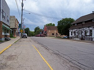
Cecil, Wisconsin
Village in Wisconsin, United States
Distance: Approx. 208 meters
Latitude and longitude: 44.80944444,-88.45222222
Cecil is a village in Shawano County, Wisconsin, United States. The population was 529 at the 2020 census.

Washington, Shawano County, Wisconsin
Town in Wisconsin, United States
Distance: Approx. 1036 meters
Latitude and longitude: 44.80472222,-88.46055556
Washington is a town in Shawano County, Wisconsin, United States. The population was 1,903 at the 2000 census.

Wescott, Wisconsin
Town in Wisconsin, United States
Distance: Approx. 8274 meters
Latitude and longitude: 44.81583333,-88.55555556
Wescott is a town in Shawano County, Wisconsin, United States. The population was 3,653 at the 2000 census.

Shawano Lake
Lake in the state of Wisconsin, United States
Distance: Approx. 4902 meters
Latitude and longitude: 44.81,-88.51305556
Shawano Lake ( SHAW-noh) is a lake situated in Shawano County in northeastern Wisconsin. Shawano Lake is a hard water drainage lake with multiple inlets and one major outlet, the Wolf River. A dam on the Wolf River located in the City of Shawano raises the water levels of Shawano Lake.
Shawano Municipal Airport
Airport
Distance: Approx. 9011 meters
Latitude and longitude: 44.78722222,-88.56
Shawano Municipal Airport (ICAO: KEZS, FAA LID: EZS, formerly 3WO) is a city and county-owned public-use airport located one nautical mile (2 km) northeast of the central business district of Shawano, a city in Shawano County, Wisconsin, United States. It is included in the Federal Aviation Administration (FAA) National Plan of Integrated Airport Systems for 2025–2029, in which it is categorized as a local general aviation facility. The airport is located on Shawano Lake and has a landing area for seaplanes.

Pulcifer, Wisconsin
Census-designated place in Wisconsin, United States
Distance: Approx. 8073 meters
Latitude and longitude: 44.84416667,-88.36
Pulcifer is an unincorporated census-designated place in the town of Green Valley, Shawano County, Wisconsin, United States. Pulcifer is located on the Oconto River and Wisconsin Highway 22 5 miles (8.0 km) northeast of Cecil. As of the 2010 census, its population is 134.

Advance, Wisconsin
Unincorporated community in Wisconsin, United States
Distance: Approx. 9735 meters
Latitude and longitude: 44.78777778,-88.33222222
Advance is an unincorporated community located in the town of Green Valley, Shawano County, Wisconsin, United States. Advance is located at the junction of county highways C and E 6 miles (9.7 km) east-southeast of Cecil.

Mosling, Wisconsin
Unincorporated community in Wisconsin, United States
Distance: Approx. 9101 meters
Latitude and longitude: 44.86888889,-88.36944444
Mosling is an unincorporated community located in the towns of Gillett and Underhill, Oconto County, Wisconsin, United States. Mosling is located on County Highway P 3.4 miles (5.5 km) west-southwest of Gillett.
Weather in this IP's area
clear sky
-14 Celsius
-21 Celsius
-15 Celsius
-13 Celsius
1018 hPa
56 %
1018 hPa
984 hPa
10000 meters
5.66 m/s
8.75 m/s
260 degree