216.126.197.80 - IP Lookup: Free IP Address Lookup, Postal Code Lookup, IP Location Lookup, IP ASN, Public IP
Country:
Region:
City:
Location:
Time Zone:
Postal Code:
ISP:
ASN:
language:
User-Agent:
Proxy IP:
Blacklist:
IP information under different IP Channel
ip-api
Country
Region
City
ASN
Time Zone
ISP
Blacklist
Proxy
Latitude
Longitude
Postal
Route
db-ip
Country
Region
City
ASN
Time Zone
ISP
Blacklist
Proxy
Latitude
Longitude
Postal
Route
IPinfo
Country
Region
City
ASN
Time Zone
ISP
Blacklist
Proxy
Latitude
Longitude
Postal
Route
IP2Location
216.126.197.80Country
Region
quebec
City
montreal
Time Zone
America/Montreal
ISP
Language
User-Agent
Latitude
Longitude
Postal
ipdata
Country
Region
City
ASN
Time Zone
ISP
Blacklist
Proxy
Latitude
Longitude
Postal
Route
Popular places and events near this IP address
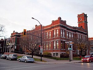
Notre-Dame-de-Grâce
Neighbourhood in Montreal, Quebec, Canada
Distance: Approx. 584 meters
Latitude and longitude: 45.47675,-73.61432
Notre-Dame-de-Grâce (French: [nɔtʁə dam də ɡʁɑs], locally [nɔtʁ̥œ̈ dam dœ̈ ɡʁɑːs], lit. 'Our Lady of Grace'), commonly known as NDG, is a residential neighbourhood of Montreal in the city's West End, with a population of 166,520 (2016). An independent municipality until annexed by the City of Montreal in 1910, NDG is today one half of the borough of Côte-des-Neiges–Notre-Dame-de-Grâce. It comprises two wards, Loyola to the west and Notre-Dame-de-Grâce to the east.

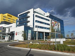
McGill University Health Centre
Hospital in Quebec, Canada
Distance: Approx. 1052 meters
Latitude and longitude: 45.472891,-73.600974
The McGill University Health Centre (MUHC; French: Centre universitaire de santé McGill; CUSM) is one of two major healthcare networks in the city of Montreal, Quebec. It is affiliated with McGill University and one of the largest medical complexes in Montreal. It is the largest hospital system in Canada by bed capacity.

Vendôme station
Montreal Metro station
Distance: Approx. 855 meters
Latitude and longitude: 45.47388889,-73.60388889
Vendôme station (French pronunciation: [vɑ̃dom] ) is an intermodal transit station in the borough of Côte-des-Neiges–Notre-Dame-de-Grâce in Montreal, Quebec, Canada, near the town of Westmount in the Westmount Adjacent area of Notre-Dame-de-Grâce that adjoins the Décarie Expressway. It is operated by the Société de transport de Montréal (STM) and serves the Orange Line of the Montreal Metro. The Metro station connects to Exo's commuter rail network by a pedestrian tunnel, permitting access to platforms providing service on the Vaudreuil-Hudson, Saint-Jérôme and Candiac lines.

Villa-Maria station
Montreal Metro station
Distance: Approx. 980 meters
Latitude and longitude: 45.47944444,-73.61972222
Villa-Maria is a Montreal Metro station in the borough of Côte-des-Neiges–Notre-Dame-de-Grâce in Montreal, Quebec, Canada. It is operated by the Société de transport de Montréal (STM) and serves the Orange Line. It is located in the Westmount Adjacent area of the Notre-Dame-de-Grâce neighbourhood, beside the Décarie Expressway trench.

Royal Victoria Hospital, Montreal
Hospital in Quebec, Canada
Distance: Approx. 905 meters
Latitude and longitude: 45.471851,-73.602716
The Royal Victoria Hospital (RVH), colloquially known as the "Royal Vic" or "The Vic", is a hospital in Montreal, Quebec, Canada. It forms the largest base hospital of the McGill University Health Centre (MUHC), which is affiliated with McGill University. The hospital was established in 1893 and was based at Pine Avenue, now known as the Legacy site, until 2015, when major hospital operations were moved to the Glen site (1001 Décarie Boulevard), named for the former Glen railway yards.
Shriners Hospital for Children – Canada
Hospital in Quebec, Canada
Distance: Approx. 969 meters
Latitude and longitude: 45.4719,-73.6019
The Shriners Hospital for Children – Canada (French: Hôpital Shriners pour enfants – Canada; also known as Shriners Children's Canada and informally as the Montreal Shriner's Hospital) is the Canadian branch of the Shriners Hospitals for Children network. It is located in Notre-Dame-de-Grâce, Montreal, Quebec, at 1003 Decarie Boulevard. It overlooks downtown Montreal, and is close to Royal Victoria Hospital of the McGill University Health Centre (MUHC) hospital network, with which it is associated but not fully affiliated.
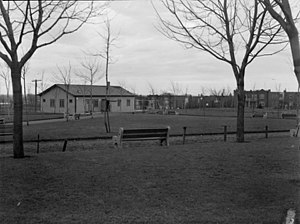
Oxford Park, Montreal
Urban park in Montreal, Canada
Distance: Approx. 610 meters
Latitude and longitude: 45.4688,-73.6075
Oxford Park, officially named Georges-Saint-Pierre Park since 1996 and located in the southern part of the Notre-Dame-de-Grâce neighbourhood, is a park in Montreal, Quebec, Canada. It was known as the Oxford Park in the 19th century, with activities operated by the Oxford Park Association, and this name is sometimes still used by some people who grew up in the area. In 1996, the City of Montreal formally named it the Georges-Saint-Pierre Park in honour of the founder of the local Caisse Populaire Saint-Raymond, a community credit union.
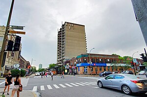
Monkland Village
Neighbourhood in Montreal, Quebec, Canada
Distance: Approx. 809 meters
Latitude and longitude: 45.4751,-73.6233
Monkland Village is a neighbourhood of the Notre-Dame-de-Grâce district in the Montreal borough of Côte-des-Neiges–Notre-Dame-de-Grâce. It is located between Grand Boulevard and the Décarie Expressway/Décarie Boulevard, and between Avenue Somerled and Sherbrooke Street. The neighbourhood derives its name from Avenue Monkland (Monkland Avenue), the commercial street at the heart of it.
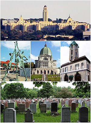
Côte-des-Neiges
Neighbourhood in Montreal, Quebec, Canada
Distance: Approx. 584 meters
Latitude and longitude: 45.47675,-73.61432
Côte-des-Neiges (French pronunciation: [kot de nɛːʒ], locally [koʊ̯t de naɪ̯ʒ]) is a neighbourhood of Montreal, Quebec, Canada. It is located at the geographic centre of the Island of Montreal on the western slope of Mount Royal and is part of the borough of Côte-des-Neiges–Notre-Dame-de-Grâce.
Monument aux braves de N.D.G.
Distance: Approx. 121 meters
Latitude and longitude: 45.4725,-73.6137
The Monument aux braves de N.D.G. is a war memorial in the Montreal neighbourhood Notre-Dame-de-Grâce.

Empress Theatre (Montreal)
Movie theatre in Quebec, Canada
Distance: Approx. 114 meters
Latitude and longitude: 45.4718,-73.6129
The Empress Theatre (also known as Cinema V), is an abandoned Egyptian Revival style theatre located on Sherbrooke Street west in the Notre-Dame-de-Grâce district of Montreal, Quebec, Canada. After operating for 65 years, the theater closed in 1992.

Notre-Dame-de-Grâce—Westmount
Federal electoral district in Quebec, Canada
Distance: Approx. 569 meters
Latitude and longitude: 45.46666667,-73.61666667
Notre-Dame-de-Grâce—Westmount is a federal electoral district in Quebec. It encompasses areas formerly included in the electoral districts of Notre-Dame-de-Grâce—Lachine (40%), Westmount—Ville-Marie (59%) and Outremont (1%). Notre-Dame-de-Grâce—Westmount was created by the 2012 federal electoral boundaries redistribution and was legally defined in the 2013 representation order.
Weather in this IP's area
light snow
-15 Celsius
-22 Celsius
-17 Celsius
-14 Celsius
1026 hPa
77 %
1026 hPa
1022 hPa
9656 meters
4.12 m/s
180 degree
100 %
