216.126.197.149 - IP Lookup: Free IP Address Lookup, Postal Code Lookup, IP Location Lookup, IP ASN, Public IP
Country:
Region:
City:
Location:
Time Zone:
Postal Code:
ISP:
ASN:
language:
User-Agent:
Proxy IP:
Blacklist:
IP information under different IP Channel
ip-api
Country
Region
City
ASN
Time Zone
ISP
Blacklist
Proxy
Latitude
Longitude
Postal
Route
db-ip
Country
Region
City
ASN
Time Zone
ISP
Blacklist
Proxy
Latitude
Longitude
Postal
Route
IPinfo
Country
Region
City
ASN
Time Zone
ISP
Blacklist
Proxy
Latitude
Longitude
Postal
Route
IP2Location
216.126.197.149Country
Region
ohio
City
grand rapids
Time Zone
America/New_York
ISP
Language
User-Agent
Latitude
Longitude
Postal
ipdata
Country
Region
City
ASN
Time Zone
ISP
Blacklist
Proxy
Latitude
Longitude
Postal
Route
Popular places and events near this IP address

Grand Rapids, Ohio
Village in Ohio, USA
Distance: Approx. 2138 meters
Latitude and longitude: 41.40694444,-83.87361111
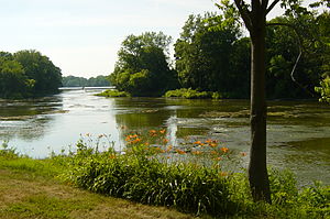
Grand Rapids is a village in Grand Rapids Township, Wood County, Ohio, United States, along the Maumee River. The population was 925 at the 2020 census. Grand Rapids is served by a branch of the Weston Public Library.

Weston, Ohio
Village in Ohio, United States
Distance: Approx. 7577 meters
Latitude and longitude: 41.34638889,-83.79472222
Weston is a village in Wood County, Ohio, United States. The population was 1,455 at the 2020 census. Weston is located just 10 miles west of Bowling Green, Ohio, a university town.

Grand Rapids Township, Wood County, Ohio
Township in Ohio, United States
Distance: Approx. 1160 meters
Latitude and longitude: 41.40916667,-83.8575
Grand Rapids Township is one of the nineteen townships of Wood County, Ohio, United States. The 2020 census found 1,586 people in the township.

Washington Township, Wood County, Ohio
Township in Ohio, United States
Distance: Approx. 7890 meters
Latitude and longitude: 41.42305556,-83.75972222
Washington Township is one of the nineteen townships of Wood County, Ohio, United States. The 2020 census found 1,864 people in the township.

Weston Township, Wood County, Ohio
Township in Ohio, United States
Distance: Approx. 6769 meters
Latitude and longitude: 41.3525,-83.8
Weston Township is one of the nineteen townships of Wood County, Ohio, United States. The 2020 census found 2,124 people in the township.

Damascus Township, Ohio
Township in Ohio, United States
Distance: Approx. 8149 meters
Latitude and longitude: 41.3775,-83.94194444
Damascus Township is one of the thirteen townships of Henry County, Ohio, United States. As of the 2020 census the population was 1,783.

Providence Township, Lucas County, Ohio
Township in Ohio, United States
Distance: Approx. 7079 meters
Latitude and longitude: 41.46416667,-83.84416667
Providence Township is one of the eleven townships of Lucas County, Ohio, United States. The 2020 census found 3,378 people in the township.

Providence, Ohio
Ghost town in Ohio, United States
Distance: Approx. 2714 meters
Latitude and longitude: 41.41805556,-83.87222222
Providence is a ghost town on the north side of the Maumee River in southern Providence Township, Lucas County, Ohio, United States, about 24 miles (39 km) southwest of Toledo. After suffering a destructive fire and a cholera epidemic in mid-19th century, the village was abandoned. In this period, canal traffic had also fallen off.
Bend View Metropark
Park in Waterville, Ohio, United States
Distance: Approx. 8102 meters
Latitude and longitude: 41.452425,-83.781119
Bend View Metropark is a regional park located in Waterville, Ohio, owned and managed by Metroparks Toledo and named for its view of a 90-degree bend in the Maumee River.

Providence Metropark
Distance: Approx. 1852 meters
Latitude and longitude: 41.4158333,-83.8586111
Providence Metropark is a regional park near Grand Rapids, Ohio, USA, owned and managed by Metroparks Toledo. The park contains mule-drawn canal boat rides on the Miami and Erie Canal and features canal lock 44, the only original functioning lock in the state of Ohio. The park also contains the Isaac Ludwig Mill which was built in 1866 over a two-year period.

Mary Jane Thurston State Park
Park in Ohio, USA
Distance: Approx. 2598 meters
Latitude and longitude: 41.41027778,-83.87777778
Mary Jane Thurston State Park is a 105-acre (42 ha) public recreation area one mile west of Grand Rapids in Wood and Henry counties, Ohio, United States. The state park lies along the south bank of the Maumee River near remains of the historic Miami and Erie Canal. It is named for Mary Jane Thurston, a schoolteacher from Grand Rapids who bequeathed land for the establishment of a park.
Otsego, Wood County, Ohio
Unincorporated community in Ohio, U.S.
Distance: Approx. 7843 meters
Latitude and longitude: 41.4475,-83.77916667
Otsego is an unincorporated community in Wood County, in the U.S. state of Ohio.
Weather in this IP's area
broken clouds
-3 Celsius
-7 Celsius
-3 Celsius
-3 Celsius
1031 hPa
76 %
1031 hPa
1005 hPa
10000 meters
2.68 m/s
4.47 m/s
77 degree
60 %